OpenStreetMap logo OpenStreetMap

ChristianA's Diary

Recent diary entries

Gear for MTB mapping

Posted by ChristianA on 17 September 2018 in English.

One of my favourite activities is mapping trails and other stuff in the forest, especially when mapping using an MTB. Using a bike allows my to get further quicker than I would by foot, and with the bike I can go more or less anywhere.

Also, it is really fun to ride an MTB in the forests where I live. I try to map the trails that might be useful for others. Another important thing is that other map providers often do not have any information about trails/paths in the countryside.

So I thought it could be interesting to show what stuff I usually pack when going on a trip. Apart from what is shown in the images I also bring some food or snack, such as fruit or a chocolate bar. Then I also keep some backup carbs such as a gel in my pack, just in case I run out of fuel.
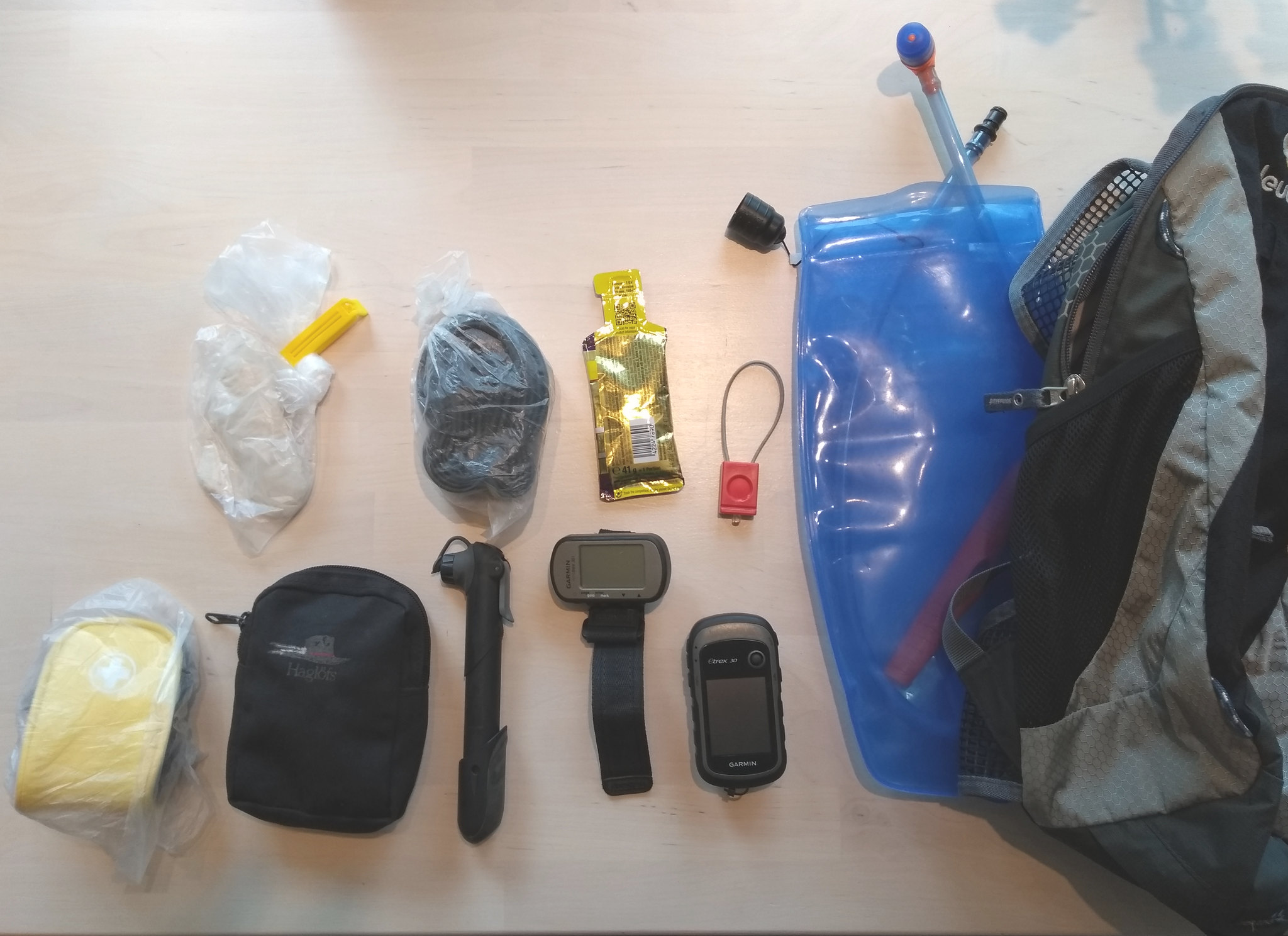
Backpack for mapping From right to left we have:

See full entry

Location: Skogstorp, Norrköpings kommun, Östergötland County, Sweden

Öppna Data: Import av Lantmäteriets Terrängkartan och Trafikverkets NVDB

Posted by ChristianA on 13 February 2018 in Swedish (Svenska). Last updated on 14 February 2018.

På senare tid har jag importerat en del data från Trafikverket och Lantmäteriet, eftersom båda har släppt en del data som CC0, vilket gör det möjligt att använda i OSM. Jag tänkte dela med mig av några av de erfarenheter jag har fått detta.

Trafikverket

## NVDB NVDB= Nationella VägDataBasen är Trafikverkets databas över vägnätet i Sverige. Det finns många olika fält och Trafikverket släpper inte all information fri vad jag vet. Men det som finns är ganska omfattande. Jag har endast importerat geometrin och översatt ett par attribut så att vägarna ska bli hyfsat taggade i OSM.

Först laddade jag ner alla län och sedan valde jag ut ett par intressanta filer, som jag slog ihop för hela landet. Sedan rensade jag bort (för mig) ointressanta attribut från shapefilen med QGIS. Jag har använt Vägtyp och funktionell vägklass för att gissa vilken “highway”-tagg som ska användas. Hastigheten går att använda rakt av. Dessutom har jag försökt gissa beläggning efter Vägtyp och funktionell vägklass. För de vägar i tätorter där gatunamn finns har jag importerat dessa. Allt detta har gjorts i QGIS med hjälp av Fältkalkyltorn och ett par rediga CASE-satser. Fördelen med att mappa om attributen redan i shapefilen är att när man sedan importerar denna i JOSM kan behöver man bara kopiera vägarna mellan shapefilens lager och det aktuella OSM-lagret, taggarna finns ju redan på plats, vilket sparar tid. Eftersom JOSM inte kan hantera shapefiler så bra har jag ett litet script som klipper ut det område jag är intresserad av ur filen med hela Sveriges vägnät.

Lantmäteriet

See full entry

Location: Katrineberg, Björsäter, Åtvidabergs kommun, Östergötlands län, Sverige

The little cape made out of slag

Posted by ChristianA on 26 November 2017 in English.

Yesterday morning I went on a short bike trip. Since the mountainbike conditions are not very good at the moment, I took a ride on my cyclocross bike. As the temperature had been a few degrees below zero, the gravel roads were perfect (like sandpaper glued to concrete!) so the ride was very enjoyable.

The "Slag cape" in Stavsjö

I checked out a few paths and small logging roads that I had not mapped before. I also visited “Slaggudden” (meaning “The Slag cape”) in Stavsjö. In lake Stavsjön it is a small piece of land that consists mostly of discarded slag from the ironworks that started in this village in 1666. The ironworks in this small village was the largest producer of cannons in Sweden, during the time of the Swedish empire.

Anyway, I tagged the place as “natural=cape”, though it is not really natural.

See full entry

Location: Björkebo, Stavsjö, Nyköpings kommun, Södermanland County, 618 95, Sweden

The joy and sadness of open data

Posted by ChristianA on 10 November 2017 in English.

When I started out with OSM (around 2011) there were no satellite data I could use with OSM around where I live. If I wanted to map something it always meant going out in the field, and often estimating distances between things in order to get a fairly complete picture of, say, a residential area. I would add a mark in my GPS where a residential area started, and estimate how “deep” the gardens were, in order to be able to draw the residential area in JOSM.

As the years have gone by, OSM have become more popular, both in terms of mappers but also in number of end-users. At the same time there has been an ongoing trend to publish more geographical data as open data. So one day I found fairly decent satellite imagery in JOSM for my main mapping area. I was glad to see that my guesswork was, on average, not too bad.

Recently both the swedish road administration and the land survey has released vector data as CC0, making it possible to use import it into OSM. This in itself is a good thing. However, for me the mapping work has more and more become armchair mapping; drawing areas on top of satellite imagery or editing shapefiles to match OSM tags. Though I like to see the results after having uploaded a large edit, I must admit that it makes the mapping work a bit boring. It’s a bit more like administration, which I have always found a bit dull. Or like being stuck indoors a beatiful summer day…

So, my dear mapping friends, don’t forget to go outside and map the real world. Grab your GPS, put on your walking (or biking!) shoes and boldly go where someone probably has been before, and discover and map all that the world has to offer! The mapping adventure is just outside the door!

Location: Häradsgården, Krokek, Norrköpings kommun, Östergötland County, 618 30, Sweden

More mapping of old quarries

Posted by ChristianA on 2 November 2017 in English.

I’ve been busy lately and haven’t had time for much OSM mapping. But yesterday I went on a mt bike trip. I had planned the route so that I could check out some old quarries and a couple of possible paths as well.

The temperature was a couple of degrees above 0, but there was still ice on the small pools of water on the trail. Sometimes the ice was so thick that the bike would not simply go through but first skid on the ice and then go through. It was also very muddy and wet, so the biking conditions were quite tough. But if you go mtb-biking in Sweden in november, these conditions are pretty normal.

The first quarry had not been used for some time, but it was quite easy to find. It was used for stone material, not any metal extraction. Stora Mossen

See full entry

Location: Jakobsberg, Kvillinge församling, Norrköpings kommun, Östergötland County, Sweden

A trip to Dwasieden castle ruins

Posted by ChristianA on 29 July 2017 in English.

So we’re on Rügen; the beatiful island on the coast of Germany. This used to be a part of DDR during the cold war. Of course there are still many things left from this period. One such thing is the Dwasieden castle. There is no english wikipedia page for it, unfortunately, but at least a short german one: Dwasieden on german wikipedia

Ruins among the trees

In short, the castle was used by the Kriegsmarine during WWII. After the war, the Red army destroyed most of the castle but used the area for military purposes. There are industrial buildings (more or less ruins) left in the area, what seems to be bunker entrances and many remnants from military and industrial activitivies. I would love to know more about it, but it seems hard to find info in english.

See full entry

Location: Rügener Ring, Sassnitz, Vorpommern-Rügen, Mecklenburg-Vorpommern, 18546, Germany

So, it’s vacation time. Lots of time to do some mapping. Well, not really when one has a house that needs attention, and 4 kids that can’t be left alone for too long.

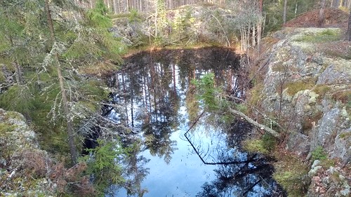
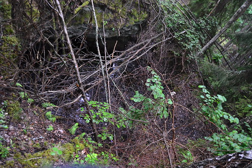
Today I had some time, but it was raining. But the two oldest kids wanted to come along for some evening mapping of old quarries. The areas surrounding our village has plenty of old quarries. Some are marble, while the older ones are most often iron or copper. Over the years it has sort of became a separate hobby to find and map them all.

I had seen the quarries on an old orienteering map, so I knew were to go. Lots of fallen trees over the quarry

See full entry

Location: Nya Holmtorp, Norrköpings kommun, Östergötland County, 618 32, Sweden

Yesterday my brother came by for a visit. He wanted to go for a short walk in the forest. So we drove to a place that we had planned to check out for some time. According to some an old quarry map, there was supposed to be a quarry for black granite in a forest area. The exact location was quite uncertain, and it was not entirely clear if the thing existed at all.

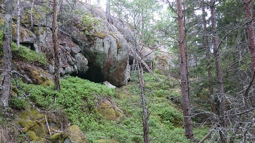
So we parked the car were the road ended and started walking along an road created by forestry machinery. We searched but could not find any trace of any quarry. Finally we gave up, but on our way back to the car we decided to try another old forestry road. After a few hundred meters we spotted an bare rock surface that looked interesting. It did not have any quarry, but instead several cave entrances. The caves were quite small, but still! These caves did not exist in the swedish cave database, which made them a very nice find!

Caves!

See full entry

Location: Norrtorp, Norrköpings kommun, Östergötland County, Sweden

Ruins of another sawmill

Posted by ChristianA on 2 June 2017 in English.

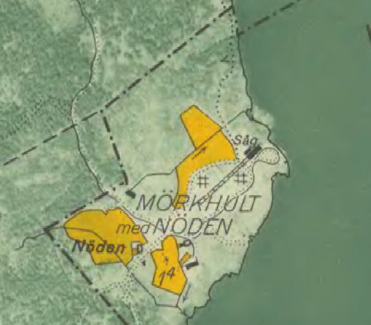
So I found the ruins of another sawmill in a forest. OK I had known about it for some time, though I was not sure it was much left or not. On an old map from the 40s (Ekonomiska kartan) it was visible and on an orienteering map from the 80s it was marked as a ruin. So I figured there might be something interesting there.

Ekonomiska kartan

See full entry

Location: Norrköpings kommun, Östergötland County, Sweden

Last week I went twice to visit (and map!) the ruins of an old sawmill, called Älsebo såg in swedish. There were two POIs on openstreetmap, but I wanted to check it out to see if I could map some areas also, and perhaps roads as well.

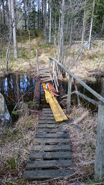
The first time I was out biking and mapping in the forest. I knew from studying an old map that there was supposed to be an old disused road in the forest. These are among my favourite things to map and so I was very happy to find the road in the forest. Unfortunately there was a stream crossing the trail, and the bridge was more or less nonexistent:

Not the best bridge I've crossed

It was possible to cross but very difficult to also get my bike across at the same time. I considered throwing the bike, but since it is only two months old I’d rather get wet instead. But I managed to get across.

See full entry

Location: Älsebo, Kvillinge församling, Norrköpings kommun, Östergötland County, Sweden

I like mapping by going out in the field, especially in the forest. Finding new (for me) trails and roads is very fun.

For mapping in Sweden I often use an old (expired copyright) map called Ekonomiska Kartan, by adding is as a tile layer in JOSM. It has names for farms, hamlets, mountains, forests, lakes and so on, which is often hard to come by otherwise. However, since it is old many things have changed on this map. I use this map together with Mapbox satellite images in JOSM, which is more recent.

Sometimes it is hard to determine if an old road, or similar, still exists, bu purely looking at Ekonomiska Kartan and Mapbox satellite. Recently I made a tile layer (just for the area where I live) that consists of DEM from SRTM, together with slope data from the Swedish forestry administration (Skogsstyrelsen). While this data is “open data”, it has a license that is incompatible (I think) with OSM. So I just use this tile layer to figure out where to go with my GPS to map in the field.

See full entry

Location: Grindstugan, Nyköpings kommun, Södermanland County, 618 95, Sweden