OpenStreetMap logo OpenStreetMap

DeBigC's Diary

Recent diary entries

Newry meetup yesterday

Posted by DeBigC on 17 November 2019 in English.

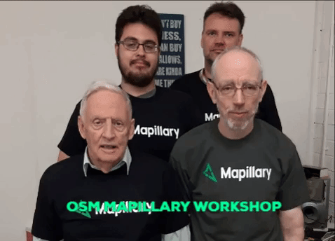
I was at the #osmIRL and #digitalNewry meetup yesterday.

It is wonderful to see the people of a town coming together and speaking about the challenges they have in situ, boundaries, licences, old buildings clumped together in their town core. There was a diversity of interests, yet a common idea that getting Newry more mapped than it presently is.

Newry still misses a lot of details on buildings

I used to live in Belfast, for around 5 months in 1995. I went there to do a piece of research, some of which was ethnographic, and the rest of it was a few visits to the Northern Ireland Statistics Office. It was an amazing time for that city in terms of peace breaking out, and a City literally stretching with a sigh of relief. And it was an honour to be there at that time. Since my return to Dublin, I only went back three times. Which is very little for a place that I felt very much at home in.

Heading up with my mapping buddies Lineo and Tad we talked about how streetsigns and road markings have subtile differences across the now infamous brexit hard/soft border.

Lineo compared the border to that between Lesotho and South Africa, while Tad resolved to come back this way on his motorbike and capture as much imagery as possible while it remains open.

Arriving at Queens

See full entry

Setting Goals for DeBigC’s mapping

In the year ahead I want my mapping to be more strategic and pointed. I have set the following goals, to assist it in achieving this. These goals will be hard to achieve in total, but if the majority of them are, I will be very happy since they will mean I am moving towards my goals. I am a board member of OSM Ireland CLG LTD, so just for clarity sake these goals are nothing to do with any position taken by the board or on behalf of the community.

My Hot-Spot

Firstly, I want my heat map to shift to Ireland. I have been a large #MapLesotho contributor, but for my own reasons I want to map Ireland much more. At the moment the largest concentration of my nodes is Lesotho as shown on this heatmap

My Ireland Rank

Next, I want to maintain a top 10 place in the Ireland 2 monthly contributor list. I’m all for other power mappers flexing their muscles, so this is a relative target to whatever they contribute, I will stay up with them.

Map on the move

Ireland doesn’t have a “millionaire” Mapillary user, and there are more than 50 of these worldwide. My target has three aspects,starting with me reaching 1 million images by the end of January 2019 (right now I’m on 913k). I want my Irish image haul to reach 1 million by June 1st.

Mapping Gaps

Regarding my own contributions Dublin is priority. For some reason large parts of North Dublin are not well mapped, with some exceptions like Castleknock and Clontarf, due to the stewardship of large locally focussed mappers. However, there are huge swathes of urban Dublin barely mapped at all aside from landuse and road networks. I’m aiming to map Coolock, Raheny, Drumcondra, Beaumont much more than they are done, to the point where all the buildings in these areas are complete.

I was asked to do a workshop on mapillary yesterday by the OSM community.

I delivered some slides to kick off. These are here I was focussed on discussing how best to manage the mapillary app on an android device.

Two of the teams

At the end of the talk we went walking after breaking into groups of 2 and heading out with our phones held high. We decided simply to walk around the blackpitts area of Dublin and capture some of the uncovered areas. In general main roads in Dublin have a high chance of some coverage, but when you look at side streets and a lot of residential roads there simply isn’t the same level of coverage.

See full entry

At the end of 2017 I was the biggest Mapillary contributor in Ireland, without really trying too hard and just using a front facing Samsung camera in my car and short diversions on the commute to and from work.

At some point around March 2018 my good buddy and OSM Ireland contributor Dave jumped ahead by about ten thousand images. I made a solemn (ahem… competitive, but sporting) promise/threat to get working on closing the Mapillary gap from me to him. I know, this sounds like General Buck Turgidson from the movie Dr. Strangelove….

mapillary_me3.jpg

See full entry

Location: Santry, Whitehall C Ward 1896, Dublin, County Dublin, Leinster, Ireland

Martin Dittus normally does this sort of analysis!

Just looking at our present counts of everything in #MapLesotho

We count nodes being created, edited and deleted. We have set up the count to feed out of the osm database, so anyone working within the polygon of Lesotho is picked up. Of course GeoFabrick only gave Lesotho “spatial sovereignty” in February 2015, so we have a year and a half of editing to look at here. This shows 824 people involved.

I like to cut off at 100 mappers. When you do that you see that the top 100 have done 97% of the mapping. The remaining mappers listed tend to have very modest contributions to #MapLesotho. The modal value of nodes is in fact 1. I have no idea what causes this, but when I click into their usernames I tend to see a mixture of once-off mapping, dormant accounts, while others are do appear to be active. Indeed, there are even some that I see involved in other HOTOSM and missing maps tasks. So regarding humanitarian mapping I guess #MapLesotho is like a holiday resort, a bit of a hotel to park your single node. And its not a high priority task, so that’s ok isn’t it…?

Between 50 and 100 is an interesting space. Most of the mappers here I have met and taught to map. They are mostly Irish schoolkids from Portmarnock or Basotho Planners. Mapping didn’t really grab this group as their favourite activity, of course they can have up to 10 mapping days and over 10,000 nodes. But those that are not new are attenders, they sit back… others will organise the Mapathons. Others will map alone. They feel safe in the big group and have mainly helped the mapping by making the feeling of a flock. But when we get to the 50th mapper mark we still have have 94% of the mapping done by those above.

See full entry

MapLesotho Month

It has been blogged about and tweeted to death. The summary is a modem, with a month’s unliited credit heading around the Mountain Kingdom stopping at 12 venues and allowing 80 people to map.

Co-ordination of task on paper from far away

Why a modem

Why was it needed? Because people in Lesotho have peculiar attitudes to the internet. That is a mixture of awe and myth, with generally a pessimistic view of the chances that it wont crash, or isn’t for them to use, or costs too much. Of course more than half of Lesotho’s population is carrying a smartphone, which is of course a million possibilities to connect to the worldwide web and there is wifi in each district somewhere if you root around. But the modem gave everybody comfort.

Cynicism

See full entry

JOSM and Me... (DeBigC)

Posted by DeBigC on 27 February 2016 in English.

I have been intensively mapping for over two years now, most of that obviously connected to the #MapLesotho project. I had an older account which I handed over to my son to do a Geography project, and he never returned it !

GIS to Potlatch

When I started OSM mapping I had a good deal of experience of GIS (15 years!), and was well used to the simple “drawing and editing” tools in MapInfo and ArcView for example. When I started using OSM I was using Potlach and while it seemed to close down a lot I eventually got the hang of it and started marking in walkways that other mappers in Ireland seemed to miss. The main thing I did was apply location point tags to things, not knowing that because I opened it in Internet Explorer that Potlatch was unavoidable….. still and all, I had things to map and mapped them.

Potlatch to ID Editor

Summary: a breath of fresh air!! Should I say more? Some quirks exist acknowledged here. And a whole lot of other things happen people depending on their quality of internet connect and state of health of their machine…. just like all the other editors “shit happens”. I managed to rack up something like 750,000* quality nodes in Lesotho with ID, which I think shows that there are misnomers about speed, and different editors suit different people. In being co-ordinator for #MapLesotho in Fingal I was aware that all browser based editors can waste internet connectivity, which is gold in Africa. However, having roots in GIS I am used to a little Cartographic rendering, a little styling, and a little of what educationalists call “visual grammer”. ID cannot be faulted for its simple, tactile style.

ID Editor to JOSM

See full entry

Location: Royal Oak, Santry, Turnapin DED 1986, Fingal, County Dublin, Leinster, Ireland

My last visit to Lesotho

Posted by DeBigC on 9 February 2016 in English.

I am in Maseru to train 14 members of the #MapLesotho OSM community. This is the third, and final year of the training. That is explained here here

14 mappers form clusters

So far the community members have decided that they will form three clusters of interest, and these are:

  • Training and Engagement - main mission, to make Lesotho be as mapped as it possibly can be, and ensure that lots of users are recruited and make a contribution to the map

  • Technical Quality - ensure all that is mapped is traced and tagged in an orthodox way to increase usability of the map

  • Spatial Analysis - will use the data as much as possible to investigate matters relating to the physical layout of Lesotho.

I will be sad to leave, but to see the OSM community become so focussed here is a wonderful thing for me, knowing that in some small way I helped it. Right now the guys here have the basemap for the whole urban area 1% from completion and 2% away from validation.

See full entry

Location: Fribel, Old Police Residence, Maseru, Maseru District, 100, Lesotho

#MapLesotho

Posted by DeBigC on 2 January 2016 in English.

I don’t write these often enough, but with the last few joules of energy I have before sleep I thought I would write something about #MapLesotho.

I am visiting Lesotho in February, most likely for the last time as the agreement (memorandum) expires between Fingal County Council and the Ministry for Local Government. We were never going to get a fully loaded map done with just 24 months and three visits.

However, we leave behind a one million node mapper in Tshedy. We also have six 250,000 node mappers. We also leave Lesotho in the condition of being one of the “least mapped” countries in 2013, to Africa’s most mapped nation, now beating countries that are higher on the development indices. But that’s not good enough.

By the end of February a small team of four will start to analyse all this data and use QGIS to increase the use case of OSM over incomplete and licenced data. They will do this to answer real questions and come up with real solutions in managing Lesotho’s environment. Another team of four will be custodians of a server, and employ error fixing tools and mind new mapping tasks from a technical standpoint. A third team will be beefed up with a train-the-trainer using LEARNOSM and ID/JOSM manuals. to create more mappers.

Is this the perfect storm of making Lesotho the most mapped, most geodata focussed, most evidence driven country in Africa. Probably not. There are associated projects, like the creation of a Planning Institute which is independent of Government. And there is is broad understanding of NGOs working in the country, chief among them Action Ireland Trust who are logistical users of the mapping.

We have a lot to do to prepare for February. Wish us luck, but more important than that wish the burgeoning new community of #MapLesotho well, and support and engage with them..

Location: Royal Oak, Santry, Turnapin DED 1986, Fingal, County Dublin, Leinster, Ireland

#MapLesotho

Posted by DeBigC on 13 July 2014 in English.

Having worked with individual planners in Lesotho to map the country in February, and with work continuing very gradually ever since we now have the towns of Mafeteng, Qacha’s Nek and Hlotse finished or close to being finished. The vast bulk of the rest of the country remains unmapped other than the national highways and the tourist spots.

MapLesotho is now a big push to crowdsource in the extra help needed to create a decent basemap of the Kingdom. It takes place on July 25th 2014.

Fingal and Lesotho

Posted by DeBigC on 27 March 2014 in English.

Fingal County Council and The Kingdom of Lesotho have a memorandum of understanding which seeks to improve the profession of Planning in both territories. As part of an evolving relationship there is work underway to impove the spatial data analysis capacity of the Lesothan planners.

Given various considerations about this including cost, adaptability and sustainability mean that stimulating the (underpopulated) potential of Open Street Map is an important step. Planners themselves will get involved in populating OSM and will get involved in seeking others to do so. The ultimate objective would be to have a sufficient OSM community in Lesotho to sustain a detailed resource, free and available to all from which Planners can work optimally to create an evidence based decision making culture within their profession and system.

Planners require OSM projects for the areas in which they are most familiar. These initial areas are (subject to expansion):

town (district)

Maseru City and suburbs (Maseru)

Ha Foso (Berea)

Hlotse (Leribe)

Mafeteng (Mafeteng)

Qacha’s Nek (Qacha’s Nek)

Location: Thaba-Tseka District, Lesotho