GOwin's Comments
| Post | When | Comment |
|---|---|---|
| Photomapping with cheapo action cam | Nice! What’s the camera brand? You can also contribute your geotagged images to Mapillary or OpenStreetCam, and those imagery can be made available to other OpenStreetMap contributors (especially where imagery is sparse), and could also be used to train AI/ML for road feature detections. |
|
| Recent edits (Quảng Nam; Đà Nẵng (Việt Nam)) | Have you seen the MapWithAI plugin for JOSM: https://gitlab.com/gokaart/JOSM_MapWithAI ? |
|
| OpenStreetMap Foundation Chairperson's Report for the 2019 Annual General Meeting | Thank you for your service, Kate. |
|
| The Philippines' 1st ("ata") LGBTQI+ Mapping Party by MAP BEKS | Thank you for leading this activity, Mikko. Congratulations for gathering the support of passionate volunteers, and introducing them to OpenStreeMap. I hope that this is only the first of many other mapathons you will be leading soon. Also, kudos for holding what seems to be the first ever LGBTQI-themed mapathon! That’s awesome. |
|
| CWTS Mapping Experience | Ngano man diay? 🙃 |
|
| 4th and last week of Intership in CWTS++ | Jenjereren hails from Ilocos, and kindly provided a translation for this entry in Ilocano: “Mapatime sessions, good morning, it’s nice to work on and look for places to add in OpenStreetMap. I learned how to check what is needed and what can improve openstreetmap. It is also to improve myself. One thing I was happy to learn was how important paths are especially small ones.” Thank you for contributing to OSM. |
|
| Adjusting newly-created road in OSM. | Thank you for posting the details, @drivingforce. These descriptive notes are useful in the changeset themselves, to allow other mappers to have better contextual background about a particular edit. |
|
| First Edit | Thank you for your contributions to the map @drivingforce, and welcome to OpenStreetMap. Apart from SatNav tracks (from GPS, Glonass, etc.), you might be interested in collecting street-level imagery using Mapillary or OpenStreetCam. The added advantage to this approach is that you’re not only collecting tracks, you’re also collecting photos that could be added to the commons which could be useful for extracting other information. There are also various tools available that makes data contributions or editing on mobile more convenient. Check out the gamified StreetComplete, or the general purpose mapping apps with editing function like OsmAnd or Maps.Me. If you’re keen to interact or have questions in mind, there are several channels for reaching out to local communities, check out the channels listed on osm.org/wiki/ph . We’d love to hear more from mappers outside the capital region. Cheers, GOwin |
|
| Lupang Arenda drone mapping - part 1 | @kucai |
|
| You Don’t Have to be Mad to Live Here, But it Helps | Thank you for sharing diary entries like this, Alex. They’re always a joy to read. |
|
| Community Mapping with the Elderly | Hindi ko napagtanto na mas personal pala ang koneksyon ng kuwentong ito. Salamat sa pagba-bahagi, Rally. |
|
| A Local Mappers API | Nice one, Martijn! It would be lovely to connect this with the Notes, where local knowledge is quite helpful. |
|
| Too bad I don't have a camera rig | Wow! That’s coverage is awesome, especially if it was done on bike. Kudos! |
|
| First Day | That’s awesome, Jessa. Welcome to the OpenStreetMap community. |
|
| First steps | Awesome! Welcome to OpenStreetMap. |
|
| filipinas | Let me guess, places you’ve visited in the Philippines? 😉 |
|
| My First Edits | Congratulations on your first edit, and thank you for your contributions. |
|
| First edit | Congratulations on your first edit. And, thank you for updating the map of your neighborhood. |
|
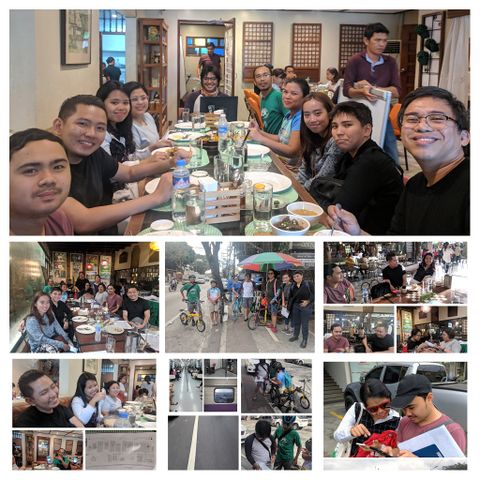
| Marikina Mapping Party @ Lilac Street | Thanks, Harry. What do you think of this collage?
I uploaded this and a few more of the photos I took with a PD-self license in the OSM wiki: MapaTime! |
|
| Marikina Mapping Party @ Lilac Street | We’ll all be looking forward to that. I remember you actually joined us for late lunch after the 2016 mapping party. :grin: |