OpenStreetMap logo OpenStreetMap

Harry Wood's Diary

Recent diary entries

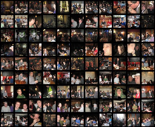
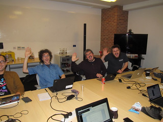
We’ve got an OpenStreetMap London pub meet-up tonight!

We’re managing them approximately monthly these days, so last month we had a pub meet-up to kick off 2017. We went to the Wenlock Arms. It’s a nice little pub which almost got demolished but was saved after a campaign. Now with all the big new buildings around it reminds me of the very last scene of Batteries Not Included. But they have modernised a little. I remember their rather sparse pub website used to link to OpenStreetMap, but sadly their website was since rebuilt by some boring web designers with boring google maps.

I remember it used to be good for real_ale=yes, and that was certainly there still. Crazy strong stuff. Luckily I’d stuffed myself with fish n chips before arriving because food=no! But it does have real_fire=yes!

on the wiki

(Another photo for the real_fire=yes tag)

See full entry

Location: De Beauvoir Town, Dalston, London Borough of Hackney, London, Greater London, England, N1 4DA, United Kingdom

I was meaning to say (and left it a bit late) it is a great honour to be nominated for the OpenStreetMap awards.

I have realised recently, with some embarrassment, that despite trying to contribute in many different areas, my greatest contribution to OpenStreetMap has almost certainly been my diary entries about people sitting around in pubs! :-)

montage of OpenStreetMap pub photos

See full entry

Long Names of OpenStreetMap

Posted by Harry Wood on 31 August 2016 in English. Last updated on 1 August 2019.

Check out this thing which I just got working again:

>>> Long Names of OpenStreetMap <<<

So that’s elements with a name tag, where the name seems to be very long. It’s a full list of the longest names in the planet (>150 chars)

I just found this old code and dusted it off. I made it originally back in May 2010 when Richard Weait ran a “Project of the week” looking at long names. I called it “namecheck” at the time, but I’m renaming it “longnames”.

A crazy long name is probably a data bug to be fixed. It certainly looks like a bug when we try to render it.

flickr

But… well taking that example. Here we have a few university buildings, each with a name, which list several departments. Can we class this as wrong? I think so, yes, but I’ll have to make a hand-wavy non-scientific judgement: I’d say it ceases to be a name of the building and becomes more of a “description” when it gets that long…. in this case. And maybe that’s a problem for a lot of them.

See full entry

Tree named pubs of London

Posted by Harry Wood on 30 May 2016 in English. Last updated on 1 June 2016.

It’s London Tree Week. I saw someone tweeting at OSMLondon asking “Can you help identify tree named pubs In London?”. Why yes I believe we can! We’ve always specialised in pubs. We even used to have a tree named pub “The Mulberry Bush” as one of our OSMLondon regulars.

This seemed like fun, so I went ahead and did it. Here’s the tree-named pubs of London on a map.

screenshot

My method was maybe a bit old these days. See this bash script which fetches the London metro extract, uses osmosis to get pub nodes, then pub ways, then merge pub ways and nodes, then uses osmconvert to get centroids on the ways, then convert to CSV. Then grep to filter ‘Bush’, ‘bush’, ‘Tree’ and tree’ (but not ‘Street’) [Update: I’m now also finding tree type names. See comments below], to result in treepubs.csv. After that I fiddled with the CSV to make it a javascript array, and loaded that into my leaflet marker array example, and loaded in the treepubs as markers. Job done.

See full entry

Mapillarising Brazil

Posted by Harry Wood on 15 May 2016 in English. Last updated on 17 May 2016.

For years I’ve been meaning to try out Mapillary properly, but my phone is broken and can’t connect to wifi, so no upload.

But this was another thing I got to do while on holiday in Brazil. I persuaded my wife to install mapillary on her phone, and we mapillarised while we were driving around her home city of Guarulhos. She’s pretty bored of all this mapping stuff, but likes to keep me entertained while we’re in Brazil, and maybe she likes the idea of mapping her home town too. So we got lots of photos around these colourful Brazilian streets.

flickr

Also while going on a trip to the seaside, but sadly I don’t think I got much of a seaside view in any mapillary photos. Some are quite nice and jungly though

See full entry

School Edit Tracker

Posted by Harry Wood on 28 April 2016 in English.

The “UK quarterly project” for the start of this year, was about schools. It was pretty popular and quite a few mappers got involved in editing and fixing up schools data in the UK. How many? Well…

I fired up my old “edit tracker” code to track School edits during the first quarter, and now it’s frozen as a record. So we can see 362 people did a total of 15548 edits to UK schools data during the quarter.

And here’s the rankings, showing that Robert Whittaker takes first prize with 1339 edits. The rankings also show a classic long tail curve. Not too uneven, but still with almost half of our 362 people only making a single school edit. But that’s OK. Getting lots of people chipping in a little bit is a good thing.

That’s why I created a new display called “New Starters”. I hoped this might get people interested in the challenge of how to spread the word and get more people joining in.

Linked from there, and from the rankings, I made another new display for each user. So here’s the school edits for the ‘Harry Wood’ user for example. We can see edits over time, so we can see my rather meagre contribution. We can also see that Robert Whitaker had a spurt of activity towards the end, while Yorvik Prestigitator seemed to take a break at the end, (and actually this allowed Robert to sneak ahead and take the top spot!)

See full entry

A missing zoo!

Posted by Harry Wood on 11 April 2016 in English.

I just got back from a holiday in Brazil. We were over there with the new baby, so we hadn’t planned anything too ambitious travel wise. Just visiting the family in São Paulo. I should say in Guaruhlos, which is a smaller big city inside of, or outside of the massive city of São Paulo, depending on who you ask (It’s really all part of the same sprawling concrete jungle)

So I didn’t manage to organise an OpenStreetMap meet-up this time, but while changing nappies and bumming around on the internet I took at a look at the attractions of Guaruhlos according to various internet listings. There aren’t many, but there is… a zoo! My wife didn’t even know about it and neither did wikivoyage… neither did OpenStreetMap :-O

Of course I insisted we go there, and so now, to my surprise, I have had the opportunity to bag a missing zoo in OpenStreetMap! Naturally I also had to map out all the different animal cages. That’s the standard OpenStreetMap zoo treatment which the Berlin Zoo mappers started I think. I haven’t mapped the details quite down to Edinburgh Zoo levels, and some of my positioning of things under the trees may need a bit of tweaking, but… behold Zoológico Municipal Guarulhos!

See full entry

Location: Jardim Rosa de França, Vila Galvão, Main District of Guarulhos, Guarulhos, Região Imediata de São Paulo, Região Metropolitana de São Paulo, São Paulo, Southeast Region, 07081-060, Brazil

Amazing what some professional video editing can achieve. I had a fairly long waffling chat with Jonathan Cronin, and he’s sliced out the good bits, overlaid some photos, etc, to turn it into this video:

harry-wood-ivan-gayton-video

In the background behind me is the Future Cities Catapult offices where I work some of the time. Some of the cutaways are to itoworld’s animated edits globe videos

Of course, he’s also interviewed Ivan Gayton from MSF. (Incidentally I recently posted my own video of Ivan as he described the Kunduz hospital bombing at a missing maps meet-up. Zero attempt at editing that one)

See full entry

Hoxton, Brixton, and lots of data entry + Holborn tonight!

Posted by Harry Wood on 4 September 2014 in English. Last updated on 5 September 2014.

Last weekend I decided to ignore all my most pressing todo list items, chill out, and catch up on some mapping (Putting in map data based on all the photos I’ve collected) I’ve been getting behind on this, which gives me a familiar “really need to get around to doing that” feeling. That goes for everything on the todo list, but I allow mapping to jump to the top sometimes because the truth is, it’s nice and relaxing. I was in the mood for some long JOSM sessions last weekend so…

In went the data from the 14th May Baker Street mapping evening. Boom!. This was an event which I have actually already managed to write a diary entry about at least, but apologies to Marco, who may have been wondering why we didn’t seem to improve the map at all. Now we have (3 months later!)

In went my data from the 23rd June Hoxton Square mapping evening. Boom!. Actually other people had already got most of that data in, so I was just following up with A few additions and refinements around the square, and the block to the West of it.

This was the mapping evening featuring a radio reporter who followed us around and shoved a big microphone in our faces while we explained what we were doing.

The result of that was broadcast on an american radio station, and is also available to hear here: From Pen And Paper To 3-D, Look Who’s Challenging Google Maps. As often seems to be the case with these media appearances, it got very heavily edited down. I was cut completely. It just had a few phrases spoken by Robert, recorded while we were out mapping that evening. These soundbites and the commentary portray OpenStreetMap as rather a tin-pot project for crazy nutters, but… ah well… Any publicity is good publicity.

And we went to the Reliance pub in Shoreditch. This pub is an old favourite of my officemates at the Open Data Institute. That evening the world cup was on, and Brazil were still doing well (to flop out spectacularly in their next game)

See full entry

Location: Stockwell Park, Stockwell, London Borough of Lambeth, London, Greater London, England, SW9 0DA, United Kingdom

OpenStreetMap birthday weekend (including wikimania etc)

Posted by Harry Wood on 20 August 2014 in English. Last updated on 31 August 2021.

Tonight we’re heading out mapping again! Join us for a London mapping evening in the Bond Street/Mayfair area.

I’m not doing very well at catching up with my diary entries on all the interesting things which have been happening. Since my last diary entry more things have happened, mostly all in one weekend! The weekend before last it was the OpenStreetMap 10th birthday party of course, but for me at least, that was not all:

  • Friday - Open Addresses Symposium
  • Friday night - wikimania entertainment
  • Saturday a.m. - wikimania OpenStreetMap sessions
  • Saturday midday - appearing on sky news
  • Saturday p.m. - OpenStreetMap birthday pub!
  • Sunday a.m. - breakfast with Frederik
  • Sunday - more wikiania sessions

The Open Addresses Symposium was an event put together by the Open Data Institute who have got funding to implement an Open Addresses project (dataset / software / community). In the UK we had an opportunity to make Royal Mail’s Postal Address File an open dataset (Why? Because it’s infrastructure. Make it free and open, and all kinds of innovation are quietly but obviously enabled) Instead our government recently sold it off as an asset along with the rest of Royal Mail, and this publicly-owned dataset was lost forever. Stupid. PAF was the topic of an open data campaign for years. It’s ended badly, but on the plus side it means we can write that off and move on. So at the Open Addresses Symposium, a couple of hundred address data experts and corporate users gathered to discuss this, and the idea of creating Open Address data. Steven Feldman has a write up here. The actual plan wasn’t laid out yet (discovery phase) but it will probably involve joining together various open data sets in clever ways, combined with some “crowd-sourcing” element.

Jerry and I were there representing OpenStreetMap. Being so busy lately I was grateful to not be doing a talk. Jerry did a great job of this:

See full entry

Location: Saint Luke's, Finsbury, London Borough of Islington, London, Greater London, England, EC1V 3RQ, United Kingdom

There’s going to be a good old London OpenStreetMap pub meet-up TONIGHT at the Monkey Puzzle in Paddington.

When was the last time I wrote a diary entry about London event happenings? A couple of months ago! The Baker Street mapping party. And I still haven’t input the data from that one! What can I say? Things have been busy. I’ve been busy at work. Lots of transportAPI shenanigans, including moving office to Euston. And busy at home. It turns out getting a new carpet involves moving… everything. But I’ve been busy with quite a bit of OpenStreetMap stuff too:

  • Pub meet-up Artillery Arms Bunhill fields
  • Introduced HOT project ideas to UCL students
  • Gave HOT talk at Start Network
  • Mapping party around Hoxton Square
  • Gave talk about UAVs & HOT’s OpenAerialMap project
  • Mapping party in Brixton
  • HOT meet-up at the ODI
  • Gave a talk to people at Exprodat
  • Geomob last week

In amongst all of that I’ve been trying to keep up with some Communication Working Group things and trying to organise meetings to get some new people to help. Pheweeee. Lots going on. The biggest thing on the OpenStreetMap calendar recently, SOTM EU, I missed because it clashed with my wife’s birthday, but… well I have not been feeling deprived of OpenStreetMap events!

The other day at geomob I was reminded of my last diary entry by the guy behind what3words… I don’t think he was too annoyed with me.

Shall I try to catch up on diary entries? Well I have notes for all these things, so I feel like I should really, but it’s a lot to catch up on. Let’s make a start.

So way back at the Artillery Arms pub meet-up (end of May!) I’ve just found my notes. Dan was scribbling on them as he showed us how to find the most remote branch of Starbucks in the UK using delaunay triangulation (and OpenStreetMap data)

See full entry

Location: Saint Luke's, Finsbury, London Borough of Islington, London, Greater London, England, EC1V 3RQ, United Kingdom

Baker St Mapping evening + Artillery Arms Tonight

Posted by Harry Wood on 29 May 2014 in English. Last updated on 4 July 2014.

We’ve got a London OpenStreetMap pub meet-up tonight! Join us in the Artillery Arms from 7pm. It’s just a social pub meet-up. We’re alternating, so last time was a “mapping evening”.

A couple of weeks back we did a bit of mapping around Baker Street. When I say “we” I mean me and Marco. He turned up at the designated meeting place, which was a surprise. But then we failed to find someone else who was supposed to be joining us for a walking talking mapping demonstration. Turns out she was actually there, but somehow didn’t find us. I was loitering outside a bank, wearing an OpenStreetMap Polo shirt and clutching a leaflet, but next time I need to make sure everyone has my mobile number.

But luckily Marco was there, so we were “go” for a mapping session. A couple of weeks back it felt like the height of summer, and so it was very pleasant to be wandering some quiet backstreets in the evening. I demonstrated taking lots of photos of shops and buildings, and then I took some photos of Marco taking photos of shops and buildings.

See full entry

Location: East Marylebone, Fitzrovia, Camden Town, City of Westminster, Greater London, England, W1T 3PP, United Kingdom

My #geomob hangover has barely cleared up, and already it’s time for a London Mapping evening. Should be a lovely sunny evening too!

We’re not really settling into a routine yet this summer, which is not necessarily a bad thing. My first summer mapping session was organised by somebody else (which makes a very pleasant change!) I already described the Olympic park mapping session in my last post. Check out my fast-farward JOSM video if you didn’t already. The last event was a humanitarian thing. I won’t go into details because you can read my HOT blog post all about it. Suffice to say it was definately a bit different, and pretty awesome. I also did an ODI blog post which talks about Open Data in Africa in general. Thanks to the ODI for… PIZZA!

It’s become apparent that a big bunch of OSMLondon people are booking places to be at SOTM-EU in Karlsruhe. So that’s going to be an awesome event. Sadly I won’t make it myself.

But speaking of big conferences, Wikimania is coming to London this year. I’m quite excited about that, but it’s making the August schedule look a bit hectic. The OpenStreetMap birthday party is listed as “fringe” event of the conference. And I’m currently pencilling in the week before that for my birthday BBQ in my back garden.

See full entry

Away on my honeymoon in Thailand, am I doing any mapping? Not much no! Firstly because my wife wouldn’t consider it a very honeymoony thing to do, but secondly everywhere we’ve been to has been pretty well mapped! The resort I stayed in Krabi is mapped despite being under a cloud in bing imagery.

Now we’re up in the north of Thailand in the historical city of Chaing Mai. Amazingly well mapped! All the temples and every other POI I could ever need within this distinctive square old town area, mapped in great detail.

Of course Chiang Mai is also a popular holiday hotspot, so this probably doesn’t mean the whole of Thailand is well mapped. I remember Matt commenting on this thing when he went on holiday to Mexico a five years ago. OpenStreetMap develops its coverage on an “interest first” basis. Interesting places get mapped, and this means holiday hotspots get mapped a lot quicker and more thoroughly, sometimes while massive cities nearby remain unmapped. Places which aren’t mapped are maybe rather uninteresting (and if you live in an unmapped place, and find this insulting… time to make it mapped place!)

Looks like the mappers in Chiang Mai are other holiday-makers rather than locals, judging by the not-very-Thai-sounding user names in this top mappers display.

See full entry

The Mucky Pup

Posted by Harry Wood on 4 March 2014 in English. Last updated on 5 March 2014.

We’ve got a London pub meet-up TONIGHT at the Penderel’s Oak.

Our last London meet-up was an interesting one. Matt suggested meeting at a pub in Angel. Not an area we’ve been to in a while because it’s in the Blumpsy mapping zone of awesomeness. But it’s also nicely near my journey home, so I wasn’t going to complain.

The Mucky Pup pub is in a residential area I’ve never explored before, so although it’s quite close to my office, I decided I needed a route map printout. And for that there’s this awesome new site cycle.travel by Richard Fairhurst. Awesome particularly because after planning a route on the site you can download a PDF, and not just any PDF. A vector PDF! This is exciting. Ever since I started OpenStreetMap I’ve had a feeling that there’s massive untapped potential for using it to create high quality map printouts. There’s various tools (see ‘OSM on Paper’). cycle.travel is a nice addition to those.

It’s designed only for printing cycle routes, not for general purpose printing, but on this occasion a cycle route is what I needed! Before I sent to print I fiddled around for rather too long to scale up the map to A4 size (I thought I could do this in the printer settings, but eventually found it was surprisingly easy to ‘crop’ using ‘preview’ on a mac). The result… awesome printout!

See full entry

Location: Canonbury, Highbury, London Borough of Islington, London, Greater London, England, N1 2AN, United Kingdom

There’s a London OpenStreetMap pub meet-up TONIGHT!

I’ve changed that wiki page around a little bit. Before we had a separate events list for winter/summer event series of pubs/mapping marathons. This works OK for resulting in an archive table, and I’ve kept that page arrangement, but I’ve now “transcluded” the details onto the main London page. Saves me maintaing two different event lists, and now it’s all always at wiki.osm.org/London , which seems like a good fixed location which new folks are more likely stumble upon. Feel free to edit, especially if you want to organise an event!

I’ve always tried to list various events which are not organised by OSMers and not focussed entirely on OpenStreetMap, but quite strongly related (geo or open data themes). Often OpenStreetMap can benefit from being represented at these events, or to look at it another way, we can piggy-back on these events and use them as hosting for our OpenStreetMap activities. Lately there’s been lots of them.

See full entry

Location: Hatton Garden, Holborn, London Borough of Camden, London, Greater London, England, EC1N 8DX, United Kingdom

January

Posted by Harry Wood on 22 January 2014 in English.

January is supposed to be the season where we recover from new years hangovers and calmly settle down to the depressing drudgery of the year ahead. Not so with OpenStreetMap!

Derick kicked things off with another stunning video - Year of Edits 2013 I need to post this to blog.openstreetmap.org actually. All that editing activity is a thing of beauty, although… it also makes it look like a big globe we’re trying to map!

Following on from that we had a storm of press coverage when emacsen wrote a blog post Why The World Needs OpenStreetMap.

I’ve tried and failed to fathom what piques the interest of the press. It’s quite mysterious, but in this case clearly the blog post has a punchy headline. Rather over the top. The sort of headline which online press like to use to gain click traffic these days. But it would be unfair to suggest that was all there is to it. emacsen has followed up with a good explanation of the commercial battle for location dominance, and OpenStreetMap’s role as the antidote to that. A good read.

And lots of other people thought so too. It hit the top of reddit and hackernews, got picked up by various U.S. press, and then by the guardian. I wonder whether re-posting of CC licensed article texts is something the press are starting to do more of. Anyway we saw a massive increase of U.S. and U.K. sign ups as a result of all of that. We even overtook Germany for a time (back to normal now). The U.K. ones came mostly after the Guardian re-posted. In the #osm-gb IRC channel we have a chat bot which tells us when a new user starts editing, and this went ballistic on the day of the guardian coverage. Awesome!

See full entry

OpenStreetMappy Christmas!

Posted by Harry Wood on 26 December 2013 in English.

OpenStreetMappy Christmas! I think there should be an official OSM blog post with that message hey? [BOOM there it is]. I’m a day late with this because (weirdly) I wasn’t really spending time on the internet on Christmas day, but…

I did do a bit of mapping! For our family Christmas day walk we went along the Meanwood Valley in North Leeds, all of which I’m delighted to say, is mapped out in a lot of detail on OpenStreetMap. Looks like I have Geoff Richards, and John & Felicity to thank for that. Nice work! I used MapsWithMe to follow/plan our walking route. At the top of the valley went in search of a mysterious and magical place called Adel Crags, which was not on the map. I took some geolocated iPhone photos around there, and used these later with JOSM to add the rock and the access footpath to the map. That’s my normal way of mapping things, but I’ve also been adding a few bits and bobs using Go Map!!

So that was my OpenStreetMappy Christmas day, but we also had an OpenStreetMap Xmas party… with biscuits!

See full entry

I’m wearing my OpenStreetMap polo shirt in the office today. All set for tonight’s London winter pub meet-up at the Monkey Puzzle.

We’ve had a couple in the series of winter pub meet-ups already this season. There’s also been these awesome things which already have write-ups:

The typhoon crisis mapping event at the ODI. My diary entry, and my write up on the ODI blog, and Sam’s blog

The OpenStreetMap Hack weekend. Jerry’s blog gives a good run down of various hacking activities. There’s also this from Dan. Looks like it was a great event. Sad to have missed it! Apparently this photo is everyone trying to do the Harry grin:

flickr

It’s not quite right guys. Keep trying. …having said that you’re probably getting it closer than this lot at SOTM :D

See full entry

Location: Spitalfields, Whitechapel, London Borough of Tower Hamlets, London, Greater London, England, E1 6EW, United Kingdom