OpenStreetMap logo OpenStreetMap

Harry Wood's Diary

Recent diary entries

Camberwell Mapping Party

Posted by Harry Wood on 26 August 2009 in English. Last updated on 27 August 2009.

We had a lot of fun in The Bear pub in the Camberwell for last night's London Mapping meet-up

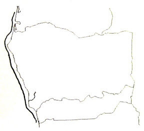
Which country is this? (The fat double-line is the Atlantic coast)

That's right. It was pub quiz night again! The above map-based question appeared. There was even an aerial imagery recognition question. All plain sailing for team "OpenStreetMap" you'll be pleased to hear. In fact we did pretty well on the whole quiz this time. We got really stuck on the first question, which was "Do you want to take part in the quiz?", but after much discussion we hit upon the correct answer, and went on to win! Our vast winnings (~£38) have been donated to the OpenStreetMap foundation.

See full entry

Location: Elmington Estate, Camberwell, London Borough of Southwark, London, Greater London, England, SE5 7JD, United Kingdom

London meet-up tonight!

Posted by Harry Wood on 25 August 2009 in English.

I just blogged over here about the 5th Anniversary Party. With all that weekend excitement let's not forget there's mapping to be done!

Next London meet-up is TONIGHT in Camberwell South London. Enough of the sugary cakes, here's a cold harsh bitter digital cake with a sprinking of NoName streets:


Sign up on the wiki for a slice of the cake

Location: Elmington Estate, Camberwell, London Borough of Southwark, London, Greater London, England, SE5 7JD, United Kingdom

Brick Lane Mapping Party + other events

Posted by Harry Wood on 19 August 2009 in English. Last updated on 24 August 2009.

If the state of my gastrointestinal system is anything to go by, then Monday's London mapping and curry meet-up in Brick Lane, was a real stonker. A good turn out as predicted, and we all met up and managed to spread onto several tables outside the stylish Vibe Bar, before heading on to have a meal in the "Standard Balti House" which was... well pretty standard really.

Brick Lane photos on facebook

I suppose this curry house might appear on the map soon (here somewhere) although nobody had signed up to take on the challenge of slice 2 in the end (cake diagram) Overall this is a pretty mixed and varied area to do mapping in. My slice 12 was fairly grotty along most of its length. In the facebook album there I've included a photo of a derelict building with several trees growing out of it. Without wanting to be too impolite to the residents of Whitechapel Road, it really does look like a 3rd world country in places :-)

As predicted a key topic of conversation was the OpenStreetMap Foundation elections. If you care about OpenStreetMap you really should be voting, and before you can vote you have to join, so get yourself sorted out now! The deadline for voting by email is Thursday midnight i.e. Friday 00:00 BST i.e. not long to go! In fact if you didn't join already you might be pushing it.

The next London mapping evening is scheduled for Tuesday 25th August in Camberwell, but before that on Saturday we've got the aformentioned AGM, and the worldwide party spectacular that is the OpenStreetMap 5th Anniversary Birthday party. The London location is now set. The Porterhouse. I like the beers in this place, and I shall be drinking many of them. Oh yes! [went to the mulberry bush in the end]

And for a little more event-overload, we've kicked off planning of WhereCamp EU.

Location: The Old Truman Brewery, Whitechapel, London Borough of Tower Hamlets, London, Greater London, England, United Kingdom

Brick Lane tonight, etc

Posted by Harry Wood on 17 August 2009 in English.

Tonight is curry night! Sign-up! Sign-up!

We don't normally do Mondays, but even so I've a feeling this one could be quite popular. Nick's been promoting it on facebook where we already have "13 confirmed guests".

We're heading to brick lane to do a bit of mapping and then meet-up at the vibe bar, which has an outdoor seating area under and tent type thing. We'll sit there and have a chat before heading to a restaurant.

There's plenty to chat about. Thanks to the efforts of Thomas Wood, the NaPTAN Import has finally arrived in London, giving us a spectacular sprinkling of bus stop nodes! We've continued to fiddle with U.S. interstates. Here's a duplicate nodes map. More on that soon. Also emerging today, a new improved whitewater maps from Johnathon Riddell. Gnarly! I dare say the forthcoming foundation elections will come up in conversation too.

In other exciting news, I went out exploring yesterday afternoon and discovered that the path around this reservoir (part of the "capital ring" route) has been blocked up with construction hoardings.

See full entry

Location: The Old Truman Brewery, Whitechapel, London Borough of Tower Hamlets, London, Greater London, England, United Kingdom

Landuse

Posted by Harry Wood on 14 August 2009 in English. Last updated on 28 April 2021.

I've been pondering landuse again.

Some people seemed to be confused by using the tag landuse=farm for mapping farms fields AKA farmland AKA farms! A field is part of a farm is it not? The confusion seems to come when people see the farmyard tag. So let me help you out here:

[UPDATE: This is a very old 2009 diary entry. Some of these issue have now been clarified in the documentation. In particular landuse=farm has since been documented as clearly the wrong tag to use]

...

To be fair though, this does leave some unanswered questions. There are many awkward questions about mapping landuse, which haven't really been answered with any kind of guidelines as far as I'm aware.

See full entry

BBQ meat-up!

Posted by Harry Wood on 10 August 2009 in English. Last updated on 14 August 2009.

As I said on my blog, big thanks to everyone who helped me celebrate by 30th birthday by coming along to my BBQ bash.

More photos on facebook

As well as consuming vast quantities of meat'n'booze, quite a few people got involved in mapping Tottenham on the Saturday Morning (see Cake Diagram). I feel quite guilty about dispatching people to do my mapping dirty work. ....Guilty? or jealous about my territory? not sure. Anyway hopefully everyone had fun. I even organised some sunshine! Not bad eh?

Next one will be Brick Lane on Monday 17th. Sign up! Sign up!

Location: Crouch Hall Park, Crouch End, London Borough of Haringey, London, Greater London, England, N8 8HL, United Kingdom

Mayfair's paper-based mapping party

Posted by Harry Wood on 7 August 2009 in English. Last updated on 16 November 2009.

So we had our big post box gathering session in Mayfair over a week ago now (Another London evening meet-up) I guess maybe I should report back on the spectacular number of postboxes we've added, but so far I've not even found time to enter my data. Promise to do this soon though.

This meet-up was papertastic, with most people opting to use the walking-papers.org service over any kind of GPS-based mapping. GPS is not so effective in central London, so paper is the way to go.

A good bunch of people this time. Lots of new faces, including some people quite new to mapping (I want to attract more of these to come along!)

We also had Nick demonstrating Mapzen. The new OpenStreetMap editor under development at Cloudmade. I'm excited about the tutorial features which are designed to help newbies learn the ropes in a more gradual less "thrown in at the deep end" kind of way, rather like the training missions in computer games.

See full entry

Location: East Marylebone, Fitzrovia, Camden Town, City of Westminster, Greater London, England, W1T 3PP, United Kingdom

From Chattanooga to Mayfair

Posted by Harry Wood on 30 July 2009 in English. Last updated on 31 July 2009.

We've been pondering TIGER fixup in the states, and getting basic interstate routing working. I think Andy's going to blog about it a bit more. I made a fun clickable visualisation of routing connections. You can use it to figure out where major connectivity problems exist in the tiger data, or you can use it to test your knowledge of U.S. cities!

Cities like... Chattanooga. Never heard of it? Neither had I, but I've spent a good few hours editing the motorway junctions there. Like this one for example:

But this evening we're turning our thoughts closer to home. Tonight's mapping party is in Mayfair. Come join us!

I picked this location based on detailed analysis of cross-correlated data visualisations, but it turns out I should've just asked Dave why he didn't map the postboxes around there when he was mapping it back in 2006. Time to revisit the area I'd say... If you're in London, come join us tonight!

Location: North Chattanooga, Chattanooga, Hamilton County, East Tennessee, Tennessee, 37450, United States

Mapping Kings Road

Posted by Harry Wood on 19 July 2009 in English.

The last London mapping evening, was on Thursday last week, which was uncomfortably close after the big conference weekend. I've been ultra busy all week following up on things and catching up on things (CloudMade have had a flood of enquiries about this that and the other). Happily User:Solexious was keen to prepare a nice cake diagram, which was one less thing for me to worry about. Thanks for that.

By the way, if anyone ever wants to get involved organising a London meet-up, or just one aspect of London meet-up, please feel free join in and/or take over. Choosing pubs, preparing cake diagrams, setting up event listings, etc, all takes time. I mostly enjoy doing it, but I also quite like not having to do it :-)

In fact I didn't have to choose the area & pub this time either. The Kings Road mapping party was Matt's idea. It's a frightfully posh area. I think we all enjoyed not having any grotty concrete housing estate to map for a change. No no, it's all quaint little residential streets with white columns, or multicoloured pastel washes, in an area which apparently has the largest per square-metre property prices after central Hong Kong!

I met with Joe Eckert who was interested to see my mapping techniques, and interviewing me about OpenStreetmap for his research. It was a good mixed mapping session for this purpose. We wandered around some of these pleasant residential backstreets, and also mapped a length of Kings Road itself. Lots of shops, which I photo-mapped (which means leaving most of the effort still to do back on the computer) Very hoity-toity fashion shops. Nothing like my mapping Roman Road at the previous Bow mapping evening (The fast food icons are mostly kebab shops. Classy)

See full entry

Location: World's End, Brompton, Royal Borough of Kensington and Chelsea, London, Greater London, England, SW10 0DT, United Kingdom

King's Road Mapping Party tonight

Posted by Harry Wood on 16 July 2009 in English.

It's looking like tonight's King's Road Mapping Party (Central London), will be a big one. We're starting to run out of cake slices for people to bagsie!

I haven't had chance to enter in my data from the Bow mapping party yet. Gah! Too much going on!

Location: World's End, Brompton, Royal Borough of Kensington and Chelsea, London, Greater London, England, SW10 0DT, United Kingdom

State Of The Map 2009

Posted by Harry Wood on 16 July 2009 in English. Last updated on 24 July 2009.

I remember feeling after the 2008 OpenStreetMap conference in Limerick, that I'd just been bombarded with more exciting ideas and met more interesting people than I could possibly hope to keep track of. This year it's the same feeling x2 + canals + houseboats + bicycles = State Of The Map 2009! Utterly awesome.

For me the conference got off to a slightly over-the-top-partying start on Thursday, as I arrived on the train and went straight to the bar, drank all evening forgetting to eat any food, spent an hour and half wandering around canals looking for my house-boat, and finally managed to accidentally fall and dunk one foot in the canal as I was boarding the house-boat. I woke the next morning feeling very rough, and headed to the Friday "pro user" day with one wet foot!

See full entry

Location: Weesperbuurt, Centrum, Amsterdam, North Holland, Netherlands

Bow meet-up

Posted by Harry Wood on 2 July 2009 in English.

It's hot hot hot in London at the moment, but by the evening the streets are at a very pleasant temperature for a spot of mapping. So that's what we did last night over in Bow East London. The tube journey over there was sweaty as hell though. I think the central line was at about gas mark 7 (yes I know... I should get a bike)

I mapped an interesting little patch of new cafes and pubs in a canal criss-crossed area sandwiched between Mile End park and Victoria Park, before heading into some grotty concreteness which Tower Hamlets is more known for. Just as I decided to head to the pub I discovered my cake slice was flanked with a road full of crappy little shops. I'm getting quite into my crappy little shop mapping now though.

The Morgan Arms was in a little oasis of swankiness. Very nice. A big table was no problem, although it was only just big enough. Another good turn out. Very good considering we were a bit out of the centre. Good to see Mike along again, and we had one or two other new faces. Most of us were boring and ordered burgers (the official mapping party dish) We wondered what the oddly described prawn dish would look like, and we wondered when Jenny had got to. We also talked about...

SOTM! It's SOTM fever at the moment. We're all excited about the big trip to Amsterdam. It's going to be great. Really looking forward to it, although it's creeping up fast. I need more time to prepare!

Other server admin talk. LightHTTPd conf and all that malarkey, and how ipv6 is the most important thing for OpenStreetMap right now (not)

Finally Jenny arrived, and confirmed our suspicion that she'd been out doing a very thorough job of mapping until it got dark. She also ordered the oddly described prawn dish. All the important questions answered!

See full entry

Location: Old Ford, Bow, London Borough of Tower Hamlets, London, Greater London, England, E3 2RZ, United Kingdom

Events events events

Posted by Harry Wood on 30 June 2009 in English.

Tonight there's a #geomob meet-up (Geo mobile developers). Steve's in town and he's weaseled his way onto the programme at the last minute.

Tomorrow Evening we're mapping East London. Should be nice to get out and about and map some London streets which are receiving a severe sunshine baking at the moment. Know anyone who lives in an easterly direction? Invite them along!

And finally... ZOMG! It's nearly time for SOTM!

Location: Covent Garden, Bloomsbury, City of Westminster, Greater London, England, WC2E 8RE, United Kingdom

Kings Cross Mapping Party

Posted by Harry Wood on 19 June 2009 in English.

The Kings Cross mapping evening was another big one. ~15 people there! rivalled only by last year's Euston Rocket meet-ups. It seems that northern side of central London attracts a lot of people. I picked it rather hastily, along with the pub choice, because the date crept up on me this time around. "The Waiting Room" pub is part of a Premier Inn (ultra-modern and not in a good way). But actually this worked out nicely because with so many people, we would have struggled to fit into one of the more stylish pubs in the area. In this pub we had loads of space. A massive circular table for the knights to sit around, whilst the others (kings and queens?) sat on sofas alongside.

See full entry

Location: Regent Quarter, Barnsbury, London Borough of Islington, London, Greater London, England, United Kingdom

Help map Iran

Posted by Harry Wood on 18 June 2009 in English.

Mapping Kings Cross tomorrow (Thu) evening. Could be a big one. Come along!

Last night I spent an hour or so sketching some roads in Tehran. This was my little contribution to the efforts of the Humanitarian OSM Team. I was doing some armchair mapping, adding some missing motorways and also tweaking some roads around Azadi Square, which looks beautiful in the Yahoo aerial imagery. Not such a beautiful place to be yesterday unfortunately.

"Heavy restrictions have been placed on the BBC and other foreign news organisations. Reporters are not allowed to cover unauthorised gatherings or move around freely in Tehran ... Our correspondent says the picture outside Tehran is more confused but there are reports of demonstrations and government attacks on demonstrations." - BBC

Freedom of speech is a basic human right, and an essential ingredient of properly conducted elections. After the election Iranians are showing that, if they are not given freedom of speech, they can start to use new technologies to take it for themselves, with a bit of help.

See full entry

Location: Ostad Moein, District 9, بخش مرکزی شهرستان تهران, Tehran County, Tehran Province, Iran

Pately Bridge Mapping Party

Posted by Harry Wood on 8 June 2009 in English.

I was up in Yorkshire for the weekend for a friend's wedding, so I had signed up to also go along to the Pately Bridge Mapping party. On the Saturday we had utterly miserable weather in West Yorkshire. Francine decided there was no way she was getting up early to go to another mapping party in the rain. I very nearly opted to stay in bed too, but my dad and I decided to go for it.

Good job we did, because unbeknownst to me there was an email sitting in my inbox from Chippy, the guy organising it, saying "i'm flat on my back with some kind of fever-flu". We arrived in the Pately Bridge car park, and waited for him, and gradually it emerged that other people were doing the same (should've brought my OpenStreetMap cap) Then Rollo, a guy from from the AGI northern group, arrived with a bunch of other people, a gathering of ~20 people, at which point it emerged that I was the only one with any OpenStreetMap know how! It seems Chippy had done a better job than expected at attracting newbies from the AGI northern group and also Leeds university.

So we crouched around some dubious printouts my dad had run off, and I drew a cake diagram there in the car park. I gave them a rough description of the kinds of things to be making a note of, and sent people off on their merry way. Mostly we were in teams of three or four, some borrowing GPS units from the well equipped Mike Shankster from the environment agency.

We met back for lunch in the Bridge Inn. This was a pretty big pub, but not quite big enough for a large party. What's more some people had brought pic-nic food and some people hadn't arrived yet, so we didn't have much choice but to sit outside. We had a nice lunch and a nice chat about OpenStreetMap

See full entry

Location: Nidderdale Hall, Bewerley, Pateley Bridge, North Yorkshire, York and North Yorkshire, England, HG3 5HW, United Kingdom

Peckham Mapping Party

Posted by Harry Wood on 4 June 2009 in English.

With Matt, TomH and Firefishy all ducking out, who was left to map Peckham last night? As it turned out we had great mixture of people with some mapping party regulars, some new faces, and some other familiar characters from the OpenStreetMap community.

>> Photos <<

Scott Day, who does the maps at SouthWark Council, had arranged to meet me while I was out and about mapping the cake slice 4. This turned out to be an evil tangled nest of modern housing estates with footways going in all directions, and what with half concentrating on chatting with Scott, I got fairly lost and probably didn't manage to map it very systematically, but I got quite a few photos of housing estate maps (That old cheat)

Tom Chance lives locally, so it was nice to be able to hand over responsibility for pub choice and cake diagram. Dankarran was also along.

Bar Story was an cool venue. A departure from our usual standard pub. Funky music inside, but for the sake of map chat, we sat ourselves outside on some funky railway sleeper seating, which later on turned out to be pretty close to the funky raging bonfire!

Lots of map chat related to Local Councils. Scott Day has an very interesting insider perspective, and he is going to be researching the possibilities around OpenStreetMap for Local Councils. Tom Chance is one of the people behind the excellent Sutton Green Map. That along with his other political work, means he knows all about local councils too.

See full entry

Location: 51.470, -0.070

London Hack Weekend

Posted by Harry Wood on 1 June 2009 in English.

We spent the hottest weekend of the year so far... in the office, for the London Hack Weekend. I put photos on facebook just for a change. It was a good get-together. Steve's been over from the U.S. and the pub gathering on Friday was particularly good, with special guest appearance from Frederick.

Now you can get involved in translating the website interface, especially if you speak something more unusual than the languages we already have.

Wednesday we're mapping South Bermondsey. Hopefully the weather will hold out till then. Sign up! Sign up!

Neuer Tagebucheintrag... Speichern

Last weekend I was visiting a friend in Northampton. I did manage to do a little bit of mapping in-between pub crawls and other such shenanigans. Northampton is one of the lesser mapped cities, so even though I didn't gather much data, it was still quite satisfying to enter it in last night. Helping to fit a few more pieces into that jigsaw. I actually did a lot more mapping while out on a walk in the Northamptonshire countryside near Great Brington & Little Brington. Charming little villages, and I guess I shouldn't be surprised to find that absolutely nothing has changed in the area since the NPE maps were drawn.

The process of keying in data for shops (crappy little shops) from millions of photos along Cricklewood Broadway was more tedious, but actually the rendered results are quite satisfying.

In other news, the audio from my talk to the BCS is now available, although it seems to cut off before the end. I tried to use this to make a "slidecast" on slideshare.net, so you could try getting that to play back, but it's not working on my browser :-(

We're having a London Hack Weekend this weekend. Search, Monitoring and rollback, API improvements, Advanced multipolygons, Turn restrictions, non-mainstream editors, rewrite Potlatch in AS3, GPX API, i18n_2, OAuth Come along if you know how to hack on any of that. If not, well rest assured it'll all be working by the end of the weekend :-)

Location: Brington, Little Brington, West Northamptonshire, England, United Kingdom

Kilburn Mapping Evening

Posted by Harry Wood on 20 May 2009 in English. Last updated on 22 May 2009.

Last night we mapped Kilburn (A London mapping evening) or at least some of us did some mapping before meeting the lazy ones in the pub :-)

I took a bus all the way up Kilburn High Road, past where it becomes the dubiously named "Shoot Up hill" and mapped the section called CrickleWood Broadway. It's all the same road, and pretty much all full of the same crappy little shops. I walked along and took a photo of each and every one of them, so it looks like I've got several hours of farting around with AgPifoJ ahead of me (haven't done it yet). I'll try to add shop=* nodes for each of them, and also get addr:housenumber off the shop signs. As I mentioned before, there's wiki work to do on documenting different types of shop tags better. I'll no doubt spot a few tagging dilemmas while I'm going through these photos of crappy little shops. For example:

See full entry

Location: Kilburn, London Borough of Camden, London, Greater London, England, NW6 4JL, United Kingdom