Kachkaev's Comments
| Post | When | Comment |
|---|---|---|
| 3D mapping - my experiences and methods | Great stuff! I remember mapping a couple of blocks around Baker steet and it took forever. Your commitment into 3D is definitely the next level! Thanks for spreading the word! I hope we’ll see more people adding building materials, colours and roof shapes and one day we’ll have enough data to run some interesting stats! |
|
| Via Monte Napoleone | Great detail! Adding POIs in an editor takes a lot of time indeed. Can’t imagine how many hours it took you to add all these. |
|
| Стихотворение про OpenStreetMap | Гениально! Прям подняло настроение с утреца :-) |
|
| Warning: GPS tracks recorded with an iPhone can be a waste | ianlopez1115, it does not apply to iOS 5 and earlier versions because there were no apple maps there. By the way could anyone try recording a track on iOS 7 and see if the problem remains? (InsideRoomB says it should not) |
|
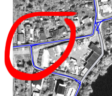
| Warning: GPS tracks recorded with an iPhone can be a waste | kusmi, yes, we did the reverse test, iPhone 3GS does the same sort of alignment when the road network is available, and iPhone 5 acts as iPhone 3GS when it is offline. Have a close look here:
This can be nothing else but the alignment to existing roads (the real road is ≈ 10 m away; we were 3 times on that intersection). |
