Nielkrokodil's Notes
Notes submitted or commented on by Nielkrokodil
| Id | Creator | Description | Created at | Last changed | |
|---|---|---|---|---|---|
| 4657157 | Nielkrokodil | Unable to answer "Who is allowed to park here? Parking may be free or paid." – Parking Lot – osm.org/way/698091754 via StreetComplete 60.1: Im Winter vermutlich niemand. Vllt im Sommer Kunden? Attached photo(s):
|
|||
| 3819928 | Nielkrokodil | In context of "Shops" overlay for osm.org/node/9955511166 via StreetComplete 53.3: Kein Hinweis vor Ort, dass es das noch gibt. Kann man löschen |
|||
| 3622930 | Nielkrokodil | Unable to answer "What type of shop is this?" for osm.org/node/10171808144 via StreetComplete 51.1: Stickerei (Aufnäher etc) |
|||
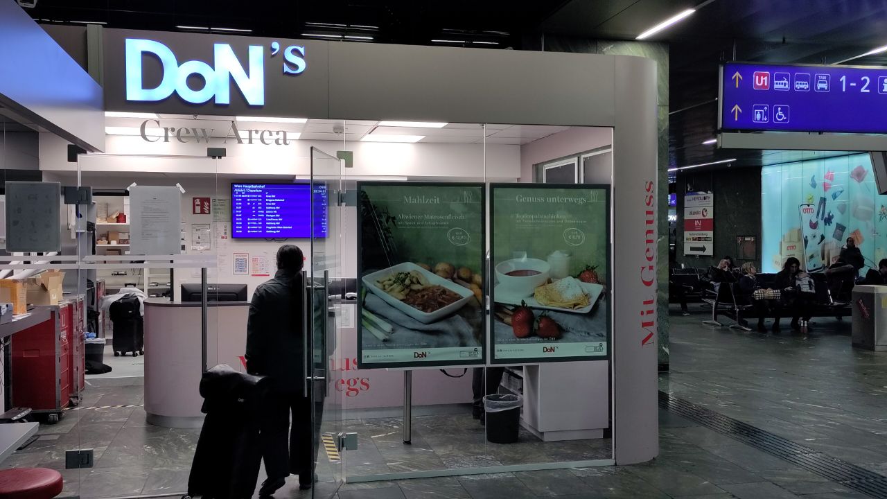
| 3611712 | Nielkrokodil | Unable to answer "What’s the name of this place?" for osm.org/way/396042598 via StreetComplete 51.1: Das ist kein Café, sondern der Pausenraum des Bordrestazrantbetreibers. Es heißt DoN's Crew Area Attached photo(s):
|
|||
| 4646600 | Nielkrokodil | Hier gibts mittlerweile ein Geradeaus-rechts Gebot. Man darf also nicht mehr links in die Alois Czedlik Gasse links abbiegen. |
|||
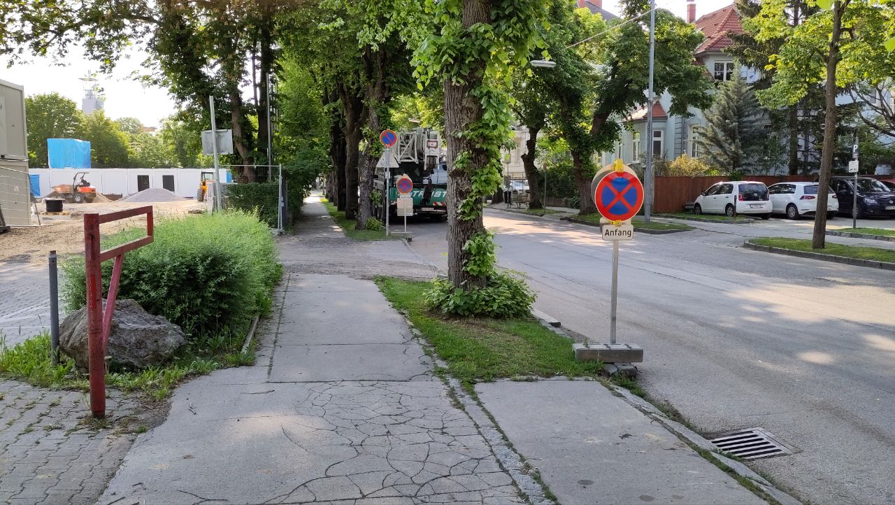
| 4396444 | Nielkrokodil | Footpath connects the two streets via StreetComplete 58.2 Attached photo(s):
|
|||
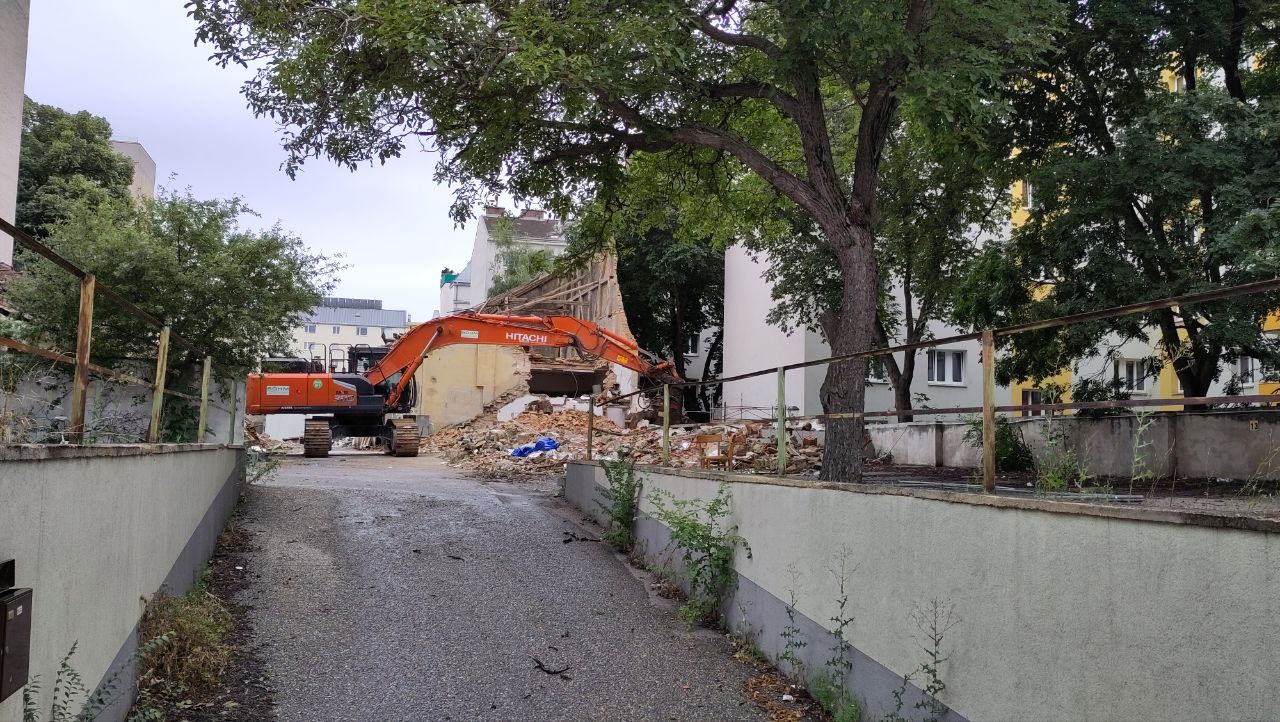
| 3819927 | Nielkrokodil | Unable to answer "What are the opening hours here?" for osm.org/node/456408020 via StreetComplete 53.3: Ein Teil des Hauses wird gerade abgerissen Attached photo(s):
|
|||
| 4610948 | Nielkrokodil | Ist der Anninger Trail in diesem Abschnitt (Abstecher zum Aussichtspunkt Friedrichswand) für Fußgänger begehbar? Falls ja, dürfen die in beide Richtungen gehen?
|
|||
| 3713715 | Nielkrokodil | Unable to answer "Is there a shelter at this stop?" for osm.org/node/724967806 via StreetComplete 53.0: Existiert nicht Attached photo(s):
|
|||
| 4610563 | Nielkrokodil | Unable to answer "What height limit is indicated here?" – Service Road – osm.org/way/1007124152 via StreetComplete 60.1: Es sind 2 Wege. Der eine nahe der Straße ohne Begrenzung, der zweite nahe des Hauses 3,4m. |