PlaneMad's Comments
| Post | When | Comment |
|---|---|---|
| ref OSM tag for all Indian States | Neat! Next need to figure out how to get such codes on the http://openstreetmap.in/ style. |
|
| Openstreetmap | Welcome! |
|
| National Highways new numbering scheme | Also helpful, this map that I made :)
|
|
| Simple 3D Buildings | This is so beautiful! How many hours did it take to map the building in OSM? How did you get the correct dimensions? |
|
| OSM in BD | It was during my undergraduate years in 2008 that I heard about OSM and went knocking on the doors of my city officials to see if they had any existing maps that could be used. Made some friends in the GIS dept there and gave me access to their many CAD based map prints. They were of terrible quality and not to scale, but had the street topology and names that I could use in OSM. Much of Chennai was mapped by me this way, but other cities essentially were mapped just by local volunteers and many big cities remain empty to this day. You might find my talk at SOTMUS this year of interest, where I shared my experiences doing this in India. You can watch the lightning talk here. @fidelcastrogi to clarify, there is no open GIS data available that we can use for OSM. The national mapping agency Survey of India maintains tight control over the availability of maps and even accessing them involves a lot of paperwork. |
|
| Mapping Streams in Mountain Areas | A nice relief shaded map used as an overlay can instantly help differentiate valleys from streams. The cyclemap layer is pretty ok for this for this purpose, but a specialized layer could really help. |
|
| OSM in BD | We have the same problem in India where geospatial data is never released by the Gov. Nothing like a good neighborhood mapping party to for some high detail maps. This is the area near office where we do regular field mapping. Much better than what any company or Government can collect! |
|
| Flood | Haha, classic! Flooded large parts of India myself back in the day :) |
|
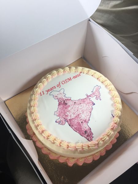
| Map evening in Bengaluru: The open mapmakers guide to life | The cake has arrived!
|
|
| Simulate traffic using OpenStreetMap-data and SUMO- Simulation for Urban MObility. | Looks very interesting Jinal. Also found some more tutorials that could come in handy to learn how this can be used in some real world scenarios. Pretty cool software! |
|
| Designing a compact and legible city map | naoliv, thats pretty neat what JOSM does. I’m using Mapbox Studio, making a style like this was just an hours work. To customize the style for different regions, I would need to create a custom OSM datasource with an extra attribute for each road. Its going to be tough to be able to do that much processing on the planet dump using my current setup. |
|
| Designing a compact and legible city map | Thanks Alan and Marcos. In India we drive on the left hand side which si why it was styled this way. Centering it would make it difficult to spot oneway unless I added arrows which would clutter the map. The only solution I can think of is another style with an inverted offset for other countries. Tags for left/right, would need to be added to every road in the world and may not be practical. |
|
| Tracing India's presidential estate | Thanks! Never knew Dr APJ was against mapping, do you have any particular references for this? Incidentally found this speech where he encourages the youth of the country to get involved in neighborhood mapping :) |
|
| How we apply map feedback | @trulasans, its for any Mapbox map irrespective of location or application. Try it out on http://geojson.io/ , click the (i) at the bottom. |
|
| How we apply map feedback | @trulasans, its for any Mapbox map irrespective of location or application. Try it out on http://geojson.io/ , click the (i) at the bottom. |
|
| Initial activity and retention of first-time HOT contributors | @desktop this is fantastic, would love to know the tools you use for processing this data. Was curious to see similar stats for the Nepal activation which was the biggest till date and if there were any anomalies from TH and ER due to the much higher media coverage. |
|
| How we apply map feedback | @SimonPoole The edit map option is available before as well.
|
|
| How we apply map feedback | Some stats since February when we started working on map-feedback: - 4,080 issues logged - 1,895 issues not actionable - 754 map issues fixed - 112 osm notes opened |
|
| How we apply map feedback | @SimonPoole Thanks for bringing up that point. In after submitting feedback we prompt the user to directly edit the map using the live editor into OpenStreetMap.
We have noticed that users of apps like Runkeeper have consistently gone to edit OSM themselves after submitting feedback, thereby fixing the map even before we look into the issue. The conversion rate has been lower from other referrers, but we are definitely seeing new editors coming in through this process. Even though iD makes it really simple to edit the map, for an end user on a mobile who does not have the inclination to learn a new tool while using his app, map feedback becomes the easiest way to contribute to OSM in a matter of seconds. Once a user has crossed this step, it becomes much easier to convert him into a map editor by showing him the way forward. Let there be no doubt that we want to grow a strong OSM community, and map-feedback has been one of our approaches to help do that. Also note that this is still an experiment which has given very good results so far, and any ideas for improvement is definitely something we will factor in seriously and try out. |
|
| Tracing forests from landsat | true, landsat is extremely low res mapping. obviously not anywhere close to accurate as gps or yahoo, but still it acts as a good base for a start, especially for large scale features like reservoirs and forest areas. |