OpenStreetMap logo OpenStreetMap

Reinhart Previano's Diary

Recent diary entries

Pertama-tama, saya mengucapkan Selamat Tahun Baru yang ke 2020!!!

Screenshot Description

Dengan maraknya program Gerakan Nasional Non Tunai (GNNT) yang diselenggarakan pemerintah sejak 2014, saya mengajak para penyunting peta (editor/mapper) untuk bersama-sama memetakan metode pembayaran yang diterima di Indonesia, misalnya dalam restoran, kafe, tempat parkir, halte, jalan tol, tetokoan, dan lain-lain.

Untuk Apa Dipetakan?

Dengan memetakan pembayaran nontunai di OpenStreetMap, para pengguna dapat langsung mengetahui pembayaran yang diterima dalam tempat tersebut (setidaknya di dalam situs www.openstreetmap.org). Hal ini akan memudahkan mereka untuk mencari tempat-tempat yang menawarkan penawaran diskon/cashback dengan lebih cepat dibandingkan dengan peta daring (online) lainnya.

See full entry

Months after I announced this upgrade project I’d like to announce that Transjakarta Corridor 9 has finally become the second (and currently longest) fully-validated route (next after MRT Jakarta in Jakarta, according to Geofabrik OSM Inspector Tools.

And that also means I’m closing https://gitlab.com/reinhart1010/osm-transjakarta-v2/issues/9 as fixed.

image

Similar to the MRT, Corridor 9 routes have been split into two separate relations (to comply with PTV2 schema): Transjakarta Corridor 9: Pinang Ranti → Pluit (6198079) as well as Transjakarta Corridor 9: Pluit → Pinang Ranti (10042521).

If you would like to contribute in upgrading process, use the above conventions for route names:

Transjakarta Corridor <X>: <Start> → <End>

Corridor 9A

See full entry

As you might have noticed, OpenStreetMap offers the delivery= tags/keys to tag places and restaurants which offers food deliveries. But, have you ever wondered how to tag those who do not have their own delivery service, but they do accept orders from food-ordering and delivery apps?

I have seen this case multiple times on small restaurants in Indonesia which indirectly accepts delivery service from GoFood and GrabFood. Sure that there are other similar services available in the world including MelbSC (Australia), Deliveroo (multiple countries), Foodora/Foodpanda (multiple countries), UberEats (multiple countries), Just Eat (multiple countries), as well as Demae-can (Japan).

So, why not we tag these services into OpenStreetMap the same way as payment:*= tags?

The rules are simple. For every food delivery apps that one place accepts, tag delivery:<app or service name>=yes. For example, if one accepts both GoFood and GrabFood mentioned earlier, give both delivery:gofood=yes and delivery:grabfood=yes respectively. If the place does not have their own delivery service, as originally intended in the wiki, tag delivery=no.

Some users might want to quickly find the place in respective food delivery apps. To ease that workflow, I suggest to add a sub-subkey named delivery:<app or service name>:ref=, which stores the URL or URI of the food delivery website/app. Using URL/URIs for this will be much easier for mapping, rather than finding and obtaining respective “restaurant ID”s similar to wikidata= and wikipedia=.

Location: RW 02, Gambir, Central Jakarta, Special capital Region of Jakarta, Java, 10110, Indonesia

I am currently working to improve Transjakarta, one of Jakarta’s major BRT/Busway operators, to comply with Public Transport Version 2 schema in OpenStreetMap, though Version 3 is being purposed.

image 
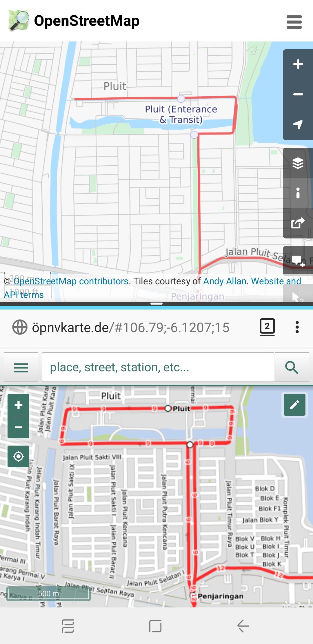
Before and After map of Transjakarta Corridor 9 route, between Pluit and Penjaringan bus stops

Legacy Tags that I’d like to keep for compatibility:

  • amenity=bus_stop for PTV1 compatibility on bus stations
  • corridorXX=yes: assigns which Transjakarta corridors are served, such as corridor9=yes for Corridor 9 and corridor12=yes for Corridor 12 (see Implementation Notes if you are a developer utilising this tag for queries)
  • HOTOSM InAWARE tags
  • network=Transjakarta, now also reinforced withnetwork:wikidata and wikidata values
  • shelter=yes
  • shelter_tj=yes (see Implementation Notes if you are a developer utilising this tag for queries)

Things I REMOVED

See full entry

Location: RW 04, Pluit, Penjaringan, North Jakarta, Special capital Region of Jakarta, Java, 14440, Indonesia

Mapping Indonesian Payment Systems and Proposal for New Payment Tags

Posted by Reinhart Previano on 20 April 2019 in English. Last updated on 8 August 2022.

This post is neither created nor endorsed by companies involved in establishment of payment systems listed below.

The OpenStreetMap payment: tag allows mappers to tag stores that accept certain payment methods (cash, debit and credit cards, etc.). Currently, the wiki only accepts those payment methods, so now I decided to introduce new ones in Indonesia.

What’s new?

First, let me introduce five new tags: three of them are dedicated to Indonesia’s newly-established GPN (Gerbang Pembayaran Nasional, literally National Payment Gateway). Currently it is a debit card switching network, similar to that of VISA and MasterCard (Maestro). Here, I propose payment:gpn_debit to be used in all merchants accepting GPN debit cards.

The Indonesian government has plans to replace existing payment networks in Indonesia with GPN, so does with credit cards and mobile wallets (e.g. Apple Pay and Google Pay). I am proposing payment:gpn_credit and payment:gpn_qris to be reserved for later use. The latter refers to the QR Indonesian Standard (QRIS) payment, similar to the SGQR system in Singapore.

The rest of these tags are payment:akulaku and payment:grabpay, reserved for Akulaku Pay and GrabPay. Both payment systems are currently used in multiple countries across Southeast Asia. In Indonesia, GrabPay has merged to Indonesian digital wallet app OVO, so merchants using OVO-GrabPay QR code sticker (see below) should be tagged with payment:grabpay=yes and payment:id_ovo=yes.

See full entry

Location: RW 02, Gambir, Central Jakarta, Special capital Region of Jakarta, Java, 10110, Indonesia

Fixing Genting Highlands

Posted by Reinhart Previano on 1 December 2018 in English.

Changesets: osm.org/changeset/65071147 osm.org/changeset/65071317

Removed 20th Century Fox World (constructed roads)

I reverted the mapping of roads under construction in this area as 20th Century Fox decided to stop the project (and Genting sues them). No, I’m not planning to change the type of Fox World’s area to brownfield, as this case have not been settled yet. However, I might want to improve the mapping of other theme parks in OSM, as other mappers have mapped some with great details. (such as in Universal Studios Japan)

Readjusting First World Hotel towers

Prior to these changesets, the First World Hotel consists of 2 towers: Tower 1 and Tower 3. The building which is named as Tower 3 in OSM is supposed to be Tower 2, as Tower 3 is built as an extension to Tower 2. I have stayed there once, so I also added a cafe in the Tower 3 lobby.

Next, I also adjusted the First World Hotel towers based on the newer DigitalGlobe imagery. Towers 1 and 2 are supposed to be curved, so I added that change to OSM. (You can confirm the shape using the older Bing imagery) As a result, these towers are aligned better towards Genting International Convention Center as well as the SkyAvenue shopping mall.

Skytropolis

During the development of 20th Century Fox World, Genting also have prepared a renovation of the First World Indoor Theme Park which will become “Skytropolis”. As the construction of this new the park is almost complete, I decided to add this to OpenStreetMap.

Other things

  • Added more parking lanes near to Genting Grand hotel

A note on previous changesets

This post is a continuation of my previous diary which I considered it controversial. Here are my next plans to fix those issues:

See full entry

Mapping the New Genting Highlands

Posted by Reinhart Previano on 7 November 2018 in English. Last updated on 8 November 2018.

Major Edits in Resorts World Genting, Malaysia

Today I am going to announce a large change to the OpenStreetMap database. What is it? The complete removal of the old Genting Highlands Theme Park assets.

If you are using Bing, MapBox, or DigitalGlobe (Premium) satellite imagery, you are still seeing the old face of Genting theme park.

Image 1

However, if you use the standard DigitalGlobe imagery, you will see that everything has changed since 2015, the last time I visited this place.

See full entry

Location: Gohtong Jaya, Genting Highlands, Bentong, Pahang, 69000, Malaysia

Connecting Rivers

Posted by Reinhart Previano on 30 October 2018 in English.

False-color render of river A false-color render of Citarum river. Note that the unmapped line shown above is not geographically accurate.

Days after my attempts in extending the Citarum River, Indonesia (see this post), a HOT (Humanitarian OpenStreetMap Team) project added an unconnected part of the same river (highlighted in above image in dark blue color). Today, I have mapped the gap between both rivers to be joined into one in Changeset #64012348.

One thing that surprises me in the HOT changeset is that the river that flows in an opposite direction with my drawn rivers. I am confident enough to change the direction of the river to follow the direction of the dam in (-6.69206,107.41797) as well as the tributaries found at the unmapped part of the river (after the HOT changeset).

I am planning to do some QA on the HOT-added river before merging with the main river line.

Location: Wangunjaya, West Bandung, West Java, Java, 41164, Indonesia

Finished Result

Continuing from my previous post, I have submitted 8 new changesets (#63876977 #63877356 #63885737 #63885836 #63947501 #63947694 #63965928 #63976086) to add the aircraft parking lanes in klia2 (Kuala Lumpur International Airport, Terminal 2).

Additional Notes

  • Someone has suggested in the previous post to refine the aeroways (e.g. taxiways) in the airport and adding metadata to them (such as taxiway width), which I would be happy to do so. However (as OSM does not allow paths encoded by Bézier curves), I need to both improve and simplify the appearance of the curves to save space on the map database.
  • Someone added some footpaths inside the airport terminal which connects to AirAsia’s RedQ (headquarters building), but these paths are currently disconnected from the Gateway@klia2 (the nearby shopping plaza) and the gates.

See full entry

Location: Sepang, Selangor, Malaysia
  1. Added Pier P gate numbers
  2. Added Pier Q gate numbers
  3. Added Pier K/L gate numbers

I have discussed those changesets in Part 1 and Part 2. Now it’s time to complete this map.

I recently added the final gates in klia2, which is located at Pier J (Domestic). That’s the main message, however someone have added some lengths of lines connected to the taxiway. Unfortunately, these are not visible in the regular OpenStreetMap layer.

Before changeset Before changeset

Apparently, they are the aeroway:parking_position paths. These paths are self-explanatory, which are the ones followed by an aircraft to safely deliver passengers to the parking spot (and terminal gates). Bing satellite imagery provides a clear view of these lines to be added.

See full entry

Location: Sepang, Selangor, Malaysia

Continuing from one of my previous post I have added more gates for Pier K/L and Pier Q.

After changeset After changeset

Before this changeset is submitted, the map of klia2 only has a full set of Pier P gate numbers (added by myself) and a lonely Gate Q10. I reused the old Q10 node in these changesets so there are fewer changes to the map database.

Additionally, as in Changeset 63791506, I decided to join the Airport Gate “nodes” to the entire klia2 building. This makes node placement easier as I am no longer need to estimate the equal distance between the airport’s edge to those nodes.

See full entry

Location: Sepang, Selangor, Malaysia

That's a lot of changesets! That’s a lot of changesets!

Back then, when my relatives come back from Bandung, Indonesia to Jakarta, I was told by them that they were in a rest area on the 97 kilometer mark of the Purbaleunyi toll road. I tried to search on OpenStreetMap and there were no results.

Apparently, that rest area were not added to OSM yet. So, I started to add that place on Changeset #61579993.

Oh, no! Satellite images show that there are roads and bridges nearby, yet there were no nearby roads listed to the OSM database. So, I added a few roads, in Changesets #61580342, #61761820, #61761878, and #61761940; then #62783689 and #62783948 (after adding some rivers).

See full entry

Changeset details: osm.org/changeset/56642302

The Central Park Mall is one of the popular shopping malls in West Jakarta, Indonesia. It is also inspired by the design of the Central Park in New York City.

This mall has a park for visitors to walk around, called the Tribeca Park. Aside from that, this mall is also connected to the Tribeca (a 2-storey section of Central Park Mall consisting of several restaurants) and Neo Soho (the shopping mall below the new Soho apartment near to Central Park). These malls are owned by the same developer, PT. Agung Podomoro Land.

In this changeset I added the new Tribeca (mall) section at the other side of Tribeca Park, including the skybridge connecting Tribeca ↔️ Central Park ↔️ Neo Soho. I also added more details on Tribeca Park itself, including added new footpaths, restaurants, ponds, fountains and a new escalator. There’s 1 more pond left unmapped, as I need to re-check on site for the accuracy of its position.

So far, here’s the changes I made to this shopping mall. As of now, there might be some mistakes in my changes to, which I will fix it later.

See full entry

Location: RW 06, Tanjung Duren Selatan, Grogol Petamburan, West Jakarta, Special capital Region of Jakarta, Java, Indonesia