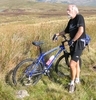
Just spent a weekend in the New Forest (Sandy Balls) on a running club training weekend - sadly only coaching for me. Managed to sneak out and do some mapping on both bays. Firstly tidied up, named and added some features to minor roads south of the site. Saw plenty of the handsome ponies and sadly a dead badger. Asked some MTBers if a track they were on was legal or not and they meekly said "no, but looked a good un to have a go at". Also mapped the whole of the residential eastern side of Fordingbridge - some fabulously wealthy looking properties, in marked contrast to some areas I have been mapping recently in London, with the usual long stares from lawn trimmers and car washers as one goes into "their" dead end roads. Quite a bit more for someone to do in the north and centre, including more POIs. But really good to be out in the sunshine collecting GPS tracks in the raw for a change. Still on a vain mission to generate enough GPS points to make the top 50 on the stats (last entry is now 1.36 million). Suspect I spend too much time NPE tracing, which doesn't count - for that particular chase to ever be realised.
Steve Chilton's Diary
Recent diary entries
Spent some lovely sunny days visiting my son in Sevilla (at Uni there). Took a bit of time out to map a bunch of stuff to west of the river/canal, and to tidy up some other stuff in the city centre. Using the excellent free Servici loan bikes to get about (of which quite a few more stations are now mapped) - which got 2 sons to join in. Would have loved to map by Segway, which you sometimes see floating around the city. Met local OSMer Pedro there for a chat about OSM, oranges, bike loan systems, and life in general - over a couple of beers.
Two productive days - so many ways of doing stuff in OSM
Posted by Steve Chilton on 24 January 2009 in English.Yesterday being a lovely sunny day I headed out to my nearest place with a significant number of un-named roads (Goffs Oak), thinking an hour or two would knock it off. Unfortunately, when I got there I discovered loads of others that weren't on the map at all, so GPS tracked them, naming them and others as I went. However, now I have to go at least once more to finish off, and then again at least once more to do all interconnecting footways, which are so prevalent in these estates. Have traced the landuse=residential from Y! to delineate the areas. Also find that GPS traces are far better than Y! traces in this kind of environment because they are newish estates, with all the spurs, deadends, footpaths, parking areas, etc which you can't get the nuances off without actually being there. Even when there I sometimes can't decide when things are road and when they are just shared driveways to one or two houses. I usually go by the change in surface. If they have a lip and change from tarmac to sets or some other fancy surface I usually stop there.
Best road name - Dig Dag Hill.
Filled in a few street names, and mapped a few roads when staying with a friend in Yateley last night. Today filled in some nonames roads right by Ordnance Survey HQ on a visit there.
Whilst travelling to watch a cross country race I detoured to map a load of nonames stuff just south of the big woods by Ruislip Lido. Looking at the nonames layer there is quite a few chunks that need a load of naming in this area of London. All a bit far for for a casual trip for me though.
Just spent a few lovely days in sunny Seville (whilst it snowed in London). Mapped as much as possible of the street names of the historic centre, most of which had been traced from Y! and were nonamers. Potlatch's new filter helps alot when editing this way (cheers RF), although I did find I didn't name some highway=pedestrian instances as my printed nonames output didn't show them as such. Also met up for a drink and chat with Pedro, who is mapping his city and showed me his cool Openmoko device.
Some problems mapping in this location: very poor GPStracks due to very narrow streets and tall buildings; very difficult to make judgements on highway types (what I thought were pedestrian streets often had scooters and even vans and cars coming at you); stiff neck from constantly looking skywards to collect road names high up sides of buildings; deciding whether to map names as displayed or to add Calle (went for former); hot work in the midday sun (cafe is good).
There is a free city bike service with many pickup/dropdown points. Would have used it more but time limit is 30mins and you can't immediately re-register for another bike (ie swop and continue). Urban mapping by Segway could be the way forward. Seem to be legal in most of Europe, except UK.
Last three days has seen me mapping at different levels in three different locations. Friday just walking around near work (Hendon) capturing some street names alerted to by nonames layer. Saturday at a family wedding in Minster (Kent) just adding some detail to the village we were staying in. Sunday did the morning stint at the Wembley/N London mapping party, before going to the (not so) Grand Junction Arms to meet others. No beer on tap, and whatever food you like as long as it is called roast.
Now, over time I have regretted entering some streets AFTER having doing so, particularly in some sink estates. Well, today I found a road that I wouldn't even enter, even in a car. It was in Brent Park, just off the N Circ. Coming to a mini-roundabout in a combined residential/industrial estate there was a left turn into a road that needs adding to the map. It was guarded by discarded electrical appliances, bedsteads, parts of cars, prams, etc, and two large alsatians (I think you get the picture). Looking down the street I could see menacing looking youths, and a few urchins, white vans, fancy caravans, and bikes/toys strewn all over the road. It was a dead end so I knew that going in to get a gpx trace would mean stopping, turning round and coming out again. So I took the street name down (yes it is a permanent location, with houses etc) and will mark an estimate of the length of it in the db, with tags such as note="not entered, estimate", access="the very brave", etc.
Visiting family and relatives and managed to do a little more infill in South Wales. Some minor roads to west of Chepstow, including some of lcn 31 and 32; all road detail of Sedbury and Beachley; and as much as I could get of Dulverton. Noticed original Severn Bridge (M48) and it's associated footway/cycleway is not shown as bridge, but unsure of where bridge actually starts and finishes, so left for another time.
Bike ride out to do more of Bury Green, Churchgate and start Flamstead End. All stuff round Rosedale Way and Peakes Way to do still. Area south of Andrews Lane took ages due to having stubby roads, houses with no roads, plus footpaths and alleyways linking everything. Yahoo is no good for correctly entering this mixed stuff. New technique for naming country roads that have no sign visible. Note market garden firm (loads round here) that has web address and look up where they think they are based (worked for Barrow Lane). After seeing the rough end of town it was nice to end up doing some of the heritage stuff opposite St Marys Church. Nice bit off off-roading through Theobalds and Whitewebbs to finish. Over 4 hours out, of which about two and a half mapping, and editing done in under 2 hours.
Being in the area and having an hour to spare today I thought I would fill in some of the un-named streets to west of Cheshunt. Filled in some in Goffs Oak and the new housing development around Gladding Rd Open space, then some more down towards Churchgate. Found loads of residential roads not mapped so will have to make another couple of trips out there with GPS. Many stumpy little cul-de-sacs and roads with branches with same name as the straight bit. Best names - Dig Dag Hill and Bread and Cheese Lane. I also like finding roads that have same name as major roads elsewhere. Cromwell Road, Cheshunt is a dingy little road with no more than 20 houses, compared to the other one in hip Chelsea, London. Can also tag the previously surveyed new roundabout on Lt Ellis Way (for new St Marys School being built) as it is now open.
Mapped another little infiller in Cheshunt tonight, all the bit between Gt Camb Rd, the B198, Hertford Rd and Winston Churchill Way. Will have to go back and capture the details of Cedars Park, which is something to look forward to.
Short bike ride to map some of lcn 88, which goes by near me. Must look up where it goes to and from sometime! Usual problem of how to map different types of physical presence: separate lane, pavement with markings, using service roads, short breaks, etc. Then on way back watched random cricket match and mapped the micro detail inside Oakwood Park, and had a nice coffee there.
Used output from the Export Tab for real today. Three strip maps of areas already mapped. Scaled to 1:15,000, saved as PDF and then printed at A4 (fit to page). Results are dead crisp and brilliant for subsequent micro-mapping of some details round Pickets Lock - the actual lock, not the stadium - then up the Lea Navigation towpath.
Now if only I can get waterproof paper to feed through my printer I would be able to read my annotations better - after being caught in drizzle for ages when out mapping!
Originally I thought the fact that the orangey selection box stayed there when you zoomed was annoying. Now realise it is so useful when patching a series of slight overlays together in this way.
Posted some tiles of progress on mapping UK canals at:
Canal map
Hope it is useful for checking gaps, errors etc, and for deciding where effort might be channelled (intentional pun).
Since posting I have digitised the gaps in the Kennet & Avon, so that is now complete.
After a meeting today near Waterloo Station I filled in some detail around the station. It is amazing what extra detail you can add in if you get down to it. Shows the disadvantage of trying to map from Y! imagery. There are so many little service roads, stubs, estate roads, and variations in onewayness (in the same street) that you really have to be there to do it justice. Complicated here by fact that the station is all on raised level and there are roads, footpaths, bridges etc all coming in at different heights and up and over each other.
Added some more detail to the area around Nottingham Trent University whilst staying at a hotel nearby before going to cross country race at Wollaton Park.
Nice afternoon so out for couple of hours exercise on the bike mapping around south Cheshunt. Surveyed a new roundabout on Lt Ellis Way that I didn't even know about. Will add to map untagged, with note to FIX as soon as it is open.
Also can add a new dimension to the bridge/viaduct saga. On way back followed the towpath of the canalised River Lea as it crosses the M25. This is just to west of the A10 junction. It crosses the motorway in an aqueduct but to all intents and purposes is a tunnel at the same time. It disappears "underground" and is covered over in such a way that the towpath is actually on top of the canal itself for a short while. Not sure how I will tag it - probably as canal + bridge, with a note to say that it is "undergound".
Mapped the main part of Chepstow town one afternoon to work off some Christmas excess. Back to do more on next visit to inlaws.
Have been doing some mapping in New Zealand following a visit there in August. Notice that Thomas Matern is also doing some mapping there. If he reads this could he please contact me (via my user page - search for steve8) so we can collaborate.