I’ve been having a great time recently using Osmium to write my own analysis code in C++ to look for anomalies in the PBF extracts. Today it found this very strange coastline in South Africa:
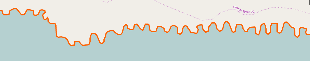
Perhaps, i thought, this is some rare geological formation, that makes an amazing wavy line? So let’s look at the data over aerial:
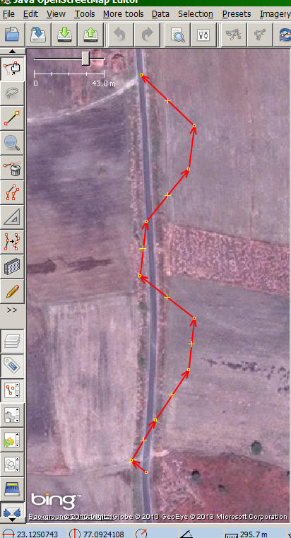
 With incremental similarity, we were largely immune to disruptions along the side of the road, because we came upon them gradually. Now, a large shadow is sufficiently unlike our starting point that it scares the algorithm into swerving away from the shadow and running off the road. (I can sympathize with the algorithm. I did the same thing in a car once :-)
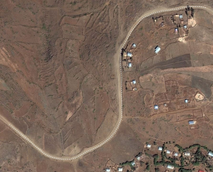 I’m guessing that this is because roads are more self-similar than what surrounds them, so looking for linear self-similarity stays on the road.
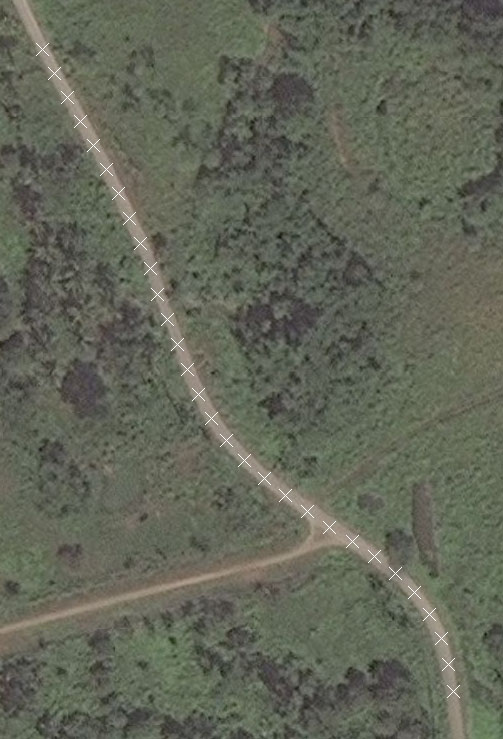
What it does NOT do, however, is find the middle of the road. Look closely and you’ll see that the path drifts over to one edge of the road and stay there, then wanders back again.
I’m guessing that this is because roads are more self-similar than what surrounds them, so looking for linear self-similarity stays on the road.
What it does NOT do, however, is find the middle of the road. Look closely and you’ll see that the path drifts over to one edge of the road and stay there, then wanders back again.