dbantoine's Notes
Notes submitted or commented on by dbantoine
| Id | Creator | Description | Created at | Last changed | |
|---|---|---|---|---|---|
| 3927067 | JoCo | ce passe n'existe pas ! |
|||
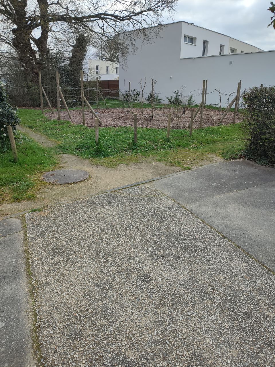
| 4158622 | dbantoine | Unable to answer "Who is allowed to use this playground?" – Playground – osm.org/way/22821518 via StreetComplete 57.1: Ce n'est plus une aire de jeu mais une petite zone plantée Attached photo(s):
|
|||
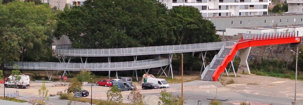
| 4139152 | dbantoine | Ici la piste cyclable est sur une passerelle surélevée qui fait une boucle. Il faut corriger la topologie, les deux parties ne sont pas reliées au "croisement" car à des hauteurs différentes, voir photo : https://www.pss-archi.eu/photos/membres/13651/l/2023/09/1694033612cfsu.jpg
|
|||
| 4171515 | dbantoine | Bande cyclable en sens inverse dans cette rue à ajouter |
|||
| 3810258 | Il y a un chemin piéton ici |
||||
| 3858683 | cartœuvertes | Unable to answer "What kind of crossing is this?" for osm.org/node/2423243991 via StreetComplete 53.3: no crossing |
|||
| 3420623 | dbantoine | Unable to answer "What’s the surface here?" for osm.org/way/320048638 via StreetComplete 48.0: N'existe plus a été supprimé |
|||
| 3420465 | dbantoine | Unable to answer "Are there curbs where this way meets this road here? What kind?" for osm.org/node/4041766603 via StreetComplete 48.0: Pas de chemin |
|||
| 3420458 | dbantoine | Unable to answer "What’s the surface here?" for osm.org/way/25904295 via StreetComplete 48.0: Ce chemin n'existe pas |
|||
| 3411967 | dbantoine | Unable to answer "What type of barrier is this?" for osm.org/node/256093658 via StreetComplete 48.0-beta1: Plot béton bas environ 10cm pour passage véhicules secours |