h4ck3rm1k3's Comments
| Post | When | Comment |
|---|---|---|
| Please help with Prishtina DXF Import | Here should be the cross on the stadium, the stadium is a bit off in osm:
|
|
| Please help with Prishtina DXF Import | Andrew, good point. If you have highres jpegs, we can trace over them!
|
|
| Please help with Prishtina DXF Import | I have added these to my default.style : node,way northing text linear
Invoke like this:
Then I can split by the layer attribute! |
|
| Please help with Prishtina DXF Import | That is great. Is there a way to get the coordinates shifted over prishtina? I can convert the dxf file. Also, these layers, I can split them from the resulting osm file. The unconnected lines, we can do that manually.
|
|
| Please help with Prishtina DXF Import | The stadium is here :
that is utm :
723814.43 -4723364.5= −3999550.07 (about -400k)
zone 34t according to :
|
|
| Please help with Prishtina DXF Import | X= 723814.43 Y = 513785.54 This coord is off, with a normal projection you wont get any points in prishtina
|
|
| Please help with Prishtina DXF Import | Upps, you have to view this with no style in firefox, for some reason the entry is messed up. |
|
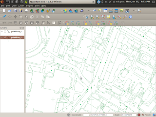
| Please help with Prishtina DXF Import | I have made some screenshots of the detail in prishtina, amazing!
|
|
| Please help with Prishtina DXF Import | using my TwoNickel to convert to osm,
using my patched version of osm2pgsql
It is now loading. Will then try and shift the data around manually with qgis. |
|
| Please help with Prishtina DXF Import | The file is here the whole time :
I am working on using my osm file from dime, converting that to pgsql and the will try and transform the data with qgis, all help appreciated.
|
|
| Please help with Prishtina DXF Import | Hi, There are points, lines and streets.
but Really, this goes over my head, I would need some exact instructions on how the coords are encoded in the dxf file so that I can decode them. I dont have autocad or windows... thanks,
|
|
| Gotten all the streets from Albania from DLG | The wikipage for the flood project is here :
|
|
| removing the EPA data from OSM | Thank you for your patience. I have removed all of them that did not get edited by someone. Please post the changesets of mine, and i will revert them.
|
|
| Call to map, Albania with the flood crisis | We have now permission to use the data :
|
|
| Call to map, Albania with the flood crisis | I have made a better image to trace from for Shkoder, and a video on how to help out with josm and the plugin. please help trace the map of shkoder.
|
|
| Call to map, Albania with the flood crisis | ||
| Planimetria de Vitoria, part 3 | CONGRATS! |
|
| Call to map, Albania with the flood crisis | I have added a new sat image :
use this in your josm:
|
|
| Call to map, Albania with the flood crisis | I have added this to the wiki
|
|
| Call to map, Albania with the flood crisis | Here it is on digiglobe!
|
