OpenStreetMap logo OpenStreetMap

jinalfoflia's Diary

Recent diary entries

For folks who would want to add some road names in Klang Valley, we have an interesting maproulette challenge for you! These are for mappers who are a little experienced. Here’s where you can get started: https://maproulette.org/browse/challenges/23131

image

Put your mapping hats on and let’s do some mapping!

We would love to hear your suggestions and feedback on these tasks so that we could better next time.

PS: Can’t wait to see who is going to be on top in this challenge (psst.. We have some goodies for you) 😉

Happy Mapping!

It was great going through the challenges in part 1. We have a few more interesting tasks as the next maproulette challenges for you all. They are for mappers who are just starting or are experienced. Here are the tasks for you all:

  1. Connectivity checks: https://maproulette.org/browse/challenges/21203
  2. Building-Road intersection checks: https://maproulette.org/browse/challenges/21201
  3. Inconsistent Road Classification checks: https://maproulette.org/browse/challenges/21207
  4. Intersecting Buildings checks: https://maproulette.org/browse/challenges/21208
  5. Correcting mixed name case: https://maproulette.org/browse/challenges/21215
  6. Connectivity checks: https://maproulette.org/browse/challenges/19892
  7. Invalid Turn restrictions checks: https://maproulette.org/browse/challenges/19890

Put your mapping hats on and let’s do some mapping!

We would love to hear suggestions and feedback from you on these tasks so that we could better ones next time.

See full entry

Let’s look into some connectivity checks in the Philippines! [Part 1]

Posted by jinalfoflia on 31 May 2021 in English. Last updated on 13 October 2021.

Are you wondering what to map next? Don’t worry we got you covered! We have three interesting tasks as the next maproulette challenges for you all. They are for mappers who are just starting or are experienced. Here are the tasks for you all:

  1. Connectivity checks: https://maproulette.org/browse/challenges/17714
  2. Sharp Angle checks: https://maproulette.org/browse/challenges/17716
  3. Invalid turn restrictions: https://maproulette.org/browse/challenges/17715
  4. Crossing ways: https://maproulette.org/browse/challenges/17943
  5. Wrong one way- double way - https://maproulette.org/browse/challenges/17958
  6. Road Islands - https://maproulette.org/browse/challenges/17950

Put your mapping hats on and let’s do some mapping!

We would love to hear suggestions and feedback from you on these tasks so that we could better ones next time.

PS: Can’t wait to see who is going to be on top in this challenge (psst.. We have some goodies for you) 😉

Happy Mapping!

Mapping with RapiD

Posted by jinalfoflia on 7 August 2019 in English.

My team at Grab and I got an opportunity to experiment with the RapiD – AI-assisted mapping editor. We found this tool to be useful in mapping missing road networks. It is also helpful in increasing the mapping speed, as:

  • Missing features are already highlighted – helped us focus on the exact location where the feature is missing than going through an entire area.
  • Once selected, they are already traced, thus minimising the tracing efforts and help us better the quality of tracing
  • Help in increasing mapping speed plus give us full control of the data that can be uploaded and the ones that need not be uploaded.

This would be a great tool for the community in SEA as the folks here are new and would be willing to explore this to map the unmapped regions here.

Here are our major takeaways post using the tool:

  • The AI detections are pretty clear and are correctly detecting the roads.
  • The user has the option to accept or reject a detection, clearly establishing that a mapper intervention is necessary even if the AI is pretty good in identifying.
  • It automatically connects the new roads to the preexisting ones or warns when a new segment that we accept has been connected or not, which is great for new mappers to understand and validate.
  • The detections stand out but also doesn’t take up too much space, making it easier to spot the roads without having to disable to rapid assist.
  • The detections already had predefined tags, which makes it quicker for the mapper to add the roads and since the tags are already defined, it eliminates the cases of having or uploading untagged ways.
  • The AI detects the features until the end of that grid and allows the mappers of the other grid to connect the roads, which makes it easy and conflict-free.

See full entry

More street level imagery = more mapping!

Posted by jinalfoflia on 26 April 2019 in English. Last updated on 14 June 2019.

Grab is excited to share with the community, that our maps team in Thailand has been uploading street-level imagery in Mapillary for Chiang Mai City areas and we are now hitting ~82% which is approximately 1,667 kilometres of roads. We are expected to complete the 100% upload by the end of this month.💥 Update: We have completed 100% upload of the street-level-imagery in this region.

We also have uploaded imagery on OpenStreetCam for the Singapore area. ((edited-29th April 2019) This upload was done sometime last year)

Here’s how you can start mapping using Mapillary imagery, here are the detailed steps involved if you are using iD editor or JOSM for mapping. Want to start contributing imagery in your region, here’s how you can do it!

Happy Mapping!

See you at State of the MapS!

Posted by jinalfoflia on 24 July 2018 in English. Last updated on 25 July 2018.

State of the Map conferences celebrates the essence of the amazing communities that form an integral part of the OpenStreetMap. These conferences continue to strengthen the relationships that contributors around the world build both online and in person. The whole team at Mapbox cannot wait to connect with new and familiar friends around the globe at the many OpenStreetMap events happening this year.

Map of all events Here’s the map of all events, find the interactive one here

Take a look at our event-full calendar for this year:

See full entry

The OpenStreetMap Navigation map is a web application which uses Mapillary vector layer to highlight the traffic signages detected in Mapillary images. The application is helpful to add/verify/modify turn-restrictions on OpenStreetMap.

Using the navigation map, our team and the community reviewed 38,658 turn restrictions signs from Mapillary, out of which there were 18,565 valid, 11,924 redundant and 7,989 invalid turn restrictions.

We’d like to announce Mapbox will no longer maintain this tool and will no longer work from today. This is an open source project, if you’d like to run a similar project or re-use this, you can find all the information in the repository. Thank you to all the contributors!

Wikimania 2018 is happening in Cape Town, South Africa on July 18-22, 2018, it’s the annual international conference that celebrates Wikipedia and its sister free knowledge projects.

The previous year, Montréal, Canada, was the host of this conference. The OSM community in Montréal had set up a booth and did an amazing work of introducing people to the OSM project. It also became a great place for answering questions related to OSM as well as explore more ways to collaborate with different Wiki projects.

group photoGroup photo - Wikimania 2017

There were some interesting sessions related to OpenStreetMap in the previous Wikimania:

See full entry

Location: HAL 3rd Stage, Indiranagar, Bangalore East, Bengaluru Urban, Karnataka, 560075, India

Mapbox has a new logo!

Posted by jinalfoflia on 28 April 2017 in English.

OpenStreetMap is an integral part of Mapbox, I’m happy to share the announcement about our new logo with the community! 🎉

The logo is a helmet of an astronaut and my favorite part of this logo is that it reinstates Mapbox’s culture of curiosity and passion! It showcases the team’s vision and enthusiasm towards new opportunities. The star that you see in the astronaut’s helmet demonstrates our spirits to reach new heights! Know more details about the logo here.

33284852904_49008d0641_o

Though we have a new look and feel, we still continue to be the Mapbox that you all know. Our commitment towards improving OpenStreetMap data remains the same and so is our attribution around OpenStreetMap! ✨

Ottawa Mapping Party!

Posted by jinalfoflia on 26 April 2017 in English.

The OpenStreetMap Ottawa community was working on the Ottawa building import that led to an addition of 350K buildings and address points to OpenStreetMap.

This project was completed on the 7th of April with a mapping party hosted by the community, and Mapbox had an opportunity to sponsor this mapping party. As a Mapbox data team member, this was a great opportunity for me to interact with the community and get an understanding of the workflows they follow to make this import happen! The community is currently validating these tasks.

ottawa The map showing the buildings added by the community made using Mapbox

See full entry

OpenStreetMap diaries are a great way to communicate with the community worldwide. Since past few months, few of us are receiving irrelevant comments on our diary posts from users who mostly have no edits (likely that they are new to OpenStreetMap)

Some examples of such comments are:

  • This is a snapshot from a diary post by SrrReal, which has many such comments.

openstreetmap srrreal s diary ideas from an introductory osm session at trichy 20170423 png

  • This is a snapshot from a diary post written by me.

See full entry

The data team at Mapbox has been trying out mapping missing motorway exit numbers in the US. Based on the density of Mapillary street photographs, the following 9 US states were chosen to improve:

  • California
  • Florida
  • New Jersey
  • Maryland + DC
  • Pennsylvania
  • Washington State
  • Colorado
  • Texas
  • Illinois

We used the checkautopista2 tool which made it very easy to detect exits that lack a ref tag. In summary we found most of these exits to have no official exit number and added the noref=yes tag when we could confirm it on official documents or on Mapillary photographs.

exit These are the exit numbers added by the team. The pink dots represent ref=* tags and the blue dots represnt noref=yes tags added by the team, click here to view the full map

The team has been working on this from 31 March 2016 to 14th April 2016 and reviewed more than 220 highways.

See full entry

Using Maps.me mobile editor for the first time

Posted by jinalfoflia on 20 April 2016 in English. Last updated on 21 April 2016.

Maps.me is a mobile application that provides offline map service world wide and it uses OpenStreetMap. It also provides a provision to add POIs and building information. This means more eyes and contributors to OpenStreetMap. I played around with maps.me application for Android, these are some points that we should make note of:

  • The UI is smooth and makes it easy to add POI’s on map.
  • It’s a really good mobile editor.
  • The app provides fields that will help the user add information about a POI/Buildings conveniently.
  • The maps are updated only with the next release of the application, so the changes made by the user on OpenStreetMap will not be reflected until the next release of the application.
  • The tags provided are limited, for example common tag like university is absent.

photo_2016-04-20_15-13-00

See full entry

Motorways are access controlled highways with designated points of entry and exits. Missing an exit on a motorway can result in long detours of tens of kms to get back to that point. In OSM we tag the exit nodes on the highway as highway=motorway_junction with a ref tag indicating the exit number that is displayed on the road signages.

According to the OSM wiki, motorway junctions should have a unique ref indentifier or name. In the US alone there are around 7,000 exits without a ref identifier. Many exits have no official idetifier and they are usually tagged with an additional noref=yes. What about the rest? Are they missing a ref or does it not have one?

screen shot 2016-04-05 at 4 48 50 pm Overpass query to find exits without a ref or noref=yes

Here’s how you can investigate the missing ref on motorways in your area:

Find exits without a identifier

There are multiple ways to do this:

See full entry

Continuing from the previous diary post.

I worked on cleaning up the tags amenity=picnic_site & leisure=picnic_site and replaced them with tourism=picnic_site tag. Here are the changesets related to the changes made on OSM.

Changesets for amenity=picnic_site

Changeset for leisure=picnic_site

If an edit was made with-in a year, I have sent a message to the user, informing about the change I made to their edit. There were a total of 44 messages sent.


This was the message format

Subject: Re-tagging picnic sites with tourism=picnic_site tag

Hi,

I’ll be changing the tag from amenity=picnic_site to tourism=picnic_site tag as per this wiki, to find more information on this you can refer this diary entry.

This is the node that I have changed the tag for - osm.org/node/3353080237/history (The link to their node)

Thank you!

Best,

Jinal Foflia


Some pain points:

  • It is a good idea to send a message to user intimating them about the change, but the process becomes tedious after a point of time. Since this was small number it could be managed. For bigger edits it would be a great idea to have a better way in which it can be communicated.

Statistics

See full entry

As per the wiki picnic sites should be tagged tourism=picnic_site and not as amenity=picnic_site or leisure=picnic_site.

There are a small number tagged as amenity=picnic_site and leisure=picnic_site through out the world. I think these should all be tourism=picnic_site.

These are the number of picnic sites tagged as leisure=picnic_site

screen shot 2015-12-22 at 11 33 59 am

These are the number of picnice sites tagged as amenity=picnic_site ways

See full entry

Location: Indiranagar 1st Stage, Bengaluru, Bangalore North, Bengaluru Urban, Karnataka, 560038, India

Improving Routing Information Using Mapillary Imagery

Posted by jinalfoflia on 30 November 2015 in English. Last updated on 1 December 2015.

Mapillary images are a good source to verify and add information like turn restrictions and speed limits. This is not possible with satellite images. We realised that we need to have a thorough knowledge about the traffic signs used in the region we are mapping, as they are region specific.

Initially we started exploring the traffic data in USA. With help of the traffic data wiki for USA, we came up with a list of road signs which can be mapped using the Mapillary imagery. This list was created after pruning a list containing 467 traffic signs used in USA, after comparing them to the signs detected by Mapillary. We have also listed the OSM tags associated with each traffic sign.

Refer to the table given below to match the traffic sign in the Mapillary image against the list of traffic signs and it also consists of the OSM tags:

screen shot 2015-11-30 at 11 22 55 pm

Here is the traffic signal guide.

This is the workflow we used to map the turn restrictions:

STEP 1: Setting up JOSM for mapping traffic data

See full entry

Osmgeoweek celebrations in Bengaluru!

Posted by jinalfoflia on 24 November 2015 in English.

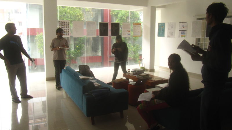
Last week, we celebrated osmgeoweek in Bengaluru, India with a community mapping party at the Mapbox office on 15th of November. On a drizzly Sunday morning, @planemad and several OSM-IN volunteers set out to map garbage dumping sites, waste baskets and street lamps in the locality.

Deciding what to map

We do a lot of detailed mapping around our neighborhood in Indiranagar to showcase the possibilities of mapping with OpenStreetMap for the local mapping community, and is now probably the most well mapped neighborhood in the country.

See full entry

SUMO is a free and open traffic simulation suite which is available since 2001. SUMO allows modelling of intermodal traffic systems including road vehicles, public transport and pedestrians.

  • This simulator has many options to customise the simulation, options like CO2 emissions on roads, speed limits of the roads etc
  • The data for simulation is taken from the OpenStreetMap

Steps to simulate traffic of a particular region.

Step 1: Download OSM data from Open Street Maps (<file_name>.osm)

Step 2: Run this command to get the .net file required for simulation. (Netconvert imports digital road networks from different sources and generates road networks that can be used by other tools from this package.)

netconvert --osm-files <file_name>.osm -o <file_name>.net.xml --output.street-names true --output.original-names true

Step 3: From the following link copy the additional polygons structures

http://sumo.dlr.de/wiki/Networks/Import/OpenStreetMap

Step 4: Save the data into a file and name it as ‘typemap.xml’ then run the following command. (Polyconvert imports geometrical shapes (polygons or points of interest) from different sources, converts them to a representation that may be visualized using SUMO-GUI)

polyconvert --net-file <file_name>.net.xml --osm-files <file_name>.osm --type-file typemap.xml -o <file_name>.poly.xml

python /Applications/sumo-0.23.0/tools/trip/randomTrips.py -n <file_name>.net.xml -e 100 -l

python /Applications/sumo-0.23.0/tools/trip/randomTrips.py -n <file_name>.net.xml -r <file_name>.rou.xml -e 100 -l

  • After the above steps, the routes have been generated, in the xml file you need to configure the file for the SUMO gui

Step 5: Search for the sumo.cfg file in the sumo folder and copy it to your working folder.

The configuration file should be modified with the following contents:

</input>

See full entry