jogemu's Comments
| Changeset | When | Comment |
|---|---|---|
| 71049067 | about 6 years ago | Ja, sobald ich einmal wieder dort bin verwende ich GPS. Das der Plan eher schematisch war ist mir klar, aber die Anzahl der Brücken wird hoffentlich passen. Die Anzahl der Querungen wirkt außerdem für mich unrealistisch. Immer wenn ich mir nicht sicher bin hinterlass ich ein fixme. Ich hätte auch über das gesammte Tal sämtliche Warnungen, die sich automatisch korrigieren lassen machen können. Ich will nur verhindern, dass das jemand macht der sich überhaupt nicht auskennt. Die vierte Methode mit dem versickern ist aber ebenfalls auf Layer -1 zu verschieben. Nur weil Wasser versickert bedeutet das nicht, dass das Wasser verschwunden ist. Es ist nur auf einer anderen Ebene. |
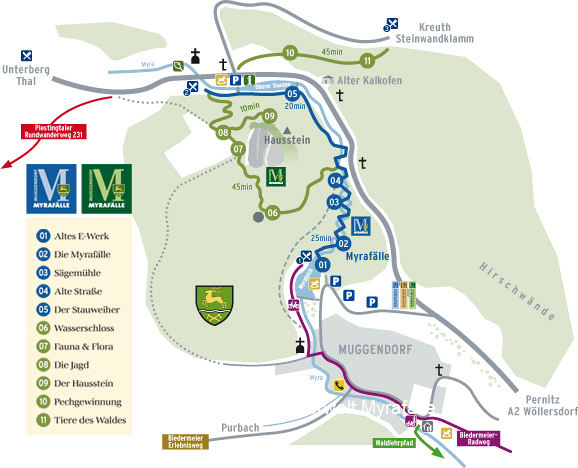
| 71049067 | about 6 years ago | Laut diesen Plan https://www.myrafaelle.at/wp-content/uploads/2017/08/mu_plan_1.jpg würde ich davon ausgehen, dass mindestens eine Querung gestrichen werden kann, da der Verlauf so aber schon seit längerem ist habe ich gedacht, dass ich am Besten nur Brücken einzeichne und den Rest so lasse. |
| 71049067 | about 6 years ago | Das fixme ist noch drauf weil der exakte Verlauf immer noch nicht passt. Ich kenne die Gegend auch mehr oder weniger genau. Eines ist hingegen sicher. Wenn sich ein Weg/eine Straße mit einem Fluss kreuzen müssen diese durch einen Ford verbunden werden oder sich auf verschiedenen Layern befinden (Brücke/Tunnel). Deswegen warnt auch der iD-Editor. |
| 71055112 | about 6 years ago | Ok, I understand. In future I will ignore this warning but be aware other mapers are able to automatically change busstops in big areas. For example a mapper with nearly no experience sees a lot of warnings, zooms out and change the tags all over Vienna with one click (excluding the upload progress). That is why it might be a good idea to check your bus stop shema on some station regulary. Then you undo the changeset itself instead of manually correcting every station (which would take forever). However, in fact I am a native Viennese but normaly I avoid changing public transport realted items. That is why I have less experience with the local schema. Especially, because I ran into mappers that were kind of unfriendly. I tell you this because I think that you might interpret the locale attribute of my changeset as my native language/location. Using a foreign language for mapping is a good way to avoid problems explaining map related information. |
| 71055112 | about 6 years ago | Thank you for this reminder. When I first saw this error I checked the OpenStreetMap Wiki (osm.wiki/Tag:highway%3Dbus_stop). According to it "highway=bus_stop [...] is [...] widely used on a node positioned to the side of the road (where passengers wait).". Should it not be standardised to make analysing more easier? I also checked that platforms are connected to other highways before adding the footway tag. According to the wiki it is not required to add this tag but it is suggested by the iD-Editor and it somehow makes sense that a plattform has to be accessable for pedestrians which is indecated by the tag. You can answer in German if you prefer. Thanks |
| 70984504 | about 6 years ago | Hi Frans, good to see you again. I spotted a problem with stream (679075706) which was laste edited by you. It looks like the whole stream was moved to the east. In older versions the position of the stream is correct. Some roads are still connected to it. Every ford node of crossing streets is also moved to the east because it is shared with the river. This causes a lot of warnings and looks awkward in the map. The stream should be moved back to west before unexperienced mappers start to solve only parts of the caused warnings. Because the stream is too big I am not allowed to move it in the iD-Editor. Could you pleace move it back in JOSM or undo the movement?
|
| 60736655 | about 7 years ago | I apologize that the description of my changes is not complete and creates confusion. Refering to the OSM Map Feature Wiki "oneway=-1" is "for traffic direction opposite to the sequence of nodes of the way (if the way cannot be reversed)". My original goal was to reverse the node sequence and change oneway to yes for oneway=-1 features that I can reverse trouble-free. I did this as you can see in my Changesets. Then I saw some unmapped pedestrian crossings and got away from the goal in some of my changesets. I forgot to mention this features in the description. I hope you understand that my changesets are not vandalism and remove your report (if possible). In general I would prefer to discuss about it before you report it. |
| 60736387 | about 7 years ago | Thank you for your tip with the crossing island. Is sloped_curb really an OSM Map Feature? I did not find it in the Map Feature Wiki (osm.wiki/w/index.php?title=Map_Features&oldid=1506438). I apologize that the description of my changes is not complete and creates confusion. Refering to the OSM Map Feature Wiki "oneway=-1" is "for traffic direction opposite to the sequence of nodes of the way (if the way cannot be reversed)". My original goal was to reverse the node sequence and change oneway to yes for oneway=-1 features that I can reverse trouble-free. I did this as you can see in my Changesets. Then I saw some unmapped pedestrian crossings and got away from the goal in some of my changesets. I forgot to mention this features in the description. I hope you understand that my changesets are not vandalism and remove your report (if possible). In general I would prefer to discuss about it before you report it. |
| 60662102 | about 7 years ago | Hallo evod, die Adressen sind jetzt so, wie du sie mir Erklärt hast. Ich war mir nicht sicher, ob manche Navigationsprogramme von den units oder den mehrfachen Adressen verwirrt werden.
|
| 49978750 | over 7 years ago | Hallo fkv!
|
| 55077776 | over 7 years ago | Verbesserung der Kartengebauigkeit war darauf Bezogen, dass ich Daten, wie zum Beispiel, Telefonnummer und Öffnungszeiten hinzufüge. Den Namen habe ich geändert, weil auf der offizielen Website, der Name als Scheimhütte geschrieben stand. Daher habe ich es für den offiziellen Namen gehalten. Ich kann es gerne umbennenen wenn du es willst. Der Weg osm.org/way/307668349 habe ich so weit ich weiß nicht Graben gennant. Ich habe nur den Verlauf des Weges geändert. Vielen Dank für dein Feedback. Ich habe den alternativen Namen nicht gesehen. |
| 51871456 | almost 8 years ago | Hallo evod, ich habe die Tags nun geändert. |
| 51871456 | almost 8 years ago | Hallo evod,
|
| 48842736 | about 8 years ago | Danke für den Hinweis. Eigentlich habe ich die Änderung bereits vor zwei Wochen versucht rückgängig zu machen, aber anscheinend wurden die Änderungen nicht übernommen ohne das es mir aufgefallen ist. Diesmal hat hoffentlich alles geklappt. |
| 48840836 | about 8 years ago | Ja, danke für deine Hilfe. Ich habe diesen Kommentar hinterlassen, weil ich nichts besseres als Arzt gefunden habe und davor, wenn ich mich richtig erinnern kann irgendein Blödsinn gestanden hat. |
| 41618482 | over 8 years ago | Ich beziehe mich mit den Änderungen auf die basemap.at. Soweit ich weiß ist das eine offizielle Seite oder zumindesten gefördert von den österreichischen Bundesländern. Aber wenn du weißt, dass es anders ist, werde ich nichts dagegen einbringen. Wenn du willst kann ich auch alles umbenennen. Du musst es mir sicherheitshalber aber noch einmal bestätigen. Tut mir leid falls ich mich geirrt habe. |
| 42240150 | almost 9 years ago | Ja, gegen die Einbahn, aber nur ein rechter Fahradstreifen, markiert durch Fahradsymbole. Keine Linien oder Abgrenzung zum markieren. Ich bin noch ziemlich neu, also weiß ich nicht, wie ich die Fahradstreifen in die Karte einbaue. |
| 41592516 | about 9 years ago | Danke! |
| 41590736 | about 9 years ago | OK Maps with Me interpretiert das anscheinend Falsch. Es sagt bei der Platform und der Stop Position an das das die Bushaltestelle ist. |
| 41590736 | about 9 years ago | Ich habe entdeckt das auf Maps with Me die Bustationen Dublikate haben. Daruf habe ich die Dublikate als zu löschen markiert. Wir war nicht klar das die Dublikate in OpenStreetMap nicht existieren. Ich habe versucht alle Orte als Erledigt zu markieren. Diese Station habe ich anscheinend vergessen. Falls du noch solche Meldungen von mir findest wäre es nett von dir wenn du einfach auf Erledigt drückst. Tut mir wie gesagt leid. Waren meine ersten Erfahrungen mir OpenStreetMap. Werde den Fehler nicht noch mal machen und werde in Zukunft OpenStreetMap verwenden. Ist eh besser aber Maps with Me bietet eine Gute Oberfläche für offline Karten. |