Open Source Routing Engine GraphHopper 0.10 released
Posted by karussell on 8 March 2018 in English.We’ve released a new version 0.10 of our open source routing engine GraphHopper. Read here for more information.
We’ve released a new version 0.10 of our open source routing engine GraphHopper. Read here for more information.
We’ve released a new version 0.9 of our open source routing engine GraphHopper. Read here for more information. Also the ‘car’ profile is now available for GraphHopper on openstreetmap.org
We’ve released a new version of our open source routing engine GraphHopper. Read here for more information

We’ve released a new version 0.7 of our open source routing engine GraphHopper. Read here for more information

The main question is: should OSM prefer more concise data if possible and move complexity to the editor? Read the full post here
Today we are proud to release version 0.5 of our open source road routing engine GraphHopper. Try it out on GraphHopper Maps and read more

We’ve improved the GraphHopper core and the GraphHopper Directions API which now includes route optimization.
Handling elevation data and combine it with OpenStreetMap can be a pain. And indeed it was when we implemented this for GraphHopper roughly one year ago. But we really wanted to make it easy for our users. And it is not only efficient but also easy to import and show the data as well as using this data while routing. Read here for more details
Today we’ve released version 0.4 of GraphHopper.
(excerpt) Highlights of GraphHopper 0.4:
Please give feedback on the mailing list or via a new Github issue.
Today we’ve released version 0.4 of GraphHopper
(excerpt) Highlights of GraphHopper 0.4: * The flexibility mode now supports turn costs and restrictions * GraphHopper is able to run offline in the browser via TeaVM since 0.3 but now we can also route offline on iOS too! * The bidirectional A* avoids heuristical results and is now the fastest algorithm for the flexibility mode * Via-point support for the web UI, contributed by rbraband ….
Please give feedback on the mailing list or via a new Github issue.
I know that HOT and other community processes improve exactly one area and I also know that paying people for OSM could be seen strange under certain circumstances.
But sometimes there is a need for a company which wants to improve exactly one area. E.g. to make self driving cars less dangerous with OSM data in one area or showcasing an OSM based application in the companies its district or whatever.
So, is there a website, company or process where one could ask for such specific area improvements for OSM? And what problems you see if there would be such a solution?
Please read on our blog for the full announcement.
I’m running world wide imports for the route planner GraphHopper and due to space savings I allow street names with a maximum length of 255 characters. This was all fine until a few months. Now I get lots of lengthy stuff in Russia - possible automated imports? What is going on there and should one fix this ugly stuff? If yes, how? I can find out the way ids if someone is interested.
E.g. the first one is here
Today we’ve released GraphHopper 0.3. Read the full announcement here.

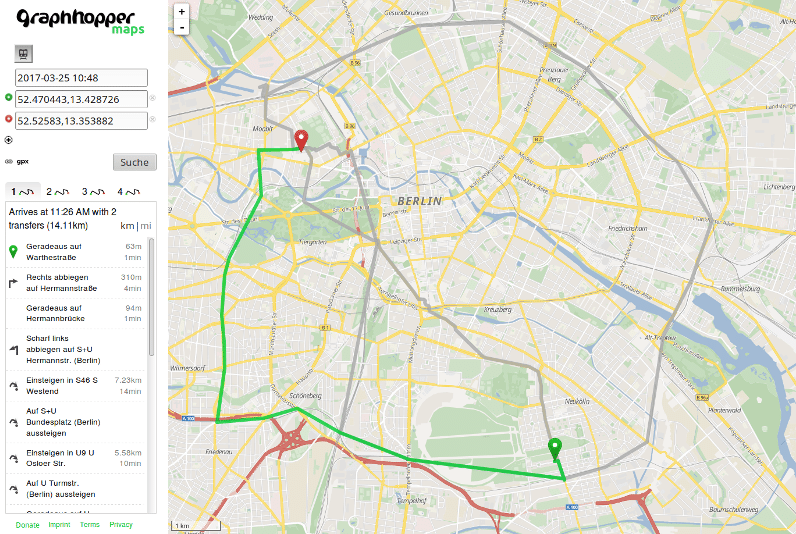
BTW: In the screenshot you see lyrk tiles
We are now using a geocoding solution with real address suggestions. Based on photon.
If you search for a location on openstreetmap.org you’ll probably miss some autocompletion. Autocompletion requires some server resources and when you have a normal SQL database (as it is the case for normal nominatim installation) this is nearly impossible. There is an Open Source solution called photon using the nominatim DB for feeding and for the search it uses Apache Solr. I highly recommend looking at this.
But if you just want to use nominatim I developed a bit JavaScript magic which displays the possible entries if you click the small triangle in the right corner of every input. And then if you hover the mouse over one entry it will immediately display the map. Test it here and sources are here - it stands under Apache License and requires jQuery Autocomplete.
I just blogged about it here

Today we’re releasing version 0.2 of our Open Source road routing engine GraphHopper written in 100% Java.
More exciting news will follow …
Have fun and try GraphHopper Maps with world wide coverage for pedestrians, cars and bicycles! You need support? Have a look at our enterprise options!
Graphhopper 0.1.1 is now available on maven central. Which means that you can include it as a dependency in your pom.xml without adding a repository. See the snippet on the website.
Also there are some minor bug fixes and better support for internationalization. E.g. GraphHopper Maps should now be able to detect your locale and apply the translation (de, en and es) automagically. Or you can force it with the locale parameter: http://graphhopper.com/maps/?point=berlin&point=madrid&locale=de_DE
PS: If you are in the USA (or use en_US) you’ll see feet and miles, which I highly dislike but people are used to it.
See the full announcement here
Quick feature summary:
Trying out this blog here. English or German … hmmh, at least linking to http://graphhopper.com ;)
