OpenStreetMap logo OpenStreetMap

mvexel's Diary

Recent diary entries

How do you map while on the go?

Posted by mvexel on 8 August 2015 in English.

I don’t do a lot of ‘on the go’ mapping. I have tried a lot of the tools out there that should help me do that: KeypadMapper, Go Map!!, Vespucci, Pushpin, OsmAnd. Most of these are way too convoluted for me. When I am out and about, I just want to make a quick edit - usually a POI of sorts - and move on.

Pushpin and Go Map!! come the closest to what I want. Both are available for iOS only, I think. (Do Android users not like simple editing tools?) They let me quickly add a node and upload it to OSM. Or add some tags to an existing one.

Still, what I end up doing most is just taking pictures with my phone. Lots of them. I try to get both overview and detail. I end up with a collection of images like this one here from right before I moved to the US.

collection

When I get home, I copy all the images to my computer and load the entire directory into JOSM. It will put the image locations on a map. I can cycle through them easily and map what’s on there using all the convenience of JOSM.
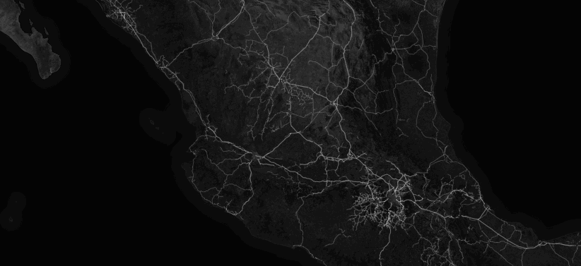
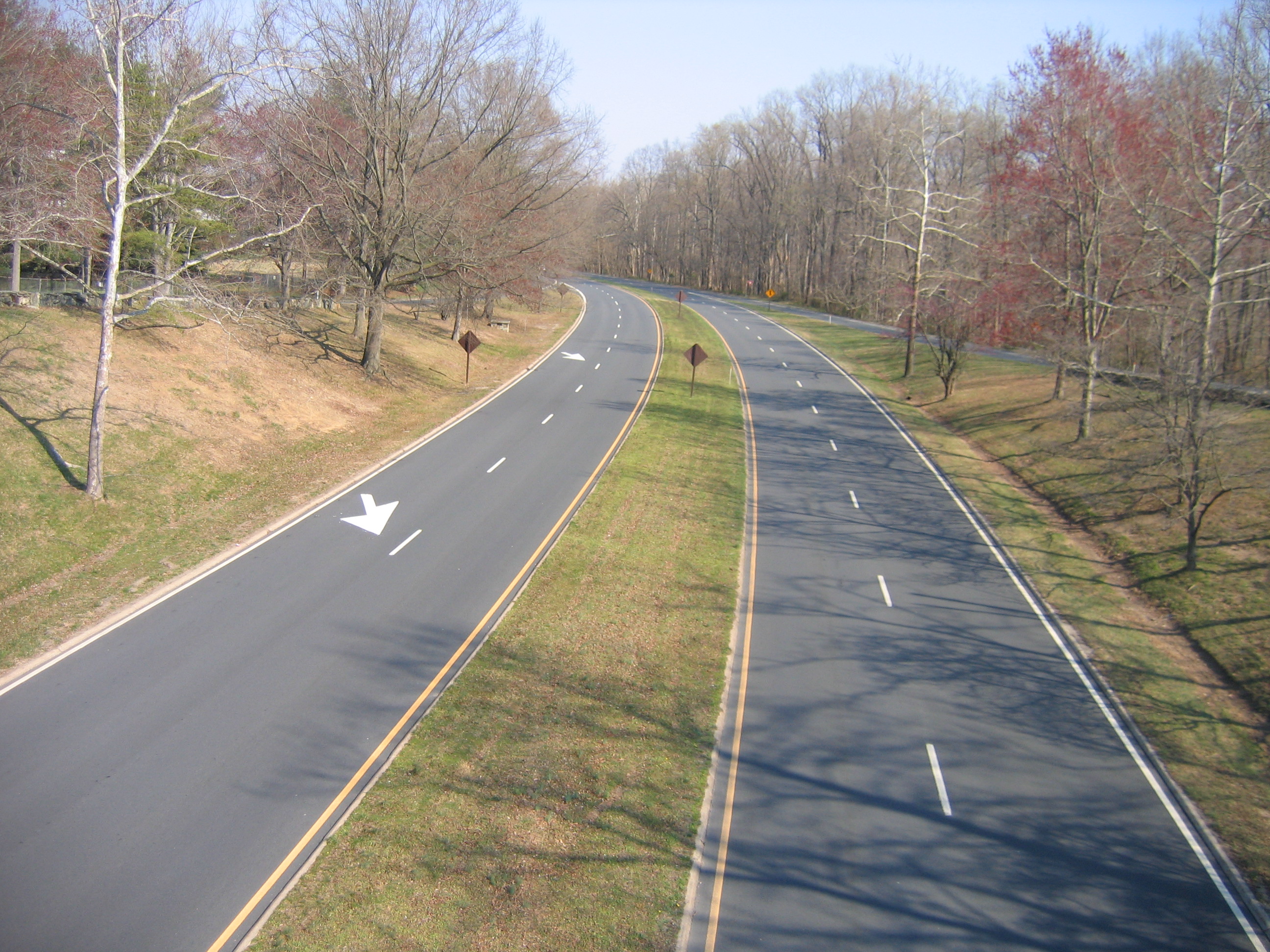
See full entry

Mapping Mexico with INEGI, you and...Cygnus

Posted by mvexel on 29 July 2015 in English. Last updated on 3 June 2022.

Mexico released a huge amount of open data not too long ago.

Huge: Mexico's statistical institute INEGI goes open data @INEGI_INFORMA (via @rodowi — Alex Barth (@lxbarth)

A lot of this data is geospatial, so I say yummie! Alex Barth wrote about this data, that comes from the Mexican national statistical agency INEGI, on his diary before, with a nifty map to show how rich this data is:

inegi-mapbox

(My mediocre animated GIF skills really don’t do it justice - check out Alex’s blog post to see an interactive map.)

So now the question becomes: how do we get some (or all?) of this data into OSM? This is not straightforward - OSM already has rich data in many places in Mexico we would definitely want to keep.

Here at the Telenav OSM team, we have come up with an answer to this question. We call it Cygnus - The Bringer of Balance. Let me explain in a few visuals what Cygnus does.

Consider this area in the Aguascalientes region. There is some OSM data there:

See full entry

New ScoutSigns release - now with Mapillary power!

Posted by mvexel on 7 July 2015 in English. Last updated on 21 July 2015.

UPDATE We are working on getting the source code out as Open Source as well. I will post with more details when I have them.

ScoutSigns is a JOSM plugin developed by my colleagues here at Telenav that displays speed limit signs (and a few other types) as a layer in JOSM. These signs are detected by users of our global Scout app if they opted in and have their phone mounted on the windshield. This is a pretty good source of sign information ready to be mapped!

scout-only

JOSM showing Scout detected signs in ScoutSigns in Hamburg, Germany

Recently, Mapillary started detecting all kinds of signs in their millions of user-uploaded street view images. What would make more sense than collaborating with them to display their detected traffic signs right along with ours in Scout Signs? That’s exactly what we did!

See full entry

Mysterious: Invisible ways in JOSM

Posted by mvexel on 9 March 2015 in English.

I think I have mentioned before that the Telenav OSM team is always thinking of more ways to help improve OpenStreetMap. Something we have recently started looking into is supplying proposed changes directly as JOSM compatible XML files. This way, we could propose changes and additions to the map in chunks, instead of one by one like we have done for MapRoulette thus far.

So looking into the JOSM file format, we created a small (hypothetical) test file that just adds some ways that connect to the current network. Shown below is the process of merging that test file with existing OSM data in three stages: Base OSM layer, change layer overlaid, and finally the merged result.

stages-merging

See full entry

Battlegrid update

Posted by mvexel on 14 January 2015 in English.

Hi folks,

The Battlegrid had been down for a while and I have had no time to look at it really. Until today! The Battlegrid is back up. And it now compares with the latest TIGER 2014 data, so bright cells should more often be a treasure trove for real problems.

battlegrid

If this is the first you hear about the Battlegrid, read much more about it in the original announcement blog post.

What are you waiting for!? Fix some cells, head over to battlegrid.us!

Telenav Signpost Mapping Project Completed!

Posted by mvexel on 12 December 2014 in English.

signpost example

Image credit: AARoads

Here at Telenav, our editing team has been working tirelessly on adding signposts to OSM for the past months. Today, I am happy and excited to report that we have completed this major editing project! We added signpost information to over 9,500 exits across the United States, covering more than 25 major metropolitan areas and a few important connecting freeways as well:

See full entry

Now Live: Notes Posted By Scout Users

Posted by mvexel on 11 December 2014 in English.

Scout (USA) has been powered by OpenStreetMap data for about 5 months now. From day one, Scout users have been able to report navigation errors to us:

scout

We have since received thousands of reports and we have worked hard to review them and learn from the feedback we get from our users. We have manually submitted OSM notes where we could not resolve the issue ourselves, and we have fixed dozens of map issues based on the incoming reports. But we felt that we could do a better job closing the feedback loop between Scout users and the OSM community. We have now taken another big step towards this goal with direct OSM Notes creation from Scout US.

Some Scout Feedback will automatically become OSM Notes

See full entry

The Magic MapRoulette Machine

Posted by mvexel on 2 December 2014 in English.

Making a MapRoulette challenge has always been a bit of a, well, challenge. I wrote a tutorial in an attempt to explain the process, but in the end, it is still more work than I would like it to be, and more technical than I would like it to be, too.

So I made something new: the Magical MapRoulette Machine!

The MMM lets you create a MapRoulette challenge interactively. Just answer a few simple questions and your own challenge can be live in minutes. The key component, the part that actually defines which OSM ways or nodes you want to have fixed, is an Overpass API query. If you are not familiar with writing queries in the Overpass Query Language, that would be the only thing you would need to learn a little bit about.

How do I use the Machine?

First download and install it using the instructions on the project page.

Once you have the Machine on your machine, you can just run it in interactive mode by calling it like this: ./mmm.py. It will then ask you a series of questions about things like the Title, Instruction, Help text, etcetera. All those bits are explained in the MapRoulette Tutorial.

See full entry

Location: Sunnyvale, Santa Clara County, California, United States

Argentina Money Advice - is this any good?

Posted by mvexel on 4 November 2014 in English.

I am headed to Buenos Aires for SOTM 2014 tomorrow, and reading up on money and general travel tips. I found this page on bringing and exchanging money. Some of the tips in there:

  • Bring cash, preferably in US$50 / US$100 bills
  • Pay in US$ whenever you can.
  • There is an unofficial ‘blue dollar’ rate that is much better than the official US$ / Peso rate.

I have never been to Argentina before, and I have no idea if these are good tips. Perhaps an Argentinean mapper can shed some light on this?

See you at SOTM!

I know, I’ve written about TIGER before…Quite a few times. I’ve pointed out problems from time to time, but I have also attempted to come up with solutions, like the Battle Grid.

battlegrid

Today is another being-part-of-the-solution kind of day. We (a few colleages at Telenav were involved in this) took the output of the Battle Grid comparison we use to generate the Battle Grid cells, divided them into more and less severe cases based on the road class and amount of difference between TIGER and OSM, and created a MapRoulette challenge out of the more interesting cases. This will make it easier for anyone to help fix antiquated, bad TIGER data anywhere.

This is what a typical case would look like in MapRoulette:

See full entry

If you have logged in to MapRoulette today, you may have noticed that the Ways Needing Smoothing and Crossing Ways challenges are now gone. There is a simple reason: they are done!

Congratulations!

Together, we resolved more than 100 thousand suspected ‘sharp angle’ errors in the Ways Needing Smoothing challenge, and just under 25 thousand crossing ways in the Crossing Ways challenge.

So at least for the United States, we now have much less of this:

smooth

.. and many less situations where two ways cross but should really have an intersection node. (Sorry, in this case an image does not say more than a thousand words..)

Not all suspected cases turned out to be real errors. For the crossing ways, about two thirds of the cases were eventually marked as ‘fixed’ by MapRoulette users:

See full entry

State Parks and National Parks

Posted by mvexel on 23 August 2014 in English.

There is a well-established definition for tagging National Parks in OpenStreetMap.

Hoge Veluwe Nationaal Park Hooge Veluwe National Park Image credit: Wikipedia

The definition,

A national park is a relatively large area of land declared by a government (just as boundary=administrative are declared/recognised by governments), to be set aside for human recreation and enjoyment, animal and environmental protection

would also apply to the many State Parks in the United States, and perhaps provincial and state parks in other countries as well. However, the boundary=national_park page does not give any specific guidance. I am about to map some state parks in my home state Utah, and I will tag them with boundary=national_park for now because they fit the definition.

How do you map state or provincial parks in your area?

Oh TIGER...

Posted by mvexel on 22 August 2014 in English.

Sometimes I wonder if those TIGER surveyors were just having a grand old time making up things as they drove past and casually looked out of the window of their cars…

TIGER...

This whole area needs lots of work - if you want to help out, that would be great!

(I have no personal or other connection to the area, but got dropped there by the MapRoulette ‘Ways Needing Smoothing’ challenge - freshly cleaned up, so most cases you get should now be real things to fix!

MapRoulette silently added a new feature a while ago: the ability to select an area you want to work in. This is one of the most requested features in MapRoulette and I am pretty excited to publicly announce it!

Here is how it works. Go to MapRoulette and select a new challenge. You will see this screen:

select challenge

Notice the button at the top? It says what it does on the tin - it lets you select a work area that will be remembered until you cancel it. (I will show you how to do that later.) When you click the button, the challenge selection window disappears and you will get this notification:

See full entry

Location: Central Ninth, Salt Lake City, Salt Lake County, Utah, 84101, United States

Scout update: new data and signpost tagging

Posted by mvexel on 22 July 2014 in English. Last updated on 4 December 2014.

Let me update you on some of the goings on at Telenav related to OSM.

Scout OSM data update

First off, we released new OSM data for the US Scout app on July 15th. The OSM data is from July 3rd. No app update is required; just launch Scout and it will automatically use the latest data. We are currently updating the OSM data that drives Scout about every other week.

If you haven’t tried Scout yet, you can download the latest version for Android here, for iOS here.

Note that the Scout International app (formerly the Skobbler GPS Navigation app) has its own data update regimen that is independent from the US version of Scout.

Signpost tagging

We continue to improve OSM data for the United States as well. We are focusing on signpost information right now (the information that you see on the freeway exit signs).

signpost

Image from AARoads

See full entry