OpenStreetMap logo OpenStreetMap

russdeffner's Diary

Recent diary entries

2015 - Year in Review

Posted by russdeffner on 2 January 2016 in English.

Hello fellow OpenStreetMap-pers,

As a Voting member of the Humanitarian OpenStreetMap Team (HOT) we ask each other to post something about how our year went and what we want to work on in the New Year. There are currently 84 of us, so it’s nearly impossible to keep up with everyone and look for opportunities to collaborate and support one another. 2015 was an incredible year for me personally and reflecting back to my aspirations for the year, I can say that it was a success for what I had hoped to achieve for HOT, but maybe not so much accomplishing my local mapping objectives.

To continue on that note and before getting into the HOT specifics; although I did not do as much mapping in Park County, Colorado as I wanted, it was a great year of activities with OpenStreetMap-Colorado. Along with a handful of fun ‘mappy-hour/geo-beers’, a few significant things occurred; one was largely thanks to the great folks from the Geospatial Centroid at Colorado State University; and that was gaining some traction building a community around OpenStreetMap in Fort Collins. This was especially fun for me as CSU is my alma-mater and I was able to see some old friends and one of my favorite professors during a few events this year, some of us actually fought wildland fire together many moons ago.

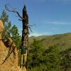
Another significant local event was our first (annual?) OSM MapCamp! This was basically another crazy idea a few of us had thrown around for a couple years now, but I just (kind of late) decided, let’s do it! And although only 4 of us went, I actually think it was a huge success as a pilot for more ‘hands-on’ field mapping in rural parts of the US, as well as a ton of fun. I was also happy to represent HOT in a panel on Citizen Science at the Understanding Risk (UR) Boulder conference. This year I’ll continue organizing for OSM-CO but won’t make a ‘resolution’ to complete any particular mapping.

See full entry

Hello OpenStreetMappers,

I just wanted to tell everyone what a pleasure it was to fulfill the Activation Curriculum Specialist opportunity for the Humanitarian OpenStreetMap Team (HOT) over roughly the last half-a-year. A bit of cut-paste-paraphrase from project docs: ‘The project was one of three priorities the community selected to fulfill a grant awarded by the Hewlett Foundation in order to improve HOT’s ability to achieve its mission, inspired by the response of the community during the West Africa Ebola Epidemic.’ What is always most special to me is meeting and working with other OSM/HOT enthusiasts – especially in person. One aspect of the Activation Curriculum project that was not certain in the beginning was that it would include leading workshops on three continents; I could not be more honored to have had this experience.

The project launched in late April with the ‘Activation Curriculum Sprint’; a 3 day workshop in Washington D.C. attended by 8 core HOT community members. These were also the 3 days prior to the first HOT Summit; somewhere between then and State of the Map – New York I lost track of exactly how many HOT voting members, board, staff and of course the 100s of other HOT/OSM community members and partners I was able to meet in person. The summer then seemed to just disappear; I had a few fun outings, including OSMCO MapCamp! but it was mostly just sleeves up working on the project. In the end we produced the HOT Activation Protocol and Training Center to organize and most importantly, start providing training to those volunteers who coordinate Disaster Mapping for HOT.

See full entry

HOT 2014 Review

Posted by russdeffner on 1 December 2014 in English.

Greetings, this is a brief recap of my contributions to the Humanitarian OpenStreetMap Team (HOT) in 2014.

In February 2014 I was nominated and accepted as a Voting Member of HOT and in March I was elected as the Chairperson for the Voting Members.

At the end of March, as some of you well know, we began an Activation to assist Médecins Sans Frontières (MSF), aka Doctors Without Borders, with the Ebola crisis in West Africa, see osm.wiki/wiki/2014_West_Africa_Ebola_Response for details. I assisted the Activation Coordinators at the beginning of the Activation by updating that wiki page for about the first month, as well as completing a handful of mapping tasks. I also remotely contributed to the Map Lesotho Mapathon in July.

As Chairperson, my focus was less on the mapping, and more on the ‘behind-the-scenes’ operations of HOT. I attempted to assemble the Voting Members for an ‘annual meeting’ twice, but was unable to get a quorum (at the time a majority) of our members. This was obviously a problem and after many meetings and conversations it became fairly clear that with a worldwide membership, even meeting electronically, would be difficult.

See full entry

Just a quick note while changing planes in Seattle…

I’m so honored and excited to have been selected to join Severin Menard in Mongolia. Severin has been in UlaanBaatar setting things up and Monday we’ll begin teaching and coordinating OSM mapping in UB. Stay tuned to the HOT network for more…

Happy Mapping, =Russ

Russell.Deffner@hotosm.org

Homage to My Alma Matter

Posted by russdeffner on 15 July 2013 in English.

I hadn’t been planning a complete armchair-micro-mapping-makeover of Colorado State University, but it was one of those things, it began by surfing the map/data in Colorado ‘hunting’ newbies (just to say hello and invite them to OSM-Colorado - and found myself admiring the good work done by our rival Buffaloes (CU) on mapping the Boulder campus(es); well I decided I’m gonna do you one better…

So, with love (it’s a friendly rivalry – I have Buff family), I think I’ve now put CSU on the map (better). Of course you’re free to have your own opinions, but could this be the ‘best’ mapped campus in the US? You’re also free to leave me comments, I’d gladly view other well mapped campuses; here is the general location of CSU on OSM

Some details in case folks are interested in some of the ‘stranger’ things in my micro-mapping style.

See full entry

Location: River Rock Cohousing, Fort Collins, Larimer County, Colorado, 80523, United States

It’s been a fairly good weekend; my side of the divide has received some actual soaking rains (of course scattered/typical CO afternoon ‘monsoons’ also with hail and lightning) for several days now. Although it’s not quite the same story on the western slope and the call for mapping continues; see osm.wiki/wiki/2013_Colorado_Wildfire_Season

I also hit 1000 edits today, or what I think should more accurately be called/is changesets; I think a better milestone is having edited 500K nodes (which I’m around 350). Anyway, I digress…

Just wanted to chart a few things:

  • I still have on the agenda, a quick recap of SOTM-US (and the follow-up in Denver); maybe just another diary entry.

  • Now that I’ve pretty much done all I can to help HOT create the Guide and Code, I starting helping the Activation working group, first by attending the meeting the other day; and of course I volunteered to help do something; so I’ll be working with Andrew Buck on humanitarian mapping project (HMP) ‘templates’ (as HMP’s basically have to come first), hopefully we’ll have something in a few weeks; ready to deploy by basically anyone (more to come).

  • And because I finally think I can relax a bit on the CO fire mapping situation, I can start working on documenting it. I’m not quite sure what medium I want to use, but expect it to be pretty directly pro OSM/HOT; but professional (maybe a bit salesman-ish) and most importantly, hopefully it will help gain interest in OSM for emergency use (obv. with a wildfire lean).

Location: Mineral County, Colorado, 81130, United States

OpenStreetMap Colorado

Posted by russdeffner on 22 May 2013 in English.

For those of you in Colorado, or passing through, or just interested; our local community is fantastic! No doubt there was a bit of momentum loss when the Coast’s moved to the PNW, and I was totally swamped last summer with our terrible fire season; but we managed to keep rumbling along. JimmyRocks moving here gave a nice boost and we had a great group show up for the Spring Editathon, quite a few new faces have begun to appear including folks from the NPS - can’t wait to hear Mamata’s talk at SOTM-US - I hope they’re contemplating our idea of mapping parties at national parks - let us in free and we’ll map ;) - and all the sudden it seems we’ve got all these great ideas for meetups beyond the norm; we’re going to have a SOTM-Denver (basically a recap for those who can’t make it to San Fran) and what I’m really excited about, a Map/Camp-ing party later in the summer/fall. Oh, and it was a small but awesome meetup last weekend; the first event with the Coast’s back in town, welcome home Hurricane!

We’d love to see more faces, so don’t hesitate to join or even if you just want to see what we’re up to, visit: http://www.meetup.com/OSM-Colorado/

Cheers - hope to see/meet you at SOTM-US or a Colorado mapping event, =Russ

P.S. Any Utah folks want to help plan a (probably very future) Moab Map/Camp-ing party? I love that place and it’s been too long since I visited.

Location: Park County, Colorado, United States

False Move

Posted by russdeffner on 1 March 2013 in English.

Hey all, I’m still in Bailey but ‘moved’ (at least my user profile) towards the middle of Park County. Starting getting in the thick of the TIGER mess toward the southern edge of the county and wanted to see if any folks are located down that way. Even referencing the TIGER 2012 data, there is no way to be 100% sure on street names, etc. without local knowledge.

Location: Park County, Colorado, United States

Burland, CO

Posted by russdeffner on 5 September 2012 in English.

So, after messing around mapping Uganda I was inspired to try and make the area around home as close to 100% mapped as possible. Not necessarily addresses, etc. but 100% land-cover (not zoning/administrative) but looking at imagery and creating a ‘raw’ “this is what is on the ground” map. I started with simple/small polygons for ‘heavily’ forested areas basically coming off the administrative boundary for Pike National Forest, but that didn’t really work the way I imagined and also would have been extremely tedious, so I started over with a larger polygon delineated by 285, 126 and the South Platte River - made this landuse=forest and then used relations to ‘insert’ meadows, rocks, etc. I tried doing a complex relationship where the aforementioned forest was the outer polygon with residential as an inner polygon hoping to make forest/meadow/etc. inside the residential areas part of the outer polygon - didn’t work, not sure why; seemed a multi-multi-polygon relationship isn’t behaving intuitively. Anyway, just finished up Burland, so please feel free to check it out and give me feedback.

Location: Burland, Bailey, Park County, Colorado, United States

Red Cross and H.O.T.

Posted by russdeffner on 17 August 2012 in English.

So as an American Red Cross Volunteer, I got word of the collaborative project between H.O.T., ARC, and Uganda Red Cross. I’ve known about H.O.T. for sometime and figured it was a sign that I should pitch in. This project is another amazing example of their work and I’m glad to see the Red Cross helping out. I also learned to be very appreciative of the imagery in the U.S.

Great work H.O.T. I signed up for the mailing list and will try to pitch in more often.

Location: Central, Lira Municipality, Lira City, Northern Region, Uganda

Park and Jefferson County Friends

Posted by russdeffner on 22 July 2012 in English.

I hope those of you I just friended on OSM find this entry. User XenonofArcticus and I are working on getting a Jefferson and Park County (and surrounded area) group together. I noticed a lot of users in the area (I friended everyone within 20KM or so) have not yet made any edits or have not in a long time. We are hoping to do a basic OSM overview and editing class in the near future. Please follow this discussion on Pinecam.com for details: http://www.pinecam.com/phpBB2/viewtopic.php?t=155214&start=12&postdays=0&postorder=asc&highlight=

Few updates

Posted by russdeffner on 22 July 2012 in English.
  1. Have about 1/2 of Park County TIGER edits complete.
  2. Have been using OSM for situational maps for a high profile Non-profit organization involved in disaster response; in conjunction I (and other volunteers) have been actively engaging in editing areas in and surrounding the 2012 wildfires in Colorado.
  3. Contacted by XenonofArcticus via OSM and started working on building a Park/Jeffco area OSM group using pinecam.com.

Harris Park and areas along the way

Posted by russdeffner on 23 November 2010 in English.

I was hoping to do nearly all TIGER road corrections 'armchair' style around Bailey Colorado, since I know the area very well; followed up by ground truth-ing some street names and eventually gathering address data. However, the TIGER data for Harris Park and the areas along the way have some major anomalies. It’s going to take a lot more verification than I was hoping for to get the roads fixed. Possibly going to take some four wheeling; plus there are a ton of hiking trails, etc up that way so don’t expect that area to be complete for quite some time.

Location: Highland Park, Park County, Colorado, United States

Idaho Springs Mapping

Posted by russdeffner on 20 November 2010 in English. Last updated on 10 August 2012.

A while back found the meetup.com group OSM-Colorado.
A few weeks before that I had learned that pretty much all of Park County Colorado was way messed up on OSM. I decided to join the group.

We met up in Idaho Springs Colorado and about a dozen of us split into teams of one or two people and mapped the entire town in just about 2 hours.

The next week we met at MapQuest HQ in Denver and started putting our edits into OSM.

This is how I met Hurricane and Steve... Great people!

Location: Argo Mill, Idaho Springs, Clear Creek County, Colorado, 80452, United States