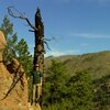
I was hoping to do nearly all TIGER road corrections 'armchair' style around Bailey Colorado, since I know the area very well; followed up by ground truth-ing some street names and eventually gathering address data. However, the TIGER data for Harris Park and the areas along the way have some major anomalies. It’s going to take a lot more verification than I was hoping for to get the roads fixed. Possibly going to take some four wheeling; plus there are a ton of hiking trails, etc up that way so don’t expect that area to be complete for quite some time.
russdeffner's Diary
Recent diary entries
Just an update; that last night I finished editing the TIGER data for Burland, a sub-division of Bailey Colorado.
Begin Park County edits
Posted by russdeffner on 20 November 2010 in English. Last updated on 10 August 2012.Today I have begun editing Park County Colorado. This entry is more of a time stamp for when the work began.
OSM and Depiction Webinar
Posted by russdeffner on 20 November 2010 in English. Last updated on 10 August 2012.Wednesday, the 17th; which happened to be GIS Day! Hurricane and I had our OpenStreetMap and Depiction Webinar.
Almost 80 people attended and most said it was a great presentation. Hopefully at least a couple dozen will become OSM contributors.
Idaho Springs Mapping
Posted by russdeffner on 20 November 2010 in English. Last updated on 10 August 2012.A while back found the meetup.com group OSM-Colorado.
A few weeks before that I had learned that pretty much all of Park County Colorado was way messed up on OSM. I decided to join the group.
We met up in Idaho Springs Colorado and about a dozen of us split into teams of one or two people and mapped the entire town in just about 2 hours.
The next week we met at MapQuest HQ in Denver and started putting our edits into OSM.
This is how I met Hurricane and Steve... Great people!