stevea's Notes
Notes submitted or commented on by stevea
| Id | Creator | Description | Created at | Last changed | |
|---|---|---|---|---|---|
| 2379891 | Mateusz Konieczny | is it REALLY landuse=residential? |
|||
| 2379890 | Mateusz Konieczny | is it REALLY landuse=residential? |
|||
| 2504427 | JessAk71 | unclear if this building is actually a fire station or is instead a office for cal fire here. per osm fire station schema tags a fire station is a "facility from which a fire brigade operates from" and its not clear this structure houses equipment or emergency staff - verification would help |
|||
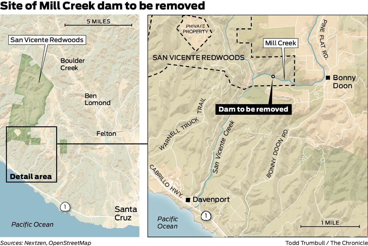
| 2642327 | DougGrinbergs | estimated location of 30' wide, 14' tall dam coming down in summer 2021
|
|||
| 2480259 | fudsnottica | This route doesn't exist, but it's park of a bike route that I'm not certain the source of truth of. I believe this foot path and the road should be deleted, but I don't want to mess up the relation. |
|||
| 1801101 | fudsnottica | uncovered bike parking for 6 |
|||
| 2379886 | Mateusz Konieczny | "closed areas" is not part of the real name, right? |
|||
| 2110831 | Kurt Radamaker | The county boundary between Monterey and Santa Cruz should run directly west from the pajaro river mouth straight along the northern edge of th Soquel Canyon boundary, to the California boundary. |
|||
| 2060962 | Adamant1 | unknown |
|||
| 1786609 | Tarwater Campsite |