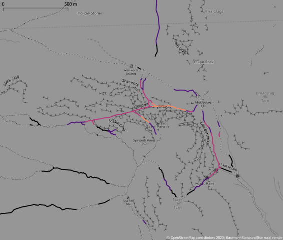
 Lord’s Rake: one of the steepest paths marked on OSM in Upper Wasdale
In my last diary I introduced the idea of using elevation models (DEMs), specifically a DTM (terrain model) to find sections of hiking paths on OpenStreetMap which may cause problems for regular hikers. In this sequel I describe a refined approach using a higher quality terrain model and a vertex-based approach to calculating slope angles actually likely to be experienced by walkers.


 Part of that was discovering several field systems of unknown date, but I have

