OpenStreetMap logo OpenStreetMap

Diary Entries in English

Recent diary entries

Posted by b-unicycling on 14 August 2023 in English.

I had mapped my first mass path a little over two years ago and made a video about it: https://www.youtube.com/watch?v=JyxYRqNG6aI. I’m revisiting the topic now for reasons I will get into.

What is a mass path?

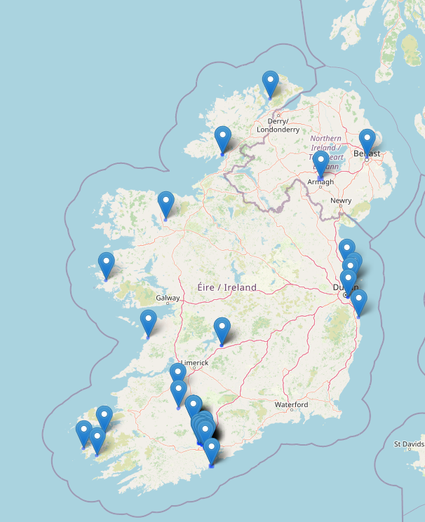
In Ireland, mass paths are either footpaths people used to walk to church or - more often - to school (because the school tended to be very close to the church). Those mass paths are basically short cuts across fields and were used until the 1960s or thereabouts. The other type of mass path dates back to the times of the Penal Laws, when Catholics were forbidden to go to mass (and to school). They met at secret locations, mass rocks or mass pits, to celebrate mass. The went out of use with the end of the Penal Laws.

Why my re-awakened interest?

My local county council had wanted to start a project to record mass paths in the county, and I considered applying for it, but I could not meet their conditions (driver’s license, insurance). This was regrettable, because I could have assembled the perfect team, but it was not possible for us. However, thanks to determination and OpenData platforms like OSM and Wikimedia, it doesn’t mean we can’t record some of them.

Methodology

See full entry

Location: Loughmerans, Dunmore, The Municipal District of Kilkenny City, County Kilkenny, Leinster, Ireland
Posted by 38446 on 13 August 2023 in English.

Today I spent half the day in the forest near Bahrdorf to prepare an orienteering map in OOMapper. First I downloaded the OSM data into the app, then set out with a tablet computer as well as fieldpaper, pencil and compass to add all the features necessary for orienteering. There are of course lots of details to attend to, but I want to write about the role of OSM in orienteering mapping today.

For a forest map that I set up from scratch, OSM data come in handy because they provide a georeferenced basemap to start from. But other than that, 99% of the orienteering map is my work, and there is not much in what I do that is of interest for OSM (except the odd information board or a path that has disappeared).

Things are quite different when it comes to sprint orienteering maps, which mostly show parks and urban areas. The availability of OSM data was a real game changer here, because we used to draw all the building outlines by hand. For a quick training map, there is a webservice that renders OSM data in an orienteering map design and lets you download the map as a nicely styled pdf. Of course, this map will only contain the features that are present in OSM and cannot be edited further, so I still prefer to use the OOMapper app with downloaded OSM data, so I can add whatever features I need for the orienteering map - and more than a few of them will also be useful in OpenStreetMap.

The biggest question here is: do I add the features after downloading from OSM, or before? One the one hand, since OSM data helped save such a lot of time, it seemed only fair to give back. Moreover, if all orienteering features of a specific area were present in OSM, I wouldn’t have to bother about map backups, and every interested orienteer could download a decent o-map from the webservice mentioned above.

So this is what I brought me to OSM. Needless to say, today I spend far more time on OSM mapping than on mapping for orienteering.

See full entry

Posted by jidanni on 13 August 2023 in English.

North America has a lot of streets that go “straight north and south”.

This presents a difficulty because once a road’s azimuth goes left of due north, its labels must flip to avoid becoming upside down (as the street continues curving.)

This is not usually a problem with straight parallel streets, as all will be left or right of due north, thus their labels will all either read all upwards or all downwards.

So why do the labels on Brown Avenue, in Evanston, IL USA flip back and forth, disturbingly different than its neighboring fellow north-south streets? (See osm.org/way/23392043 and inspect its avenue name at different zoom levels.)

Ah ha, because it wavers sightly back and forth over true north! Let’s check those azimuths as we go along it:

wget https://www.openstreetmap.org/api/0.6/way/23392043/full
perl -F\" -awnle 'next unless $#F==18; print "@F[-2,-4]"' full |
  sort -k 2n | gmt mapproject -Aof -o2
NaN
1.34312351808
1.4347131823
0.581553728998
-0.40040076319
-0.406099373288
0.930238524534
0.595013044226
1.17968994378

Anyway, “you got to draw the line somewhere” for when to flip lettering, so it’s at true north. Adding some “AI fuzz factor” would probably just complicate algorithms.

Location: Ashland Arts, Evanston, Evanston Township, Cook County, Illinois, 60201, United States

~~~This blog is also posted on my Medium account here ~~~

We often talk about how OpenStreetMap contributes to various initiatives like disaster responses, urban planning, land use analysis, and research. However, I believe we’re not doing justice to OSM by not sharing how it has profoundly impacted our personal lives. As OSM celebrates its 19th birthday, I’d like to offer my story as a birthday gift — a glimpse into how OSM has transformed me. I hope you find my journey an enjoyable read!

I became a part of OSM in 2015, just a few days after completing my final university examination. To be honest, I joined because I found myself with time on my hands, waiting to secure a job opportunity. Little did I know that this decision would mark the beginning of a transformative journey.

I got introduced to OSM by Geoffrey Kateregga, when the Ramani Huria, (Swahili for Open Map) a HOT-led project was kicking off in Tanzania. The project involved over 150 students & fresh graduates from the University of Dar es Salaam and Ardhi University to map flood-prone areas of Dar es Salaam, and this is where OSM started transforming me!

I made my first map edit at the campus ground, and it sounds trivial but I was super excited after Geoffrey mentioned that, anyone in the entire world can be able to see what I mapped, validate and actually use that! Honestly, it’s that thrill that keeps me engaged with OSM even today — yes, it’s that powerful! haha.

See full entry

I thoroughly enjoyed my involvement with the FMTM testing team, where I gained invaluable experience in data collection within Shyira Sector, Nyabihu District, located in the picturesque western province of Rwanda. Working alongside a remarkable team from Rwanda, I was inspired by the diverse and enthusiastic individuals I had the pleasure of collaborating with. The Rwandan terrain, delectable cuisine, and engaging interactions with members of the HOT community left an indelible mark on my memory.

FMTM1

See full entry

Create, Cultivate & Thrive: Are We Doing Enough?

Resilience is the ability of a community to continue to live, function, develop and thrive after a crisis. Key elements of enhancing resilience include maximizing social cohesion, collaboration, empowerment, participation and consideration of local characteristics and issues. This means dialogue within, and inputs from, the community itself. Skilled volunteers within the community are then to take the responsibility to rebuild relationships — within the community, with the external stakeholder i.e. organizations, and governments, to revive the buzz again and again, where it was left behind. These relationships form a solid foundation on which other community volunteers can create positive change, by improving their skills and abilities for better contribution. Fresh thinking is also needed more than ever because volunteers have unique attributes that make them essential and put them at the heart of the restoration process.

Like most community-based resilience volunteering, volunteering with the OpenStreetMap community is also uniquely flexible. People from all backgrounds sign up to support a wide range of initiatives, activities & organizational efforts across social, economic, health, logistics, environmental development & humanitarian crisis response by enriching open & sharable geo-data repository through the OpenStreetMap platform. We know from experience that it works as a great support in every context and adds value to every type of program, from Disaster risk reduction & response, public health, protection, wash, education, information management & logistic support, by fueling evidence-based interventions. The approach is universal and adaptable nowadays; community capacity development, operation & program management, mentoring & leadership are the key components to strengthening & sustaining activism.

See full entry

Location: Hotel Motel Zone, Cox's Bazar, Cox's Bazar District, Chittagong Division, 4700, Bangladesh
Posted by jomox on 9 August 2023 in English. Last updated on 16 August 2023.

After giving the “How to become an OSM pro” talk at CCC last year, I will give two talks at CCCamp23 next week:

Introduction to OpenStreetMap

This covers what OSM is (not), why to map, where to map, what to map, and how to map. Perfect to get your friends started with OSM!

Querying OpenStreetMap with Overpass-Turbo (cancelled)

Introduction and examples of using the [Overpass Query Language](osm.wiki/Overpass_API/Overpass_QL) and [Overpass-Turbo](https://overpass-turbo.eu/) to fetch data from the OpenStreetMap database. Can be used for mapping, quality assurance, or research

Edit: There is an Overpass talk at CCCamp already, so I’ll do mine some other time.


⚠️ The talks will not be recorded

The exact time is not yet announced, keep an eye on the (self-organized) schedule, or follow me @jomo@mstdn.io on Mastodon. See you at the camp!

Location: Mildenberg, Zehdenick, Oberhavel, Brandenburg, Germany

OpenStreetMap 19th Birthday Party

In 2023, the project’s anniversary, OpenStreetMap’s 19th anniversary birthday party will be celebrated around August 9, 2023 in cities all over the world! osm.wiki/OpenStreetMap_19th_Anniversary_Birthday_party

PROJECT LINK:

https://tasks.hotosm.org/projects/15381/

The Openstreetmap 19th birthday party event will take place today at 8:00 pm with the Quississana neighborhood map, in the city of São José dos Pinhais, Paraná osm.org/relation/1123929#map=15/ -25.5504/-49.1532 where we will map the buildings that are missing in the neighborhood and we will also promote an online meeting of Brazilian mappers in the room of UMBRAOSM - Union of Brazilian Openstreetmap mappers at the link: https://meet.jit.si/ umbraosm

The Event will be promoted by UMBRAOSM - Union of Brazilian Openstreetmap Mappers

Festa de aniversário de 19 anos do OpenStreetMap.

See full entry

One of the biggest things that’s annoyed me with OpenStreetMap is the pertinent lack of POIs, compared to the big G that many around me have generally accepted as the standard navigation app and database for everyday use. It actually made me excited for Overture Maps, as I thought we could easily take the good stuff from Facebook’s places data to improve our map.

When the Overture Maps Foundation’s data released its first alpha files, naturally, the OSM community started sleuthing in there. The job became even easier when community member @bdon released a tool to overlay the POI dataset into an OSM basemap, as seen here.

The way Meta sourced the POIs in the first place has unintended consequences, however, like…

Top 12 Beach Resorts inside Neighborhoods near Me

That heading would suffice for a top-ten listicle, haha.

I’ve manually listed a small sample of such hotels, resorts and other kinds of supposed accommodations that, for humans, “obviously don’t belong there”: first as screenshots one-by-one, and then add them all into a table.

1 — Water Park in Tract Housing

See full entry

Posted by GPS-GR on 8 August 2023 in English.

I asked my first question on the Support Forum. Member Minh Nguyễn was kind to answer it quickly and accurately. I wanted to add a speed limit to a Way but the Way was under a “Boundary” data label.. The solution: Select Edit.. Then on the RIGHT side of map area are icons. By selecting the one called “Map Data” and then clicking on heading called “MAP FEATURES” and then un-checking the box for “Boundaries” then the Map doesn’t display “Boundary Data” With that layer now hidden the WAY was easy to select and add Speed Limit Tags. The OSM ID Editor has many cool features once someone shows me.. :)

Posted by GPS-GR on 8 August 2023 in English.

Tonight I learned how to designate different Speed Limits on the same road going in different directions. The Forward direction of a “Way” has little guide triangle icons when a Way is selected that act like arrows. These triangle icons point in the Forward Direction. The reverse of Forward is Backward. After selecting a Way, there is a menu on left called TAG’s. I simply press add (+) to create a TAG called maxspeed:forward and maxspeed:backward and assign a speed limit appropriate for that section of Way. It doesn’t populate “mph” so I needed to remember to include that after the speed. I figured that out later and went back and double checked all my Forward and Backward speeds. I like best when a street has the same speed limit in both directions. However many primary streets have sections with different speed limit overlap. ID editor really has some cool features. :)

Posted by christopherius on 7 August 2023 in English.

Before I started mapping I didn’t think much about walkability. There are parts of the city that are hard to get to without a car.

Some streets don’t even have a sidewalk. Theres a chance that curbs have no ramp for wheelchair users. I will say though that the city is making things better.

A couple new walking paths were built along the two main roads. Near my house there was also work done to the roads and sidewalks. We now have ramps on the curbs!

Posted by dónal on 6 August 2023 in English.

It’s a long weekend this weekend in Ireland so I found some time today to catch up on some OpenStreetMap tasks.

Primary objective: Send welcome messages to new contributors in Ireland.

Objective status: Completed. \o/

Other observations:

  • new contributors add lots of good information. some mistakes but we also did that at the start.
  • lots of buildings still to add in Ireland.
  • impressed by the amount of organisations trying to contribute updates. Saw new contributions from libraries, public transport organisations, business improvement organisations.
  • A new contributor with a username that may signify they work in the waste industry has been adding information for new estates. Love it!
  • Terracing tool rocks! Added a whole estate in Blarney, Co. Cork in about an hour using it today.
  • Map Roulette (see maproulette.org ) is cool.

Map of recent edits for dónal

Map of Ireland showing openstreetmap edits by dónal

Location: Centre A ED, Cork, County Cork, Munster, Ireland