OpenStreetMap logo OpenStreetMap

Diary Entries in English

Recent diary entries

Posted by A35K on 20 May 2024 in English.

First time writing a diary, I have no idea how this is supposed to work

First off I´m gonna talk about the class:bicycle tag

This tag is used to describe how comfortable a certain way is for a cyclist (with class:bicycle=3 being great and …=-3 being really bad). The tag is mostly subjective and surveys are needed.

I first started using it when OSM based routers kept routing me over a secondary road where it is technically legal (?) to cycle on but rather dangerous due to heavy motor traffic combined with a speed limit of 80km/h. Since only GraphHopper seems to be using the class:bicycle tag for it´s routing it´s the only OSM router which has now stopped telling me to use that road. Great success!

Now fast forward a few weeks and I found out that this tag is extensively used in Munich to “improve” bicycle routing. I don´t fully agree with the way the people there implemeted it as now busy roads are tagged as “better” as seperate cycleways due to irrelevant things such as width.

But I don´t live in Munich so it´s not my problem, so I´d rather focus on implementing this tag in the city of Unterschleißheim. I´ve already done some progress and pretty much every road and path in Lohof-Süd is now equipped with this tag to improve routing, and it did work pretty well as Graph Hopper uses the safer roads even if the route will end up being a few meters longer. Great success again!

I want to implement this tag in other areas of Unterschleißheim but I am not really sure how to make sure that I´ve reviewed every road. I thought about creating a spreadsheet with every road name of the city but that would take a lot of time or good overpass-api skills (which I don´t have). I´ve decided that I would split the city into different sectors and add the class:bicycle tag for those sectors one by one.

About mapillary…

While this doesn´t fit to the rest of the diary I still want to include this as it would help implementing the tag.

See full entry

Location: Lohhof Süd, Unterschleißheim, Landkreis München, Bavaria, 85716, Germany

The Bangladesh Open Innovation Lab (BOIL) and OpenStreetMap Bangladesh (OSMBD) are teaming up to host the “State of the Map Bangladesh (SotMBD) ‘2024” conference, a first of its kind in Bangladesh, a national gathering focused on mapping and geospatial technology. It aims to gather all significant stakeholders, including IM professionals, NGOs, government counterparts, industry leaders, academic experts, and geospatial enthusiasts from across the nation and the globe. This inaugural event aligns with the broader “State of the Map (SoTM)” event series facilitated by the OpenStreetMap Foundation and the global OpenStreetMap Community, reflecting a global effort to enhance open mapping initiatives. Additionally, SotMBD will be integrated into the Humanitarian OpenStreetMap Team’s (HOT) Opensummit program, emphasizing its role in fostering collaboration and sharing knowledge in the geospatial community.

Set against the breathtaking backdrop of Cox’s Bazar, the longest natural sandy sea beach in the world, the extraordinary event is set to unfold that promises to captivate and inspire. Scheduled for September 28th and 29th, 2024, this unique gathering aims to unite a diverse array of participants for a celebration of community and cooperation. The tranquil and scenic beach view will be an ideal location for an event aimed at promoting connections and creating enduring memories. Cox’s Bazar, known for its breathtaking views and lively local culture, not only serves as a location but also provides an engaging experience that enhances the atmosphere and appeal of the event. The organizers are carefully curating a program that will not only leverage the scenic beauty of the area but also underscore a commitment to inclusivity and engagement. Whether you are a local resident or a visitor from afar, this event promises an enriching experience that showcases the best of what Cox’s Bazar and Bangladesh have to offer.

See full entry

Location: Hotel Motel Zone, Cox's Bazar, Cox's Bazar District, Chittagong Division, 4700, Bangladesh

We participated in the OSPP hosted by the Chinese Academy of Sciences, which stands for Open Source Promotion Plan. It is held during the summer every year and encourages students of all grades to contribute to open source projects from July to September. This is very similar to GSoC.

Introduction

OpenStreetMap is a map project initiated in 2004 by Steve Coast of the UK, based on the principle of knowledge openness. Its data model enables mappers to represent and abstract complex real-world structures by utilizing three abstract elements types, for instance, public transportation. Since 2016, the OSM Community has submitted projects related to public transport to GSOC annually. The main work is focused on a JOSM plugin called PT Assistant.

Currently, the project we initiated aims to develop a cross-platform editor utilizing a modern front-end technology stack, which is easy to use with clear interactions.

Why do we need this project?

When editing public transportation relations using iD or JOSM, you may often spend a lot of time on tasks such as selecting each segment from the starting point to the endpoint. You might be surprised to find that even at an intersection where you want to turn, the continuous straight line has not been broken for your selection.

We hope to reduce such energy consumption thing for mapper when editing public transportation by automatically calculating possible bus routes through short-distance navigation after mappers specify the stations along the way. The mapper can then fine-tune it so that it conforms to the actual route taken by buses.

At the same time, we also hope to save time in certain situations, such as when creating a group of bus stops with identical names. There is no need for manual maintenance of multiple bus stop signs composed of relations; they will be automatically matched for you. Or when moving a station sign, parking spots are moved automatically.

See full entry

Hello OSM World,

This is the first post in the Worst of OSM in Ghana series. I start with improving landuse=residential in Kumasi.

About 3 years ago someone mapping for an institution decided to randomly map a ton of residential landuse areas across Ghana. Some local contributors had lengthy message exchanges with them before they stopped to map. Why? Because these landuse areas are either connected to some building or highway, etc… 
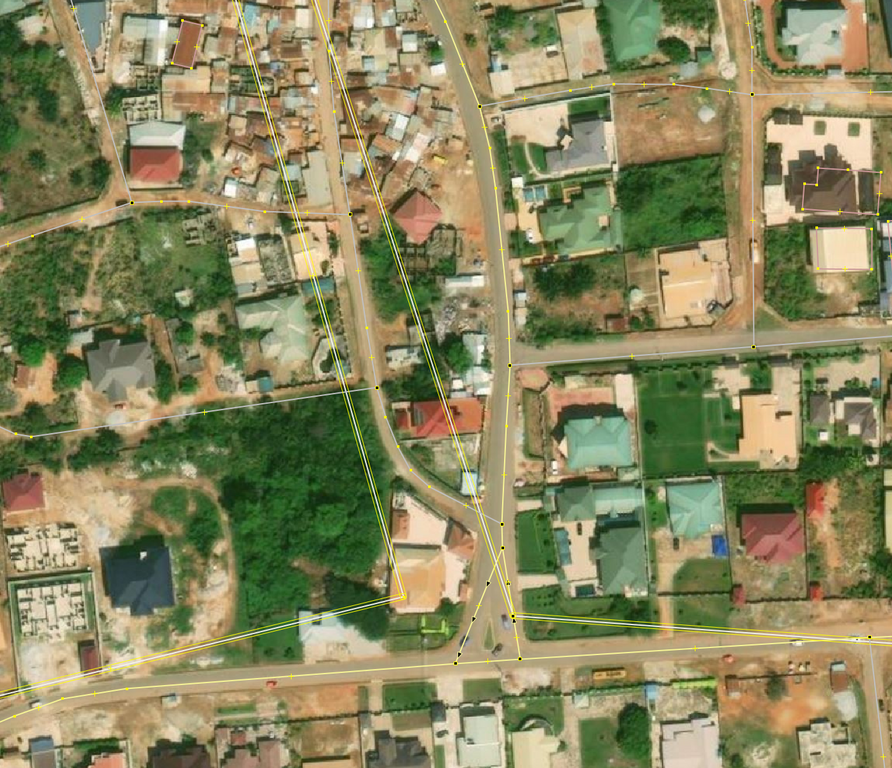
© OpenStreetMap Contributors. Screenshot from JOSM with Bing

Fast forward 2024, many of these ways still exist in OSM and interferes with new contributions. Kumasi was selected as the start of trying to reuse/delete/improve these landuse=residential because Sammyhawkrad have really put a lot of time into improving data coverage in Kumasi but these landuse=residential definitely throws him away.

In summary this is how I improved the data:

See full entry

Location: Alabar, Asokore-Mampong Municipal District, Ashanti Region, Ghana

sorry if my grammar sucks and all that I never had a good grasp on it in life. It’s been a few days since I started modeling Sweetwater so it can show up on Pokémon go when it updates their map though I’ve been aware that they might use specific versions but never hurts to model the town still, but the only issue is that no one in my town uses OSM anymore meaning I am completely alone.. a few days ago, I tried getting help which did work but not in the way I expected but hey better than nothing well all I wanted was help with buildings and all of that due to the town of Sweetwater Texas being hardly mapped (buildings wise). I tried requesting help though the notes, but it got resolved but the person gave me a website to help making it a bit faster but also giving me somewhat outdated building data.

if you’re interested in this whole thing and want to help out with the buildings or just update some information here’s the link to Sweetwater Texas

Recently while updating business information in my area, I noticed that outdated POIs would often include a defunct website. When attempting to follow the links in OSM, I was just presented with an error. That gave me the idea that I could proactively identify POIs that may need validated in person.

After some tinkering, I came up with a python script that will query OSM data for nodes with websites, then iterate over the websites to see which return errors when connecting. I started with logging these to a text file, but then realized that I could export them all to a kmz file and import them into Organic Maps. Now when I’m out and about I can launch Organic Maps to find areas that I should validate.

Screenshot of Organic Maps with pins through Amsterdam

When you select a pin, it’ll give you more details on the failure.

See full entry

Example of different map styles

Let’s imagine that you’re a pizza delivery company, and you’ve got an app that shows where you are, where your customers are and where a delivery person is between the two. Obviously you need some sort of map that shows the three in context. You can’t use Google Maps for cost or other reasons, and whatever framework your using will accept raster tiles in the almost universal format https://server/Z/X/Y.png, so why not use OpenStreetMap’s standard layer? After all, it’s free!

Well:

See full entry

Location: Pizza, Uvu Uda, Askira-Uba, Borno State, Nigeria

Amazing Experience ……..

The open street map foundation is an international not - for - profit organization supporting, but not controlling. the OSM project. it is dedicated to encouraging the growth, development and distribution of free geospatial data and to proving geospatial data for anyone to use and share. The OSMF had quite recently Started a worldwide membership campaign with the objective of growing and diversifying OSMF membership in regions where there are very low or no OSMF members.

I am proud to say that I was part of this campaign. On the first few virtual meetups via Google meet, I had promptly signed up for the campaign Ambassadors role as I believed I could use whatever little ideas and experiences. I have learnt a lot about community.

thank you for the wonderful opportunity.

Providing updates! The OSM Wiki of the OSMF Membership Drive Campaign 2024 Plan is in the wiki: osm.wiki/OSMF_Membership_Drive_2024

We will also provide updates and have a space for feedback in the Community Forum using this thread: https://community.openstreetmap.org/t/updates-osmf-membership-drive-campaign-2024/109280

Welcome to the seventh OpenStreetMap NextGen development diary.

This week, I focused on delivering core website functionalities and website and migration script optimizations 🚤.

🔖 You can read my other development diaries here:
osm.org/user/NorthCrab/diary/

📖 This project is open-source and publicly available:
https://github.com/Zaczero/openstreetmap-ng

🛈 This initiative is not affiliated with the OpenStreetMap Foundation.

In Case You Missed It…

OpenStreetMap-NG is planned to have its first development release at the end of this month, May. After this milestone, the project will be open for new contributors! My current work focuses on delivering on that promise, finishing the core functionalities, and stabilizing the code.

Originally posted in diary #5.5.

New Fast Rendering Engine

One of the highlights of OpenStreetMap-NG is its brand new, super fast object rendering engine. It’s a significant improvement over the current solution.

For example, rendering all of Poland (about 1500 ways) takes a mere 34ms.

See full entry

In March 2023, I conducted a survey on women’s participation in OSM activities. It became apparent that individuals’ perspectives came into place and interpreted the survey topic differently. The survey aimed to gather perceptions, opinions, and insights into why some women do not participate in OSM activities and what factors may discourage those who were already participating from continuing. There were various reactions about the survey, from questioning the relevance of the topic to commending the effort to address it.

I was fortunate to have had support from various individuals for the topic, including Heather Leson, Arnalie Vicario, Pete Masters, Geoffrey Kateregga, and the Geochicas family, who were interested and open to exploring the topic through webinars and discussions. One such webinar featured speakers from diverse backgrounds:

  • Stellamaris Wavamunno Nakacwa, Programme Director at Youthmappers EverywhereSheMaps
  • Mikko Tamura, Community Manager at Open Mapping Hub Asia Pacific
  • Jaqueline Amorim, Expert Mapper in Geostatical Data/HOT Data Quality Intern in 2022

The webinar was moderated by Dr. Prince Kwame Odame from Africa, a lecturer at the University of Education Winneba-Ghana. You can review the webinar here.

A unique aspect of the survey was that, in addition to focusing on individuals who identify as women, I also sought perspectives from men. I was pleasantly surprised by some of their positive viewpoints, although there were also negative responses. I am grateful to everyone who took the time to participate in the survey.

One key takeaway from the survey is the importance of considering diverse perspectives. Just because something may not be perceived as an issue by one person does not mean it isn’t significant to others. We all view the world through different lenses, and it’s essential to be considerate and open-minded to learn from various angles.

See full entry

Posted by Barroszt on 13 May 2024 in English.
  1. Introduce blocks that prevent editing in selected areas, e.g. a country, an administrative unit (editing controversial objects in the field), and not the entire world. Now I can’t improve my neighborhood due to controversial editions in Ukraine.
  2. Comments on your profile should link to a page where your changeset comments are located, not to log comments.
  3. The link to your first edits in OpenStreetMap is intended to understand the difficulties for a beginner editor.
  4. Links to apps and websites related to OpenStreetMap from main page (with map) e.g.: MapRoulette, how did you contribute to OpenStreetMap?, osm-revert.
Location: Góra Buchta, Rubinkowo, Toruń, Kuyavian-Pomeranian Voivodeship, 87-120, Poland
Posted by KhubsuratInsaan on 12 May 2024 in English. Last updated on 14 July 2025.

Delhi Cantonment is one of the most sparsely mapped area in Delhi. It might be because it is full of military areas. As I live in the cantonment, I hope to map at least the non-sensitive areas, such as Sadar Bazar and Gopinath Bazar. By my current rate, it is likely to take at least 2 months to map these two markets alone. In future I might venture out to map the big Nangal area (gulp).

This diary entry is licensed under CC BY-NC-SA 4.0.

Location: Gopinath Bazar, Delhi Cantonment, New Delhi, Delhi, India

With 2024 officially being the year of OpenStreetMap vector maps let’s do a deep-dive into vector maps: their history and how the underlying vector tiles work in detail.

img1

Vector Maps History

To understand how revolutionary vector maps were we have to go back in time to the early 2010s. One Direction is raising to international fame and raster maps are at the height of their popularity. Folks creating raster web maps rendering OpenStreetMap data into beautiful 256x256 pixel images.

But raster maps come with limitations: when you rotate the map the labels stop facing you; you can’t customize pre-rendered maps to specific use-cases on the fly; there is no fractional scaling between zoom levels. All of these problems are unthinkable nowadays: here is one example where Jochen wrote about Wikipedia struggling with pre-rendering multilingual maps for over 200 languages because they can’t change their map’s language on the fly.

See full entry

Welcome to the sixth OpenStreetMap NextGen development diary.

This week, I continued the preparation of the project for the first development release scheduled for the end of this month 🔨.

🔖 You can read my other development diaries here:
osm.org/user/NorthCrab/diary/

📖 This project is open-source and publicly available:
https://github.com/Zaczero/openstreetmap-ng

🛈 This independent initiative is not affiliated with the OpenStreetMap Foundation.

In Case You Missed It…

OpenStreetMap-NG is planned to have its first development release at the end of this month, May. After this milestone, the project will be open for new contributors! My current work focuses on delivering on that promise, finishing the core functionalities, and stabilizing the code.

Originally posted in diary #5.5.

Finishing Up the Elements Sidebar

The elements sidebar has been mostly finished. The “Part of” and “Members/Nodes” sections are now more consistent in design and have received pagination support. The orange-colored map visualization is also now working.

See full entry

Posted by bhousel on 8 May 2024 in English.

I’m excited to announce that today we released Rapid v2.3 editor for OpenStreetMap! The Rapid team has been busy working on this for the past few months - here’s 4 new features that we hope you’ll love…

🔙 Esri Wayback imagery

The world never stops changing! We added a new background layer called “Esri Wayback” to let you view historical releases of the Esri World Imagery. This background source also has a date picker to help you choose from dates likely to show changes in the current map view. Open the Background pane to try it out!

Esri Wayback

🔄 Map Rotation

Take Rapid for a spin! Now you can rotate the map to make your editing easier (and avoid straining your neck!). Rapid supports rotating with option+click-drag or shift+←/→ arrows, just like other maps you’ve used before. A new bearing control displays a north arrow, and you can click it to reset the map back to North-up.

See full entry