OpenStreetMap logo OpenStreetMap

Diary Entries in English

Recent diary entries

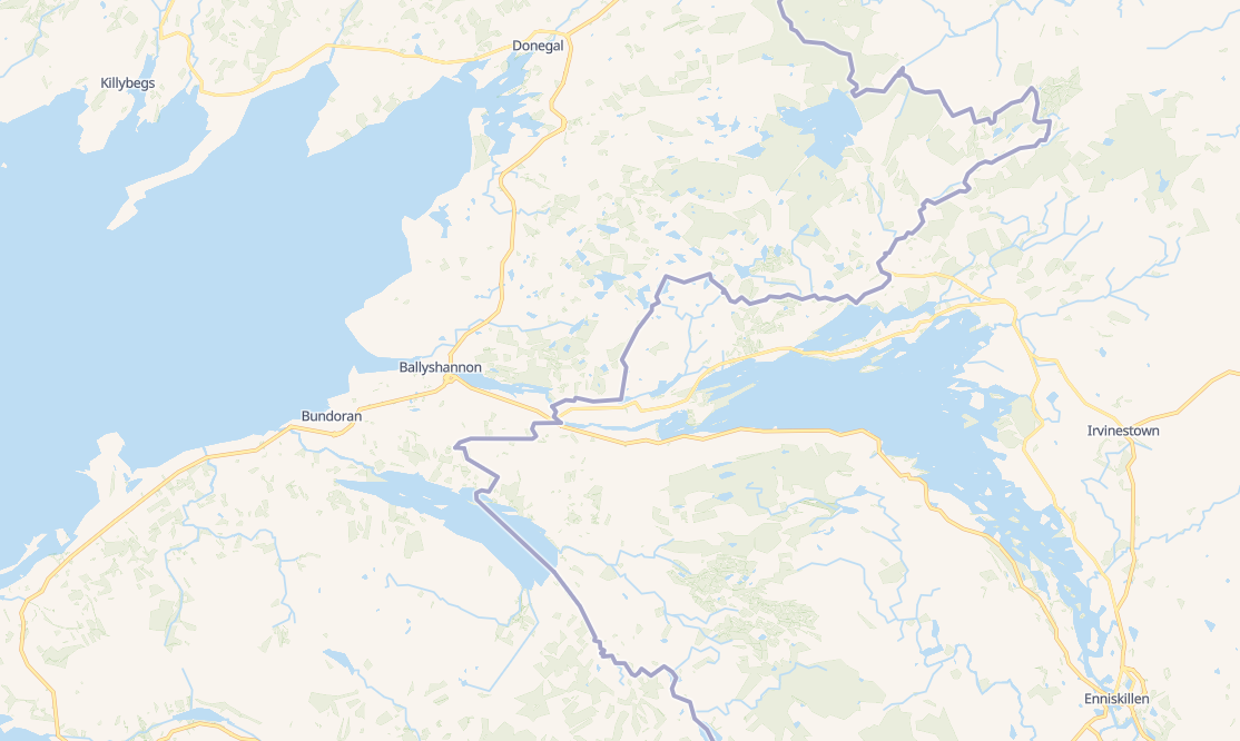
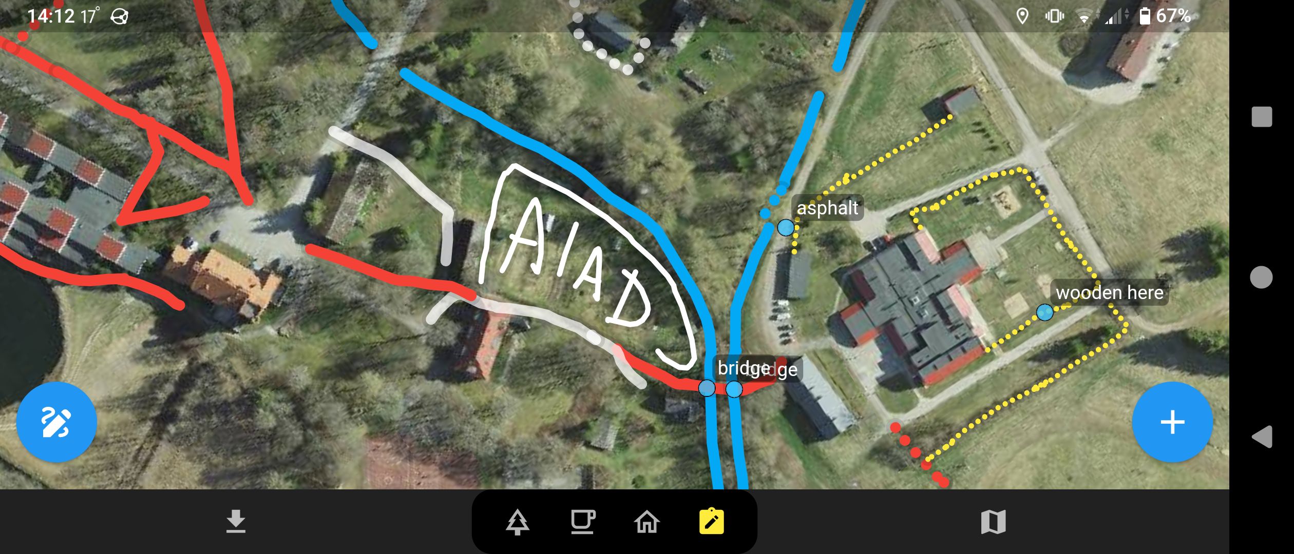
Today I mapped Përcëllesh which is a tiny village with a population of around 140. Since the village was very small, I expanded my mapping to the surrounding villages, and i also partially mapped the villages Kryezi and Gurrë.

“#100VillagesIn100Days #Day5”

Location: Përcëllesh, Petrelë, Tirana Municipality, Tirana County, Central Albania, 1034, Albania

I did most editing of the Building and other allied mine infrastructure of this mining site. This Mine site is managed by Harmony Gold Limited of Africa , which I was an employee as a Mine Surveyor .It was the site I worked for 2 months before I left for another job at Simberi Gold Mine in New Ireland Province. I used the Camp maps supplied by National Catering Services(NCS) to populate the Building names in OSM.

Location: Hamata Mining Camp, Morobe, Momase Region, Papua New Guinea
Posted by IrdiIs on 4 June 2024 in English.

Lapardha e Sipërme seems to just be a point on top of a hill (i will have to figure out if I can get my hands on some data to map the village area correctly.). I figured out the village has some neighborhoods which are located around the hill. I proceeded mapping Muhollarë (Lapardha), Goxhollarë (Lapardha), Gjole (Lapardha), Myrtallarët (Lapardha). This area is filled with greenhouses, but I mapped only some of them. I will try to map the greenhouses another day and focus only on them.

“#100VillagesIn100Days #Day4”

Location: Muhollarë (Lapardha), Lapardha e Sipërme, Otllak, Berat Municipality, Berat County, 5010, Albania

Hello, I am Sajeevini from Sri Lanka, and I am excited to share my remarkable OSM Guru journey through Open Mapping Hub Asia.

This journey began in January 2024, filled with curiosity and anticipation. It has since given me wonderful recognition within the Open Mapping Community. I was selected for the Validations Track. Before embarking on this OSM Guru role, I had significant experience with mapping and OSM training, but I was relatively new to validation tools and techniques.

Starting was a significant challenge for me, but I embraced it wholeheartedly because I thrive on new challenges. Every challenge teaches a valuable lesson, and this OSM Guru fellowship has strengthened my skills in OSM validations. Moreover, I have learned a plethora of new things in OSM.

Throughout this journey, I had various tasks to complete. These included validation tasks in the Hot Tasking Manager, creating and solving challenges in MapRoulette, performing validations through Osmose and OSMCha, and engaging in changeset discussions on OSM forums.

I have attached a link to the first project I created in MapRoulette: Highways Crossing Security Challenge. I decided to focus on ensuring the safety of highway crossings. Please take a look.

The study materials and instructions provided were vital to my progress. The self-learning methods were especially intriguing, as my OSM journey began with self-learning. I am deeply grateful to our mentors from Open Mapping Hub Asia for their guidance. Thank you for this fantastic opportunity. Throughout this journey, all the gurus were incredibly supportive and positive. I want to specifically acknowledge Mikko and Dinar, who have been exceptionally generous and supportive.

Thank you to everyone involved in this amazing journey. #OMGuru #OpenMappingHubAsia

Posted by Azharul Islam Anik on 3 June 2024 in English. Last updated on 8 June 2024.

Introduction

Hey, I am Mohammad Azharul Islam, an OMGuru fellow from the OMGuru Fellowship Program. During my tenure as a fellow in the validation track of the OMGuru Fellowship, I refined my abilities to assess and verify the precision of data.

Challenges and Responsibilities

As a fellow within the OMGuru Fellowship Program’s validation track, I refined my abilities to assess and verify data precision. This experience allowed me a lot of experiences. Followings are here, i. It had precise validation procedures which were designed and executed to evaluate the quality and consistency of the data. ii. Analyzing and identifying discrepancies within datasets, ensuring their accuracy and adherence to established standards. iii. Collaboration with the OMGuru’s to learn precise validation process and resolve inconsistencies. iv. Had to communicate with the data providers and stakeholders regarding data quality issues and solutions to the problems.

Challenges and Learnings

Participating in data validation proved to be a challenging yet fulfilling endeavor. The complex process required a thorough examination of each structure, road, and even street view, which was not consistently available. Obstructed elements such as the overcast sky or dense foliage further hindered the operation. During these obstacles, I refined my problem-solving abilities and gained vital insights at each stage.

Acknowledgment

During the whole journey, all the GURUs were very supportive and positive. I want to mention about Mikko, Dinar, and Melai, with whom I have interacted directly and they are very generous people I have met. And also the GURUs around the region.

Finally, thanks to OpenMappingHub Asia Pacific and HOT for the opportunity. It’s encouraging for the community and the mappers around our region. I wish for the betterment of our region.

#OMGuru #HOT #OSMBD #youthmappersatbsmrmu #youthmappers #APHub #openmappinghubasiapacific

Mohammad Azharul Islam 
MSc in Oceanography, BSMRMU

See full entry

Location: Eastern Housing, Pallabi, Dhaka, Dhaka Metropolitan, Dhaka District, Dhaka Division, 1216, Bangladesh
Posted by IrdiIs on 3 June 2024 in English.

Third day into the challenge. Today, I mapped Fitore, a small village in Novoselë, Vlorë. Even though I’m not a huge fan of Rapid, I used it to map most of the buildings. Then, I switched to iD Editor to add buildings that weren’t visible or well-mapped with Rapid. Additionally, I added some visible roads using aerial imagery. This village has only a one sentence Wikipedia article in Albanian. Will try to translate when i have more time.

“#100VillagesIn100Days, #Day3”

Location: Fitore, Novoselë, Bashkia Vlorë, Vlorë County, 9411, Albania

We have two London events coming up! A standard pub meet-up this coming Tuesday (4th June), and a tech presentation the week after (Mon 10th June). I’m looking forward to both of these immensely. The pub, because I’ve been wrapped up in work lately and I deserve a beer. The tech presentation, because I’m sure it will be excellent. I manage to get along to the London Ruby User Group semi-regularly anyway, to be with this crowd of ruby developers, but hopefully we’ll have a few OSMers along this time too, for this talk by Andy Allan “Things I’ve learned maintaining OpenStreetMap”. As usual you can find out more about both of these events on the London wiki page (but note you do need to sign up for LRUG following their instructions).

See full entry

Posted by IrdiIs on 2 June 2024 in English. Last updated on 3 June 2024.

I was surprised and happy to see that such remote villages are well mapped. This wikipedia article , although short, provides some context about the village.

Since Vukël was almost fully mapped, I just added a few buildings and then moved on to the nearby villages, adding buildings to those as well. I didn’t want to end the day with just a couple of buildings, so I roamed the map and chose a village named Abat (42.3106, 19.8115) and added some buildings there too. Here s also a very short article about Abat on Wikipedia.

“#100VillagesIn100Days, #Day2”

Posted by IrdiIs on 1 June 2024 in English.

Shushicë, according to Wikipedia, has a population of around 8,000 people as of 2011, which are the latest public statistics provided by the government of Albania. This village is quite significant in terms of its size and population, making it more comparable to a small city rather than a typical village.

Mapping Shushicë was a challenging task due to its vast territory and the dispersed nature of its small houses. The scattered settlements across a large area added to the complexity, making it difficult to ensure comprehensive coverage. For future projects involving villages of this size, I am considering utilizing a tasking manager to streamline the mapping process and ensure thoroughness.

Additionally, I found a short Wikipedia article about the village that could benefit from further improvements and updates. You can find the article here. Enhancing this article with more detailed information about Shushicë’s history, culture, and demographics would be beneficial for anyone looking to learn more about this unique village, so i encourage you to also contribute to Wikipedia.

” #100VillagesIn100Days #Day1 “

Location: Byshek, Shushicë, Elbasan Municipality, Elbasan County, Central Albania, 3025, Albania

Hello Fellow Mappers, My name is Henny Vianelde de Jesus Pires, and I am from Timor-Leste. I have been using OSM since 2022 and am currently participating in the OMGuru Fellowship 2024. I am excited to share how I got involved with open-mapping, what I find fascinating about the fellowship, my experiences, what I have learned, and how it has impacted me.

Introduction

Participating in the OMGuru fellowship has been a significant journey of learning and growth. As part of the validation track, I immersed myself in the world of OpenStreetMap (OSM), using various online platforms to ensure the quality of mapped data. This entry outlines my experiences, lessons learned, and the impact of my work.

How I Got Involved with Open-Mapping

My journey with open-mapping began in 2022 when I first heard about OpenStreetMap. The collaborative and open nature of OSM intrigued me, and I quickly became passionate about contributing to this global map. The idea of creating detailed and accurate maps accessible to everyone, and after hearing about the OMGuru Fellowship, I was particularly excited and it motivated me to get involved and learn more about the different aspects of mapping.

Fascination with the Guru Fellowship

What fascinates me most about the OMGuru Fellowship is the opportunity to connect with like-minded individuals who are equally passionate about mapping and geospatial technology. The fellowship provides a unique platform for learning, collaboration, and growth. Additionally, the focus on ensuring data quality in OSM is particularly gratifying. Contributing to the accuracy and reliability of mapped data not only enhances the usability of OSM for various platforms but also builds trust among its users. By validating and improving data quality, I feel that I am making a significant contribution to the global mapping community and supporting projects that depend on precise and dependable geographic information.

Defining My Experience as a Guru

See full entry

Location: Perumnas, Dom Aleixo, Dili, East Timor

(Ελληνικό κέιμενο παρακάτω)

I’ve been dabbling with overpass today and wrote this query for correcting one of my biggest pet peeves in Greek name tags, the absence of stress accents. Since by the nature of the mistake it is often one out of thousands of street names and very subtle at a distance, it is quite hard to find manually, unless someone systematically added street names without stress accents on purpose in error. Maybe I should add these to the wiki page or make one for particularly Greek language examples. I excluded bus stops because in many Greek cities they are often written in all caps. I also exclude Σκρα and Κω, two single syllable words that are often names of streets in Greece. Neither caps nor single syllables are stressed.

Έπαιζα λίγο με το overpass σήμερα και έγραψα το παρακάτω query για τη διόρθωση ενός από τα μεγαλύτερα μου pet peeves στα ελληνικά tags για ονόματα, η απουσία τονισμού. Λόγω της φύσης του λάθους είναι συχνά ένα από χιλιάδες ονόματα οδών και αρκετά διακριτικό από μακριά, είναι αρκετά δύσκολο να βρεθεί με το χέρι, εκτός αν κάποιος συστηματικά βάζει ονόματα οδών χωρίς τόνους επίτηδες από λάθος του. Ίσως πρέπει να το προσθέσω στο wiki ή να κάνω σελίδα για ελληνικά παραδείγματα. Απέκλεισα τις στάσεις λεωφορείων γιατί σε πολλές πόλεις γράφονται με κεφαλαία. Απέκλεισα επίσης τις Σκρα και Κω ως κοινά μονοσύλλαβα.

// gather results nwr ["highway"] ["highway"!="bus_stop"] ["name"] ["name"!~"ά"]["name"!~"έ"]["name"!~"ί"]["name"!~"ή"]["name"!~"ώ"]["name"!~"ό"]["name"!~"ύ"] ["name"!~"Ά"]["name"!~"Έ"]["name"!~"Ί"]["name"!~"Ή"]["name"!~"Ώ"]["name"!~"Ό"]["name"!~"Ύ"] ["name"!~"ΐ"]["name"!~"ΰ"] ["name"!="Σκρα"]["name"!="Κω"] ({{bbox}}); // print results (._;>;); out meta;

Posted by IrdiIs on 1 June 2024 in English. Last updated on 16 August 2024.

Albania’s mapping, especially in rural areas, is lacking. Villages, in particular, are often not mapped at all. To address this, I’ve set myself a challenge: to map 100 villages in 100 days. I’ve used tools like Overpass Turbo and a Python script to select these villages randomly. Below, I’ve listed the villages, although I haven’t checked if they are already mapped. In the event that a village on the list has already been mapped, I will replace it with another. I’ll update regularly on my progress.

See full entry

Posted by Candid Dauth on 1 June 2024 in English.

I really missed Openptmap ever since the service stopped working a few years ago. It was an important feature of FacilMap that I had used frequently in my daily life. This is why I have decided to invest in a bigger server to be able to render and host the tiles myself.

I have set up a tile server with the original Openptmap styles on https://pt.facilmap.org/. You can browse the tiles through FacilMap.

For now, tiles are generated when first requested, so rendering the map will be very slow when a region is first accessed. Also, there are no automatic updates of the map yet, so for now the state of the map will be frozen in time. When I find the time, I want to bring the setup up to date to enable automatic updates. If you have the skills and want to contribute, what would be needed would be to rewrite the filter and style into an osm2pgsql flex output Lua script.

If you find this service useful, a financial contribution would be greatly appreciated.

Welcome to the ninth OpenStreetMap NextGen development diary.

This week was focused on providing final touches to the core system. Within the few days I’ll publish details on how to get started contributing! Keep an eye for a dedicated diary entry 🙂/.

🔖 You can read my other development diaries here:
osm.org/user/NorthCrab/diary/

⭐ This project is open-source and publicly available:
https://github.com/Zaczero/openstreetmap-ng

🛈 This initiative is not affiliated with the OpenStreetMap Foundation.

Let’s jump into this week’s highlights.

macOS and ARM support

OpenStreetMap-NG development environment has received MacOS support. Meaning that it can now be developed on Linux, MacOS, and Windows through WSL2. The installation instructions are the same for all platforms and contain just a single step: install and run nix.

Changesets History Refresh

See full entry

Posted by SomeoneElse on 29 May 2024 in English. Last updated on 11 November 2024.

A simple "shortbread" / "VersaTiles Colorful" maplibre-gl vector map

Lots of people have written diary entries and there have been other announcements and demos. You might wonder why we need another?

The idea of this is to provide a “soup to nuts” guide in a similar style to the existing “Switch2osm” Serving Tiles guides for raster tile servers.

Introduction

There are two major pieces to this. The first piece creates a set of vector tiles that can be served by a web server. The second provides a way for clients to access that data - and clients also decide how to display it.

The code in this example is for web clients, but it’s also possible to create other sorts of clients too (for example, Android or iOS apps).

See full entry

Location: Larganhugh, Melvin Electoral Division, Manorhamilton Municipal District, County Leitrim, Connacht, Ireland
Posted by Zverik on 29 May 2024 in English.

I make Every Door to be the best on-the-ground surveying app. Its focus has always been shops and amenities, but it’s summer now! Ride a bike outside a city, take a scenic route. And bring Every Door with you, because it is ready for outdoor adventures.

Today version 5.1 has been published to both major app stores, and soon on the rest. Here’s what the app learned to do in May:

Every Door app with scribbles drawn on top of a satellite imagery

We have always had map notes, but now you can draw on the map! Saw an unmapped track road or a stream? Open the 4th mode in Every Door, unlock the scribble mode, choose the type and draw with your finger. This goes to a separate database, which you can then use in JOSM or Rapid.

Read this wiki page to learn how it works and how to add the layer to your editor.

See full entry

Two months later I’ve made my way deeper into a lot of OSM development of the last decade, learning changeset comments, OSM notes, catching up with recent tagging style and trends and using street imagery tools.

I tried to fix issues documented in OSM data as well as from the OSM notes map layer. After some quick wins I got challenged by tasks like merging dozens of tags and bus relations when merging split directions of Schandauer Straße in Pirna back to ‘ground truth’ - a 4/5-lane marked primary town highway. Destination tagging had been try-n-error before stepping into OSM community forum. That opened a wide pool of expertise and discussion supplementing the more authoritative wiki documentation, especially tools for reconstruction/QA of destination tags into visual form of road signs.

Tempted to photo-document rather than note down observations I joined Mapillary street imagery. It feels like a great tool for cheap document including sharing recent changes and situation in the field to fellow mappers. Despite of my rather basic equipment - mapillary app on mobile - I enjoyed looking at 360-degree-photograph-series of some very active contributors. These images look amazing and seem like the way to go.

Recently I made my first steps to preserving history in OpenHistoricalMap, the spin-off for information, that cannot and shouldn’t be preserved by current OSM life-cycle tagging. There is not much information in my area yet and a lot of discussion regarding rather basic mapping techniques. It feels like the pioneer days in OSM back in 2008.

More to come …

Posted by Jinoytommanjaly on 28 May 2024 in English. Last updated on 10 June 2024.

Magical world of mapping through OpenStreetMap and Wikidata

The possibilities for integration between these two platforms are incredibly vast, and I genuinely feel as if I had progressed quite a lot in the understanding and contributions I make

Date: May 20, 2024

I started my morning by getting familiar once again with OSM. I invested time in updating and linking the wards in Kerala with Wikidata. I noticed that there was some wards in OSM that are not linked to Wikidata and some issues with the names and ward numbers. Using Sparql query I downloaded the Qids from Wikidata and using QGIS I downloaded the OSM relations ids. Then using OpenRefine I reconciled the data and matched the OSM and Wikidata entries. Using JOSM, I added the Qids to OSM relations.