Welcome to the eleventh OpenStreetMap NextGen development diary.
This week has been focused on the design and implementation of new user profile pages. Today’s profile pages are boring and quite limited — let’s fix that! 🧑
🔖 You can read my other development diaries here:
osm.org/user/NorthCrab/diary/
⭐ This project is open-source and publicly available:
https://github.com/Zaczero/openstreetmap-ng
🛈 This initiative is not affiliated with the OpenStreetMap Foundation.
Last Week’s Recap
Last week the project was opened for new contributors. The codebase is now stable enough to allow for greater cooperation. There are also contributor incentives to ensure your work is always appreciated.
New Profiles
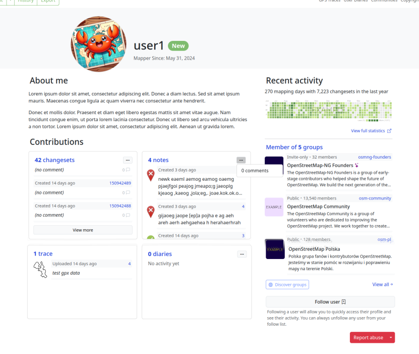
In summary:


.jpg)


 This figure illustrates the process of capturing street-level imagery using