Sailing today with P&E.
Forecast was for 10 knots with gusts to 18.
Easy out of the marina and then across the fjord to Nesodden. Very lumpy and heeling over. P&E learnt a new word “goffered” ie to get a wave in the face.
Sailing today with P&E.
Forecast was for 10 knots with gusts to 18.
Easy out of the marina and then across the fjord to Nesodden. Very lumpy and heeling over. P&E learnt a new word “goffered” ie to get a wave in the face.
BUILDINGS ADDED BY USER ZH9567 IN OPENSTREETMAP AROUND THE KLANG VALLEY AS OF 20 AUGUST 2024
Data generated through Overpass Turbo, with all features with the tag building=* on OpenStreetMap with latest revision made by Zh9567. Note that it include buildings added by others and last updated by the user, but not include buildings added by the user and got updated by other users.
As we can see in the map, Zh9567 mapped many buildings around the Klang Valley. They are mainly concentrated in Klang, southern Shah Alam, Subang Jaya, Puchong, Seri Kembangan, Kajang, Cheras, and Ampang.
As of 20 August 2024, there are 715,932 buildings (23,987 hectares) added into OpenStreetMap in Kuala Lumpur, Putrajaya, and Selangor combined. Zh9567 has added and updated 510,000 buildings (11,007 hectares) around the region, with a total of 71% (or 45.9% if counted by hectares). And these numbers will continue to rise in the future.
This is quite a major contribution in OpenStreetMap. Let’s help improve OpenStreetMap together!
Kindly fill in our survey about knowledge and opinion of maps among Malaysians (for Malaysians only at the moment): https://docs.google.com/forms/d/e/1FAIpQLSc5KOuuNLtZAAkFU8DYO_-xjZixJVTY3NukRORiIfLtGGaQVA/viewform?usp=sf_link
Support us on Patreon: https://www.patreon.com/Zh9567
Support us on Ko-fi: https://ko-fi.com/zh9567
No, not that kind of a minister!
Anyways, at the moment, Heritage Week is on in Ireland, and I gave a talk on Monday in our new library building (on OSM) about “Citizen Science and Linked OpenData” using mostly my holy well survey as an example, but a bit the Ogham Project as well. I used one of the toilets in the library to explain how the general tagging works, because it is quite nano mapped and relatable.
The Minister for Heritage (and other things) was present and kindly posted on Facebook about it afterwards: https://www.facebook.com/MinisterMalcolmNoonan/posts/pfbid09t7ubGw1CgEN6vNZeUqTGFngepAsKsARzxiJbinr6siLtn9ovPuXdEA46spxdW8xl
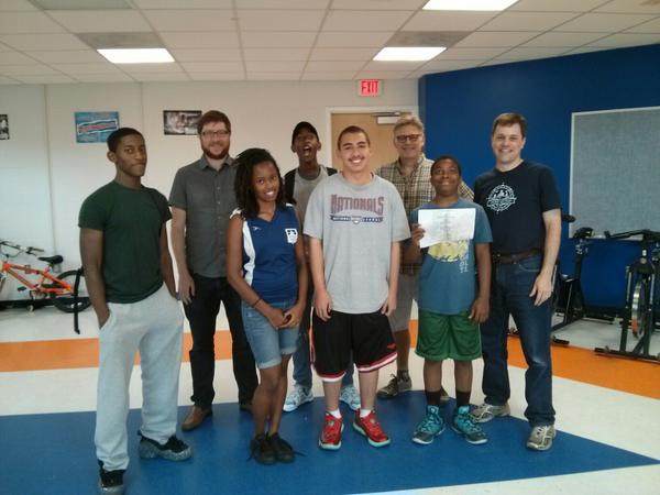
Just for context, in the first photo, he’s the guy in the middle, and the elderly people are descendants of Hubert Butler (on wikipedia), they were the other VIP guests so to speak.
It’s a busy week for him, so I was pretty happy that he attended and promoted OSMin his post. (Even though we still have to work on the spelling, but at least he didn’t use the plural like so many other people.)
I talked about the Wikiverse as well, of course. Wikimedia Ireland dedicated a blog post to it beforehand as advertisement for the talk. Thanks very much for that as well!
Recently started running to work.
It is painful every morning.
But it is never regretted.
It’s been a while since I last wrote about iD’s development and thought it would be a nice idea to make this a more regular thing in addition to the regular online community chats.
Recently, there have been some new features implemented that are worth showcasing, including several great ways that community members are stepping up to contribute to iD.

In his Google Summer of Code project, Mattia Pezzotti has implemented support for street level imagery from Panoramax. Panoramax is a relatively new completely free and open-source alternative to other street level imagery providers such as Mapillary, KartaView or Bing Streetside. It even includes features like a federated system architecture and the possibility to self-host the server software if you need to. Check the project out on panoramax.fr to read more and how to contribute your own pictures.
Read part 1 here.
I drive through the new RCUT intersection again today, this time making a GPS trace of my movements. I attempted to make each of the possible turns in the configuration. I did have to make one illegal maneuver, as the left turn north from Athens-Boonesboro does not go anywhere, and, while the light is installed and the turn lane unblocked, there are signs indicating that no turn is possible from that lane. The light is (as far as I can tell), in a semi-permanent red arrow state until the side road is developed. Since the turn lane is divided from the main road by a concrete island, the only way out is to make an impermissible left turn or unsafely reverse back into traffic. I chose to make the left turn. Cones or bollards are probably warranted to keep motorists from accessing the left turn lane to nowhere.
Based on this trace, I attempted to align the nodes for the separated left turn and U-turn lanes to the correct positions. Since the lane begins further back from where the dividing island begins, there is some ambiguity on when to split the lane into a separate line; I chose to break it off roughly where the dividing island begins. This makes for a less visually appealing line, but it does semantically indicate where lane changes are still technically possible.
This matches the approach I saw elsewhere on OSM, in Troy, MI. Apple Maps does the same thing (possibly with OSM data), while Bing Maps maps the entire turn lane as separate. Google Maps has a very interesting mix where one direction breaks away at the dividing island, but the other direction breaks away much further back in the turn lane. Google Street-View imagery from November 2021 shows bollards dividing the entire turn lane, so their system must’ve used that as the dividing point . Bing Maps imagery collected in April 2022 do not show these dividers.
Glad I found this app so I’m able to help out, as my neighborhood is very very much out of date! Many roads are missing and names are missing for many roads on the map…. Now, if I can figure out how to actually get my note to save, or how to name a road, then I’ll be in business!! hahaha.
Another little update. I am writing these, usually, on Sundays. Since I am still a new user of OSM I am writing these as a little how are things going. I wanted to share my experiences and ideas with the greater OSM community.
I am still doing the mapping and having a super hard time in some ways. I have a disability and if the OSM community could make the program more accessible that would be helpful to a lot of folks. I am haaving a really hard time mapping and understanding what the tools do. For instance attributes like car=wheel, just took that out of the air. I am not fully understanding the relationships and how many should be tagged and if there is a standard block of them already made up for new users. If anyone has any ideas on how to understand the relationships more please feel free to let me know.
I know I just mentioned that I have a challenge and I am curious what the OSM community is reaching out to folks with challenges. Keep in mind I know nothing about what OSM is or has been doing to make this possible. Its a thought I had.
No idea what github is and I am not sure if I should use it or not. I would love to learn more about it and what I can use it for and what one cannot use it for.
I am having a lot of fun doing this. Its simple yet important information. I am super curious about what happens and what the data collected goes towards after a quest is completed. Its simple yet I feel I am contributing in a small simple way.
Its not much but some questions and thoughts this time. Have a wonderful day!
If anyone knows of any answers to my questions, or thoughts, or people I could reachout to please let me know and feel free to DM me.
Pete Masters called our attention on this new feature for communities on OpenStreetMap, so I decided to give it a try.
First thing to say is that it resulted me very confusing, not only the name -as is told in the comments of the original publication- but the sign up process too. Here are some screen captures to ilustrate the process:

This part was easy but confusing. I had to take a look at the URL to be sure I was not trying to create another OSM user. And I had my OSM user live and open in another tab.
Lexington, KY is in the process of installing new “RCUT” intersections on Athens-Boonesboro Road 0, to support future development, including a new pro soccer stadium 1 along the corridor near the I-75 interstate access. I am attempting to add the features as they go live. The first section, at Competition Drive went live on 2024-07-22. I have made a first cut at adding it in this edit, basing it off of the map imagery provided by the state transportation cabinet, a drive-through I made, and an existing similar intersection in Troy, MI.
Strava > OSM
“Where a pathway is designated for pedestrians but is also allowed for bicycles you can use highway=footway and bicycle=yes.” osm.wiki/Tag:highway=footway
About a year ago I wrote about my experiences of mapping in Bonaire. It’s time for an update.
One of the challenges I had was adding data without high quality and recent imagery. Luckily, earlier this year the ‘Satellietdataportaal’ (Satellite Data Portal) made high resolution data available for Caribbean Netherlands.1
First things first though: are we allowed to use the aerial photos they publish for improving OpenStreetMap? There is a long thread on the Community forums. Whether it’s allowed or not depends on the agreement the Dutch government has with the satellite data provider.2 Luckily, in the topic itself it is discussed that it is allowed to use Pléiades, SuperView and TripleSat.
The downside? You can only use this in The Netherlands. The data is geoblocked. I’ve added a lot of new streets and buildings in Bonaire over the past few weeks, but only other people currently in The Netherlands would be able to validate that I’m mapping actual buildings. The rest of the world would need to wait for a worldwide aerial imagery provider to update their data.
In the Satellite Data Portal Viewer, after selecting Bonaire from the top left menu, you then need to select a part of the area for which you want to see the satellite data, then it gives you a list of options. Currently for Bonaire there are only three options (as we’re only interested in recent and high resolution satellite data). * Pleiades-NEO January 9, 2023 * Pleiades-NEO April 18, 2023 * Pleiades-NEO June 17, 2023
The January one is generally too cloudy, but the April and June ones are useful. Use the April one if you’re looking at the Western part of Bonaire (Rincon and Washingtong Slagbaai National Park) and use the June one for Kralendijk and all of the east and south.
You can simply click on ‘Select for WMTS’ which fetches you a link.3
Update for the past 10 days of the mapping challenge.
Today I mapped the last village on the list, so in 71 days i have mapped around 100 villages. Since my initial personal challenge was to map for 100 days, I will continue mapping and add villages to the list. I will finish mapping what is left from the Online Mapping Party for OSM 20th birthday. List of villages is we mapped and what is still to be mapped is here.
Villages mapped during the past 10 days:
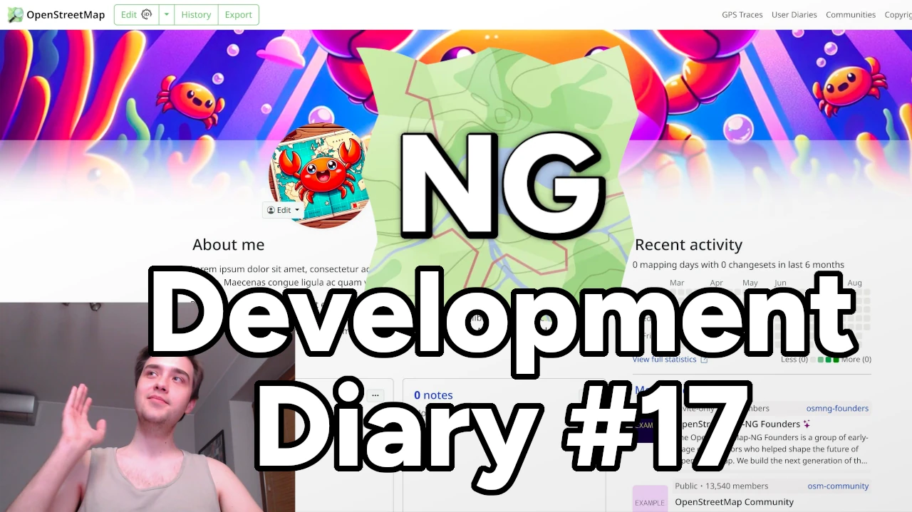
Heyy! I am very excited to share our latest OSM-NG development progress with you. Apologies for the slight delay — I wanted to wrap up some work for this week’s diary.
🔖 You can read other development diaries here:
osm.org/user/NorthCrab/diary/
⭐ This project is open-source — join us today:
https://github.com/openstreetmap-ng/openstreetmap-ng
🛈 This initiative is not affiliated with the OpenStreetMap Foundation.
It’s been a while since our last video showcase, so let’s recap the recent progress in video format. It’ll also give you a better feel of the new exclusive profile backgrounds feature.
⬇ Click below to play ⬇
or click here: https://peertube.monicz.dev/w/5fKNRsq2K8jRyF22zEG5px
With OpenStreetMap-NG, users can now customize their profile backgrounds, making their personal pages even more personal. It’s time to show off your personality!
im a new user and i was able to download a first map in pdf, however i change to transport map as i want a clean version of my map to edit on illustrator and i cant download. might use some tutorial or any help is highly appreciated
I did It. Successfully Completed 20 th osm Birthday Celebration Srilanka.
Celebration Date : 11th August 2024
Thank you all Speakers, Presenters and participants for making this 20th osm birthday celebration success. and once again thank you accept my Invitation. #Taichi Furuhashi #Pawan #Janjan Villar Orano #Priscovia #Sangeetha BC #Dibikshiya #Ark Arjun
Thank You So much everyone……
It’s been over two weeks since the last progress report, and it’s time to update on the current status.
The core modules of the project have now been largely finalized, allowing us to enter the latter stage of development. The upcoming work will mainly involve adding new features within the existing framework.
Firstly, the rendering part has been set up, though there are still some details that need polishment, such as styles and elements controlling the rendering. These will be adjusted in sync with the subsequent feature development to ensure that the styling aligns with the editing logic.
I’ve developed an OSM API module that wraps some of OSM’s interfaces using Promises and parses the returned XML into a JavaScript object for easier manipulation within the program.
Following that is the editing module, which primarily includes the operation logic and global data management.
For the operation logic in map editing, I’ve introduced a state machine, which manages the current state of the editor by listening to mouse and keyboard events. The state machine, referred to as “stateMachine.js” in the code, handles state transitions and data maintenance based on the functions and state relationships provided in the state diagram. Depending on the current state, it determines which actions to trigger and the new state to transition into. The state machine provides hooks that allow other components, such as mouse events in Pixi.js, to track events. Editing operations are carried out during state transitions.
I was having a conversation with another mapper about the resolution of notes where the resolution of the note requires some local knowledge. These notes that require local knowledge may remain stale for a long period of time. You can read the full conversation here.
However, it is not uncommon that notes are resolved by people that are mainly interested in resolving notes. Anecdotally, based on the fact that I put in a lot of notes, there seems to be just a select few people that are going around resolving notes as their primary OpenStreetMap contribution, or at least a major part of it. I have all the respect in the world for these people. And to Danmer’s point, they don’t have enough help to get all their notes resolved, so leaving them unresolved, because notes only have two resolution options—they’re either open or they’re closed—can be challenging.
If the primary note resolution engine is people that most likely have no local knowledge, it is counterproductive to rely on that corps of people to address these notes that require local knowledge.
I think that we could probably classify notes into three categories:
After years of development, I am excited to introduce a proposed feature for OpenStreetMap called Communities. Formerly called Microcosms, this feature is designed to bring mappers together and facilitate collaboration. On the main OSM website, it will be located on the Communities page.
Communities are groups of mappers who share a common goal or interest. They can be formed around a specific geographic region, such as a city or neighborhood, or centered on a particular theme, like humanitarian mapping. The purpose of Communities is to provide a platform for mapping teams to connect with one another, work together as a team, and organize events.
I’ve only been here since june, but it has been a really good time. Everything works really well and the community is really nice and has helped when I asked. Crazy that it is so old, some of the data I have edited is older than me*. This is a really cool project, thank you to the devs for all the work making it.
*just checked and it was very slightly younger than me