Hello everyone, I have come to the conclusion that the daily mapping challenge I started was probably too ambitious considering my daily life (mainly univ), so I have no choice but to downgrade my ambitions unfortunately. I still will make my best to contribute everyday to OSM and to make daily diary entries, however they won’t be all about mapping a random municipality.
Diary Entries in English
Recent diary entries
In addition to OSM, I occasionally take pictures of the areas I visit to upload them on Mapillary.
There are a few reasons I enjoy contributing to Mapillary:
- it constitutes an historical archive of pictures over time, seeing how a corner changed brings up memories and documents changes. I personally lived in two cities (Milan and Berlin) that changed a lot over the years and like to document it and observe these changes over time
- in Milan it can be used to document the space used by vehicles, including the irregular one, which is a detail not present in OSM tags
- it’s suitable for machine learning. I for one have a second job as a teacher for Data Science Retreat and a few students used this data to classify the quality of bike paths. Mapillary already automatically identifies, geolocate and segment common elements like street signs and manholes
- it’s suitable (sometimes) for 3D reconstructions for artistic purposes, like games (example here, it’s not based on ad-hoc images but mapillary could reasonably be used for it too. Mapillary calculates and provides point clouds too). I think this is an area where new approaches like gaussian splatting can do a lot
- it can, of course, be used for micromapping in OSM, these images show shop names, street etymology, fences and other details not easy to spot from satellite data and hard to add on the spot using StreetComplete or similar. Images from Mapillary are accessible directly in the iD editor.
For these and other reasons I contribute to Mapillary since years, using my phone with the Mapillary app whenever I visit a new or interesting place.
Imagine then my surprise when, a few months ago, I was contacted by Meta’s Reality Lab. They saw my contributions in Milan and offered me to borrow their GoPro MAX 360 which was not used anymore by another Mapillary contributor, to contribute as I see fit.
Posted by TheFighter137 on 26 October 2024 in English.
Today (or rather, yesterday), I worked on Illois. Near this little village, there is the A29 highway and the D 929 road. There aren’t too many single-family homes, mainly because quite a few buildings are for agricultural purposes.
Recently I’ve noticed that most of the time I spend on OSM goes either to:
- Patrolling recent changes and fixing things which, although were already mapped correctly for years (often by myself), now have been altered (probably in good faith though!) by some newbie who „thought” that the current state is somehow wrong
- Fixing things which were already mapped incorrectly for years (often by myself) at a time when the documentation was unclear or the community consensus was different
This is no good, as repetitive adding and fixing of the same things over and over can lead to hypervigilance, burnout etc., and as a result the will for further contribution to the project could disappear. As the time progresses, some newbies become not-so-newbies, face the new generation of newcomers and the vicious cycle continues.
Burnout can also lead to a premature transformation into a nagging grump, which I would love to avoid.
Solution: People with the know-how should instead focus more on providing the best documentation and tooling there is possible to the community. Working on removing ambiguities, providing accurate descriptions and thorough examples. Therefore everyone can learn (and later teach) the right approaches. This pro-active approach is more effective than a re-active one, since less time and work goes to waste, the knowledge is propagated more quickly and in a more lasting manner, economics of scale start to kick in and stuff.
Also at the time of writing this entry it is 1 AM CEST where I live so I guess this makes this post #showerthoughts -approved. Thank you for coming to my TED talk.

It’s time for another OpenStreetMap-NG development update! This week brings exciting new features and improvements that bring us closer to the project’s first public release.
🔖 You can read other development diaries here:
osm.org/user/NorthCrab/diary/
⭐ This project is open-source — join us today:
https://github.com/openstreetmap-ng/openstreetmap-ng
🛈 This initiative is not affiliated with the OpenStreetMap Foundation.
📹 Video Summary
I’ve recorded a short video summary showcasing recent progress directly on the development website. It serves as an enhanced version of this diary post, with chapter markers for easy navigation to specific topics.
⬇ Click below to play ⬇
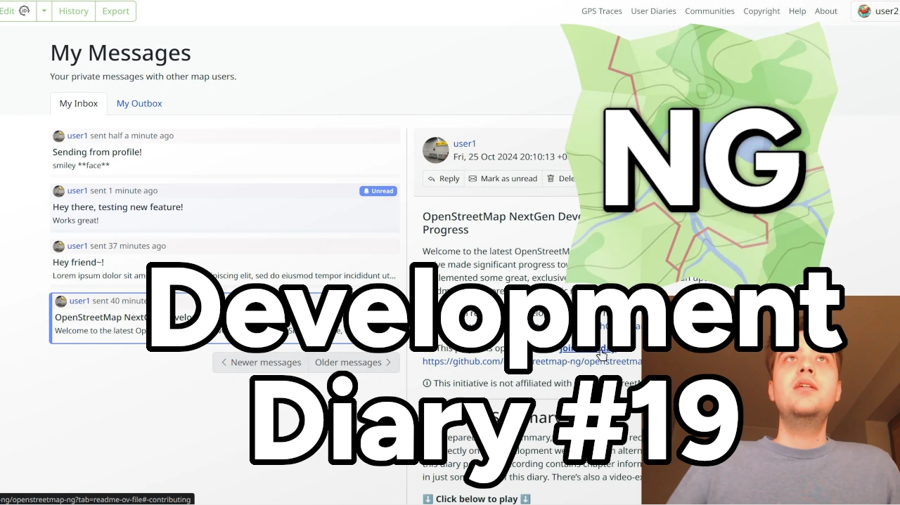
or click here: https://peertube.monicz.dev/w/ttE2rLRD1TXB2qgmuH4NBH
Messages Reimagined

Parks on the Air (POTA) information tags can be added to areas. It’s an improvement over the POTA map application as it shows the entire park area rather than a point. For example, the Victoria Harbour Migratory Bird Sanctuary (CA-4248)… https://pota.app/#/park/CA-4258 vs. https://potamap.ea7klk.es/?CA-4258
tag - “communication:amateur_radio:pota” info - Park code ‘NN-XXXX’
Posted by arnalielsewhere on 25 October 2024 in English.
Personal note
Sorry for the very delayed posting! 🥹
🎉 I can’t express how overwhelmingly grateful I am to everyone who made this idea a reality. ✨ Your passion in making the best map OpenStreetMap, and building inclusive communities is unstoppable. ❤️🔥
Let’s make the #OpenStreetMap the best and most inclusive space for all ✨🗺️
=Arnalie
————-
Key highlights: We are happy to share the accomplishments of the 2024 OSMF Membership Campaign: 1) ~ 392 sign up’s from March, most of them were through the Active Contributor Membership Program; 2) there are now members in 16 new countries!; 3) Four (4) countries made 15+ new members: Libya, Niger, Nigeria and Colombia; and 4) one of our team leads, Priscovia, became part of the Membership Working Group (MWG).
In our effort to grow and diversify OSMF memberships, early this year, we ran a 3-month long OSMF Membership Campaign with volunteers from all over the world.
I thought that the new year is the best time to encourage contributors to become OSMF members by spreading awareness about OSMF membership and the Active Contributor Program. The OSMF Membership Campaign Drive idea came up when a community member from OSM Africa asked about the membership make up.
Posted by TheFighter137 on 24 October 2024 in English.
Well it has been a while. As the result, I’m 3 cities late. Fortunately, one week of holidays is coming, so I will have quite a lot of time to catch up.
Today, I worked on Harcanville. It is a small village near Doudeville, a bigger city. It is mainly made of single-family homes, but there are quite a few agricultural buildings also.
https://princetontx.gov/DocumentCenter/View/3004/Princeton-Tax-Increment-Reinvestment-Zones-TIRZ_Whitewing-Trails-Phase-2 has information about the Phase 3

A few days ago, I started my mapping project for Jāņupe. The main objectives of this project are to add all the missing houses in the area, re-tag the existing ways and some nodes, and retrace the residential and allotment zones.
Current goals:
Add houses:
I will add all missing (unadded) houses in Jāņupe and neighboring settlements to make the map look more beautiful and updated. The current state of the map in that area is really not good, in some places, the map hasn’t been updated for 5+ years.
Re-tagging:
I will re-tag most places and roads in this area, as well, I’m going to be adding highway = turning_circle in places where they haven’t been added, and changing residential road tags to living street tags.
Retracing areas:
I will trace and re-trace most allotment and residential areas in the area, since most are wrongly drawn.
Upcoming challenges:
While I’m looking forward to work ahead, I will face some challenges like outdated data (for example some cadaster buildings are wrongly drawn or are outdated), or not much available resources to use.
I aim to finish this project in the next 2-3 weeks, breaking the project down into manageable parts. :)
Posted by TheFighter137 on 21 October 2024 in English.
I’m still late : I was supposed to do a municipality with the letter H today. I probably won’t do the letter I tomorrow either, nor Wednesday, however I’m pretty sure I will be able to on thursday.
Today, I worked on Gaillefontaine. For a rural city it is actually pretty diverse in terms of construction : the center has historic buildings, but it is mainly surrounded by single-family homes. The northwest has an industrial area though, and it looks like there are monuments on the southeast.
Links to today’s changesets :

Volunteerism, commitment, and dedication are our hallmarks as YouthMappers!
Now, repeat after me: YouthMappers Ghana… Right! We volunteered to contribute to developing a sustainable, eco-friendly urban environment in Koforidua collaboratively, and collectively (SDG 11). Using OpenStreetMap to put streets and landmarks in the right places—because let’s be honest, we’ve all been “LOST” thanks to outdated maps nau…! 😅 This is what we do while building technical skills. 🖐🏾High five to all contributors, validators, Bullet OSM and OSM Ghana.
Whoof! It’s my first Diary entry.
Posted by TheFighter137 on 20 October 2024 in English.
Today, I worked on Fallencourt. This village is smaller than the previous ones I worked on for my challenge, however something big is nearby, the A28 highway (I’d guess it creates quite a lot of noise). There is a bus stop in the center, however it isn’t used as far as I know, apart maybe by school buses.

a small project of mine over the last few years (in my spare time, when I’m not doing the job I get paid to do) is to map every building in the Kingston and new Malden area of SW London.
This is slow progress although I have now nearly finished all but a small part of Old Malden and an area of North Kingston. Although slow, the map does now look aesthetically significantly better than it did two years ago. although I am aware it could be improved further by putting house numbers on each building, I do have to keep my mental health in check here.
The Previously patchy; Berrylands, Norbiton, and Surbiton have now all been finished with finishing Old Malden being my next project and then Coombe and Ham Kingston Vale, being my next major projects
I have always found it frustrating that people will often do one or two houses on the road and then get either bored (or do their own house).
These diary entries are more to help me keep track of what iv done to date as well as give a minor update to the larger community on the slow updates.
Posted by TheFighter137 on 19 October 2024 in English.
Last updated on 20 October 2024.
Yes I know, I already missed a day for my challenge. Apologies, I will do 2 cities tomorrow.
Today, I worked on Écalles-Alix. For once, it’s not only sngle-family detached houses, as there are a few semi-detached houses (yeah not much better but still)

Dear OpenStreetMap Community and fellow mappers,
After writing to you in 2022 and 2023, you could think that these chairman reports would become pretty routine: compare a few numbers over time, tout the accomplishments of the OSMF board this year, and give a few paths for the coming year. I will be doing this, but in contrast to previous years, we do not have many positive changes to report on, because of the way the board has been (not) working. I will expand on why later, and talk about how I think the board should refocus in 2025. What might sound like board internal politics is actually, I think, at the core of how we organise as a project. This hasn’t been an easy report to write, which is why it comes so late.
We have 2088 members today, down from 2161 in December 2023, compared with about 2000 in December 2022. 1125 members today are associated members, and the 2024 membership campaign led by Arnalie at least helped diversify our membership’s geographic diversity. The next board should budget for changes to the website to recognise membership, and encourage qualifying mappers to join for an associate membership. It should also rethink the current complex membership structure, and look at technical improvements to the membership system.
We were happy to welcome Regrid, QGIS and Calimoto as silver corporate members in 2024.
Our number of registered users went down to 9851706 from 10.5 million as OWG cleaned up thousands of spam accounts. The number of nodes, ways and relations in the database keeps increasing at a normal rate, showing our growth and demonstrating how contributing to OpenStreetMap is important to many.

I was round that way this morning and confirm that there is no number 38 Crammond Place. One row finishes at 37 and the adjacent row starts at 39!
I have lived in North Muirton since 1973 and never realised this obscure fact until mapping the area.
I think, but don’t know for definite, that it is because there used to be (in the early years of NM) a council rent office in the row 39-47 which maybe didn’t have a house number and this has caused a “missing” house when the rent office ceased to be.
In the unlikely event anyone who knows reads this stuff then please let me know.
Jokes going to be on you now.