OpenStreetMap logo OpenStreetMap

Diary Entries in English

Recent diary entries

Posted by Graeme Herbert on 24 November 2024 in English. Last updated on 18 December 2024.

The Triple Frontier 3

Monday was a list of things to do, the last day before departure for Manaus. Priority number one was to move from a hostel too far away from the crossing into Tabatinga to one that was almost on the frontier, a pillar 10 metres away from our rooms marked the boundary. A brief stop for breakfast and down to Tabatinga port to buy our boat tickets, again checking out hammocks on the way.

Tabatinga 01

See full entry

Location: Barrio Colombia, Leticia, Amazonas, RAP Amazonía, 910001, Colombia
Posted by Graeme Herbert on 24 November 2024 in English. Last updated on 18 December 2024.

The Triple Frontier 2

Day two in Leticia began with another visit to Tabatinga. It was Sunday and the boat ticket office wasn’t going to be open, but we did need to get our Brazilian entry stamp in our passports, we weren’t going to get on the next boat without that. Remote land borders can often be more difficult to cross than arriving at international airports, but we had no problems here - a couple of questions about the purpose of our visit and it was done.

With the rest of the day free we went back to Leticia and got on a boat to Santa Rosa for the last time on Peruvian territory on this journey. Johnattan was carrying a small drone, and we wanted to do a bit of drone and street level mapping of the island. All of the main points of interest on Santa Rosa are concentrated on a single road, so we mapped our way up from the clutch of restaurants facing Leticia to a midpoint in the village and decided that the heat merited a refreshment stop in a friendly and spacious bar restaurant.

See full entry

Location: Mario Rivera, Yavari, Province of Mariscal Ramón Castilla, Loreto, Peru
Posted by Graeme Herbert on 24 November 2024 in English. Last updated on 18 December 2024.

The Triple Frontier

With an eye on our (OSM powered) maps the first surprise on arrival at Santa Rosa was that we were being dropped off on what appeared on the map to be a separate island. Our moto taxi driver explained the reason for this, the drought that had affected so much of Amazonia had also changed the endpoint for a ferry that had been unable to run a few weeks before our arrival. In reality the two islands shown on the map are currently one, with a dip on the muddy track being the only indicator.

The triple frontier is a curious place, there are no formal border control posts, you have to go on arrival from Iquitos to the immigration office in Santa Rosa to get the Peruvian exit stamp, a pre-condition for subsequently getting entry into Colombia or Brazil. We were almost the first ones there at the office and the exit process took about 5 minutes. Then it was down to the boats that take you across to Leticia (in Colombia) or neighbouring Tabatinga (in Brazil). It’s a short crossing, I had read a couple of months earlier that in the worst moments of the drought people were able to cross on foot. That’s no longer the case, but the creek taking us in to Leticia had barely enough water to permit incoming and outgoing boats to get past each other.

See full entry

Location: Leticia, Amazonas, RAP Amazonía, 910001, Colombia
Posted by Graeme Herbert on 24 November 2024 in English. Last updated on 18 December 2024.

The First Boat - Iquitos To The Triple Frontier

The boat from Iquitos was to be our sole concession to relative comfort on the river, foreigners have to pay a higher price for the ferry than locals, but the benefit was to be on the upper deck with more space, and an outside area at the back. There are faster boats doing this stretch of the river, but you are stuck inside the boat the whole time with very limited views of the river. Ours was the middle option between the three day slow boat and the fast service, and finally we were on our way down the Amazon.

Iquitos Peru 23

Leaving in mid-afternoon we had about 3 hours of daylight left for river watching. The first proper sunset I had seen in Peru lit up the river before dark. And then we had a glorious full moon ahead of the boat, meaning that we had some visibility all night long. The ferry is quite modern and relatively fast, we even had a TV showing Peru playing Chile in a World Cup qualifier.

See full entry

Location: San Pablo, Province of Mariscal Ramón Castilla, Loreto, Peru
Posted by Graeme Herbert on 24 November 2024 in English. Last updated on 18 December 2024.

Iquitos

One more plane, and then the real Amazon journey begins. I think I read somewhere that Iquitos is the largest city in the world that has no road connection to other parts of the country It belongs to. So a plane was the only alternative to seven days on the Rio Ucayali.The plan was to get to Iquitos and leave as soon as we could get a boat, with roughly two weeks left before arrival in Belem at the beginning of December for FOSS4G. and SOTM LATAM. In the end it was to be an overnight stay, there was a ferry leaving the next day for the Triple Frontier shared by Peru, Colombia and Brazil.

Iquitos Peru 02

See full entry

Location: Progreso, Belén, Province of Maynas, Loreto, 16001, Peru

TL;DR

Bing imagery in Greater Accra Region is very very old but it continues to be used as the primary reference for adding new data into OpenStreetMap. Esri World Imagery however seems more recent in and better aligned thank Bing.

This diary is a comparison of seleted locations in Accra with new developments that can be clearly seen in Esri World Imagery but not in Bing; one of the reasons not to use Bing as primary reference for adding new data into OpenStreetMap in Accra.

Bing imagery also have some interesting imagery offsets and mosaic problems such as the photo below and around this node. Bing vs Esri in Accra, Ghana south of Kotoka Internation Airport

Location on OSM

©Bing aerial imagery (left) and ©Esri World Imagery (right).

See full entry

Location: Kokomlemle East, Kokomlemle, Accra, Ayawaso Central Municipal District, Greater Accra Region, Ghana
Posted by Graeme Herbert on 22 November 2024 in English. Last updated on 18 December 2024.

Pucallpa

Iquitos wasn’t our first Amazonian destination, before we headed for Pucallpa - located on the Ucayali river much further south. Johnattan has worked there and is also heavily involved in the local OSM group. At one point we even considered starting the Belem boat trip in Pucallpa, the Ucayali combines with the Marañon river way down nearer to Iquitos to form the Peruvian Amazon. But an estimated seven additional days on a boat to Iquitos was a bit too much, another time maybe. I was dealing with the change of atmosphere from the western side of the Andes, it poured with rain shortly after arrival and moving around in tuk tuk style transport to get anywhere made it feel like a different country.

Ucayali inicio del viaje FOSS4G SotMLatam 2024

See full entry

Location: Pucallpa Metropolitan Area, Pucallpa, Callería, Province of Coronel Portillo, Ucayali, Peru

Huaraz

We were in Huaraz for an event on climate justice organised by the South American Wikimedia community. A very interesting event, my first with Wikimedia, and with a particular emphasis on giving a voice to the representatives of indigenous communities. Including a forum involving Saul Luciano who took the German energy giant RWE to court in a landmark case for their contribution to emissions that help to melt the glaciers that in turn threatens a deadly lagoon overflow for those living in the flood path below. He said he had never seen the glaciers recede as much as they had this year. OSM got some time and mentions at the event, although it got me thinking about how communities with so much in common seem to live separate existences.

And we did some mapping, enough to refresh data for the centre of Huaraz. My first Peruvian changesets. As for the nearby mountains, I had taken a tough packing decision to fill valuable rucksack space with my mountain boots and a bit of winter clothing in case I had the chance for a day in the mountains. it didn’t happen, the weather wasn’t kind and the boots haven’t seen any use. Of course the views of snowy peaks had to be fantastic the next day as we flew back to Lima in preparation for moving onwards to Amazonia. A planned presentation/workshop in a Lima university never happened as a strike timed to coincide with the APEC international summit closed the university for three days.

Location: Pumacayan, Huaraz, Province of Huaraz, Ancash, 02001, Peru

Landing In Lima

There were nervous moments before starting the journey. The terrible drought this year across Amazonia even put the whole project in doubt, we couldn’t be sure that the boats would be running as reports came in of Amazonian towns suffering water shortages. Together with the brutal wildfire season it seemed that we had picked the wrong year, although the real question after 2 consecutive years of drought might be whether there will be better years to come? Hard to believe when I looked at the hydrological data I had loaded for the Amazon basin. At one point I was considering buying a reserve air ticket from Lima to Manaus, which would have been a very disappointing way to do that journey. In the end October brought better news, it rained enough for the boats to run and Johnattan organised a short Peruvian itinerary (including OSM mapping!) which would take us to Iquitos for the first boat down the river. The first of three or four that we would need to get all the way to Belem with an estimated travel time of two weeks.

I landed in Lima on the 5th November and had a couple of days to acclimatise before setting off for the first destination on the trip. Great ceviche in a market stall which the tourist guidebooks will hopefully never discover, and time to see some of the city. Even time to drink a bit too much pisco, but you have to try the local products? Then it was off to Huaraz, located at 3000 metres and lying below the Andean peaks of the Cordillera Blanca. What does this have to do with Amazonia? The mountain chain is where all the debate about the source of the Amazon is focused. You can hardly get more of a landscape contrast than that between the western and eastern sides of the Peruvian Andes. I went up to Huaraz on the bus, and through the desert surrounding Lima then upwards through a semi arid mountainous landscape which differs sharply from the forest to be found on the eastern slopes.

Location: Risso, Lince, Lima, Province of Lima, Lima Metropolitan Area, Lima, 51015, Peru
Posted by Graeme Herbert on 21 November 2024 in English. Last updated on 22 November 2024.

Big River - The Project To Go With The Trip

Once I had decided to make the trip down the river I thought it would be interesting and useful to have an Amazonian themed maps and data project. A couple of years ago, in FOSS4G in Florence, I attended a presentation about TerriaMap and it ticked a lot of the boxes for a plan I had to do an open data and maps catalogue for Madrid and possibly other regions of Spain.

I had installed the tool and done some fairly basic experiments - but with the Amazon journey already being booked the focus changed and I embarked on a possibly over ambitious attempt to combine multiple data sources for the whole Amazonia region. That means a significant part of Brazil, Peru, Ecuador, Colombia, Venezuela and Bolivia. The project is online at Big River although for the moment it contains mostly base cartography sourced from national mapping agencies.

A lot of OSM data is in the queue to be loaded, already there in the case of Peru, and the first cross frontier thematic dataset covering the frightening wildfire season of 2024 across the entire Amazonian region is also in the pipeline. There’s a huge amount of open data available and work on the project will continue - but first I have to get down the big river!

Location: Jutaí, Região Geográfica Imediata de Tefé, Região Geográfica Intermediária de Tefé, Amazonas, North Region, Brazil
Posted by Graeme Herbert on 20 November 2024 in English. Last updated on 22 November 2024.

How Did I Get Here?

Big River, or how to get to FOSS4G/SOTM LATAM in Belem the slow way. There’s a backstory here, the short version is that 36 years ago - on an extended journey from Costa Rica down to Rio de Janeiro - I tried and failed to get a boat trip down the Amazon from Manaus to Belem and the fine hammock I had bought on the way in Venezuela never got used. In the end I saw very little of the river. Time passed and the regrets faded until they announced that FOSS4G 2024 would be held in Belem.

The announcement got me thinking, obviously this was a chance to try again with at least part of the Amazon. And then, because I’m fairly light on work commitments at the moment, I started thinking that the journey could begin further up river than Manaus. Maybe even in Peru?

So back in April or May I sounded out Johnattan Rupire from the Peruvian OSM community to check whether it was a crazy idea to go to Belem from Iquitos by boat. It is a bit crazy, but it turned out that he was thinking of doing exactly the same trip. And with that, plus quite a bit of internet research on just how many boats we would need to get to make it happen, I got on a plane to Lima in early November.

Location: Jutaí, Região Geográfica Imediata de Tefé, Região Geográfica Intermediária de Tefé, Amazonas, North Region, Brazil

Thankful to be facilitating the OpenStreetMap Foundation (OSMF) - Local Chapters and Communities Working Group (LCCWG) Sub-committee for OSMF Affiliation Models (wow that’s a long name! 😅 )

✍ Documentation including volunteers list and meeting notes are in the OSM Wiki.

🥡 highlights:

Group photo from Volunteers Meetup last Saturday

  1. 🤝 Last Saturday, we had our first volunteers meetup! About 14 people joined the call and we focused our session in getting to know each, and providing clear guidance and space for questions regarding the sub-committee’s goals, volunteer roles, and what to expect

  2. ✈ Today, co-leads meet to get to know each other and to set expectations

  • Co-leads expressed their enthusiasm to lead teams and identified support needed (e.g. clarity on role, resources, tasks to undertake, time commitment etc)
  • Co-leads are: Pilot (be the leaders), Support (their co-leads and team members), and Engage (facilitate within their team)

🎯 Next steps

See full entry

Recently, there’s been quite a lot of discussion about the problems with using the tag “highway=path” in the forum. See for example threads here, here, here, here, here, here, here, here, here, here, here, here, here, here, here, here, here, here, here, here and here - and that’s only the last month or so!

It’s not descriptive

On it’s own, “highway=path” doesn’t really say anything other than it’s somehow possible to get from one end to the other. Have a look at the pictures in the wiki - all of those are regularly tagged as “highway=path” in some regions.

There are some really bizarre examples out there. Up the Hillary Step to get to the top of Everest? highway=path. A scuba diving route? highway=path.

While it is possible to add extra tags to say a bit more about the feature being mapped, often this simply isn’t done.

A data consumer (map maker, routing app creator or even just a human deciding whether to go for a walk somewhere) can’t tell what they’re going to find.

The idea is that you can tag a path for pedestrians as “highway=path; foot=designated” and one for cyclists as “highway=path; bicycle=designated”.

The problem here is that “foot” and “bicycle” are “access” tags, and these aren’t always “yes” or “no”. Valid values might be “customers”, “destination”, “permissive” amongst others. If the “foot=designated” on a “highway=path” implies “foot=yes”, what should the tagging be if only customers are allowed?

In countries with some form of allemansrätten (much of Scandinavia, some other places in Europe, including Scotland) this is less of an issue. If you know you can go pretty much anywhere you don’t need to explicitly tag “foot=yes” on everything, and tagging “highway=path; foot=designated” isn’t a problem.

See full entry

Location: Piethorn, Helmsley, North Yorkshire, York and North Yorkshire, England, YO62 5HL, United Kingdom

I was thinking of sharing my experience and reflection for my second year as an OSMF board member, like I did in my first year, then thought, it would be better and greater to write it with my co-board members.

Together with my 2024 fellow board members, Craig, Dani, Mateusz, Roland and Sarah, we are grateful to share our Collective Board Report for the 2024 Year of the OSMF.

In this collective report, we share and document what happened in 2024, celebrate achievements, be transparent about our challenges, and recommend improvements to progress OSMF mission.

I’d like to also mention the collaborative process and inclusion of diverse perspective that we put in our work together as a Board and documented in this written report.

I love this excerpt from the Collective Power Playbook:

“By working together, we can achieve more and benefit more than alone. Collective power means shared ownership of outcomes, lessening the likelihood of failure and benefit for many rather than the few.”

Personal reflection

When I decided to run for OSMF Board in 2022, my main agenda were to improve representation and ensure that community agenda is at the table. Looking back, I put four focus areas in my manifesto, and shared updates for and shifting prioritization after my first year as board member.

This year, as part of the Board, I focused on the OSMF Membership Campaign, being the Board liaison to the Membership WG, and revising State of the Map (SotM) pages.

Along the road, I went through a major life change and so I needed to deprioritize and shift focus again. I decided not to re-run in the Board, and continue to contribute to the SotM and LCCWG.

My hope for the OSMF is continue to push for gender and geographic representation and inclusive participation in leadership spaces as well as increase transparency and commitment to open collaboration among its board, members and the community.


Read: The 2024 Year of OSMF: A Collective Board Report
Posted by zby-cz on 18 November 2024 in English.

For those who doesn’t know, OsmAPP is trying to be the one integrated app for everyday use which runs both on web and mobile. It should be as easy to use as Google Maps, but fully open-source with privacy in mind. We still have a way to go, but we are going stellar. 🌠🔥🍾

First we have great news to share – we are thrilled to welcome @Dlurak to the core team! 🎉 His persistence, focus on code quality and dedication to bringing open maps to public earned him a place in project maintainers. In this release he proved himself as a top contributor and also took care of other people’s PR. Thank you @Dlurak! ♥️

Release 1.6.0 sums up almost 3 months of great changes by @kudlav, @amenk, @j9d3it and also from the core team @dlurak, @jvaclavik and @zbycz.

Directions. Finally! 🚶 🚴 🚗 🚀

This was the plan from the beginning of the project. Issue #31 from summer 2021 speaks for itself. The problem was, it seemed too easy. It is not challenging enough to use some API and write a line on the map 😅.

In the end, the challenge was designing the directions form. First trials with expanded Search input were catastrophical and salvation came from AI. The v0 tool by Vercel lets you chat with GPT and get the code in any framework. You can check our results here: https://v0.dev/chat/3MwraSQEqCc

Second challenge were the form interaction and persistence. React is one-way sync by design, and synchronizing the Autocomplete inputs to URL was tricky.

But it went well in the end, and thanks to our valued core team, we got also driving instructions and beatiful start-end markers. And yes, we hear you - there are also open PRs for multiple stops and turn-by-turn navigation. Stay tuned! 🤞 🔮

Big shout out also for @karussell from GraphHopper to proactively offer us bigger limits for API usage. ❤️

SearchBox is becoming omni-box 🔎

Did you know, you can use Overpass API in OsmAPP?

See full entry

As you might know, I’m the main developer of MapComplete. For those who don’t know, MapComplete is an OSM-viewer and editor, where contributors can easily answer questions, add new points and upload pictures from a POI from a cozy website. Instead of showing all data at once, it only shows one items within a single topic, resulting in many thematic maps to choose from.

Four years ago, I started with uploading images to IMGUR, a “free” (paid for by advertisements) image host. They were really permissive at the time, and I got the API up and running in about 15 minutes. For the past four years, they served us well with barely any trouble. They rarely had outages and if there was one, it only lasted a few hours at most.

But it was not meant to last. The first crack in this relationship was a little over a year ago. Igmur changed their terms of use, making clear that they would remove “images that aren’t watched often”. In practice, this was mostly meant to remove NSFW pictures from there platform, but it was a good excuse for us to start backing up all the imgur images linked to from OpenStreetMap.

The next omen was the change of terms. From being very permissive, those went to “please, don’t use IMGUR as your Content Distribution Network”, which pretty much is how MapComplete used IMGUR. Oops. In this forum thread, I wrote “I hope IMGUR wouldn’t notice us before MapComplete made the switch to Panoramax”.

Famous last words.

About a week later, our upload got blocked. Contributors were not able to upload new pictures anymore

As such, Thibault Mol setup a Panoramax instance to be used with MapComplete (thank you very much for this!). I spent quite some time to change MapComplete to support panoramax as backend, making uploads possible again!

This has been notable in the graph by TagHistory for Panoramax: one can notice the graph going steeper during october:

See full entry

Personal note and acknowledgement

The Open Mapping Women Awards 2024 was inspired by the 𝗦𝘁𝗮𝘁𝗲 𝗼𝗳 𝘁𝗵𝗲 𝗠𝗮𝗽 𝗔𝘀𝗶𝗮 𝟮𝟬𝟮𝟯 𝗖𝗼𝗺𝗺𝘂𝗻𝗶𝘁𝘆 𝗔𝘄𝗮𝗿𝗱𝘀 where we recognized community champions across Asia. Of’course, this would not also be possible without the brains and heart of the wonder HOT Community Working Group members, and the amazing women in our open mapping community.

I would also want to thank my DEI Champion, friend and beb, Mikko Tamura, for instilling in me that why don’t we recognize every nominations? There may be some unsung heroines or leaders we don’t know globally or have just one nomination, but their impact goes beyond that.

I hope we can continue celebrating and recognizing women in our community!

(Note: Took me 8 months to write something about this. But hey, do you know that International Women’s Day (IWD) is celebrate every March 8? And yes, just want to make that connection with 8 month delayed posting lol. Sorry for the very delayed update! 🥹)


Key highlights: We gathered and amplified 🎥 10 community events through the IWD 2024 OSM wikipage, 🏆 recognized 70 women and 33 communities and projects through the HOT Community WG’s Open Mapping Women Awards 2024, and 5️⃣ women champions shared inspirational messages about their journey, reflections, challenges and hope for the open mapping community: Carrol Chan, Bafamodei Hopeful, Chisom Okwuchi, Rabina Poudyal & Sandra Lucía Hernández Zetina 🙌

Under my [former] role as Online Community Engagement Lead at the Humanitarian OpenStreetMap Team (HOT) and as part of the HOT Community Working Group, this year, we organized two initiatives:

See full entry

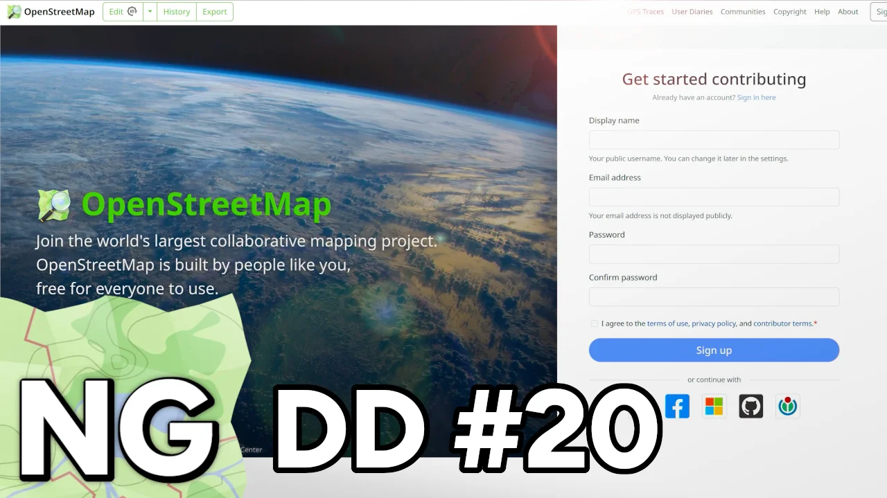
It’s time for yet another OpenStreetMap-NG development update! This week we’re excited to present completely redesigned authorization interfaces and new account connectivity features.

🔖 You can read other development diaries here:
osm.org/user/NorthCrab/diary/

⭐ This project is open-source — join us today:
https://github.com/openstreetmap-ng/openstreetmap-ng

🛈 This initiative is not affiliated with the OpenStreetMap Foundation.


📹 Video Summary

In this week’s video, I demonstrate the redesigned sign-in experience, showcase our reinvented sign-up page, and explore the connected accounts feature. As always, the recording includes chapter markers for easy navigation.

⬇ Click below to play ⬇

Video thumbnail

or click here: https://peertube.monicz.dev/w/fcKQXyH87zeKPWvscBeBq7


New Sign-in Experience

See full entry