OpenStreetMap logo OpenStreetMap

Diary Entries in English

Recent diary entries

Posted by TrickyFoxy on 31 January 2025 in English. Last updated on 2 February 2025.

Today I will talk about the new version 0.8 of userscript that adds several useful features to osm.org.

You can view existing features of the script and install it on GitHub or in the OSM Wiki

⚡️ Faster rendering

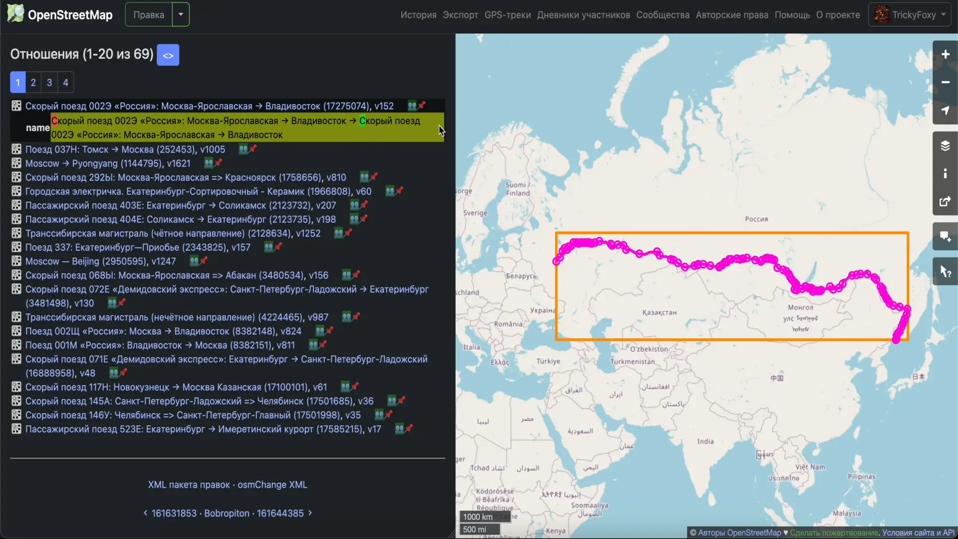
My first PR was merged to openstreetmap-website code, and now the Map Data layer loads instantly. Be sure to try it. Thanks to the maintainers for help!

For the script, this means a huge acceleration in rendering large relations and GPS tracks (yes, tracks, read more!):

icon 👥 near relations is clickable 😉

📸 Photos from Panoramax, StreetComplete, Wikipedia Commons

Now they are displayed directly on the website. In notes, in tag history, and in changesets.

See full entry

Posted by Dzertanoj on 28 January 2025 in English.

After reading this article How to transform data from NAD83 to WGS84 and based on my personal experience (taking RTK GNSS measurements with multi-frequency multi-constellation receiver hooked up to ORGN NTRIP caster referenced to NAD83(2011) epoch 2010.00), I want to share some notes.

The article suggests QGIS as a tool just to proceed with warning potential users how it could easily go wrong with no warnings. However, it doesn’t provide any methods to verify the results or the method itself except for trusting the process. Since my first attempts (independent from the content of the article) to transform my observations have failed, I was looking for the verification method and found some.

First of all, as far as I understand QGIS uses GDAL/ORG and PROJ. This toolchain has a very useful command projinfo for testing the transformation. You’d need to understand WKT output that it will spit out, but you can much easier spot the situation when it’s going to use a ballpark low-precision transformation.

For instance, this query:

projinfo -s EPSG:6319 -t EPSG:7665

among many other things spits out this string:

Conversion from NAD83(2011) (geog3D) to NAD83(2011) (geocentric) + Inverse of ITRF2008 to NAD83(2011) (1) + Inverse of WGS 84 (G1762) to ITRF2008 (1) + Conversion from WGS 84 (G1762) (geocentric) to WGS 84 (G1762) (geog3D)

It explains in fairly good detail what it’s going to do and has some useful keywords such as geog3D which means that it expects input and provides output in degrees of latitude/longitude as well as ellipsoidal height, see EPSG:6319 for details. It also mentions 0.01 m at the beginning and in the context of OPERATIONACCURACY[0.01] which is pretty self-explanatory.

Then, you can actually attempt transforming an individual set of coordinates using cs2cs. The easiest way is to throw them into its input stream like this using echo:

See full entry

Location: Caufield, Oregon City, Clackamas County, Oregon, United States

Cycling is not one thing

To most people cycling is just something people do as exercise and if you’ve seen one bike you’ve seen them all. To someone that has become deeply embedded into the cycling community at a national level as my hometown area has become a cycling hub for every variety of biking there is my view of biking has become quite diverse and how I’ve approached mapping cycling has matured and grown. I think a lot of people within the OSM community look at osm.wiki/Bicycle and scroll through pages and think, man it looks like you’ve got is all covered. However, I see this page I almost entirely see one type of cycling covered: Urban/Suburban Commuting.

So maybe a good place to start is to cover the variety of types of cycling that exist and how they are distinct and how they are also tangibly intertwined.

Even in listing these I tried to stop and logically break things in to categories like on-road, off-road, and closed circuit or hard-surface vs. soft surface of even high speed (sport) vs. low speed (recreation/commuting) but even here these starts to bleed together. For instance MTB racing has started to include gravel runs, so has cross country (XC), so has the Tour de France which is decidedly road.

Thus in no particular order here are some of the larger categories of biking and at a high level difference in how they function as it relates to biking.

Road Biking

Think tradition asphalt, curved handle bars, Lycra , fully human powered, and fast. From a mapping perspective this requires a lot of similar things to road mapping like speed limits but there is a particular interest in if roads have shoulders or if it’s an established mountain road that people train then there can be little difference.

Mountain Biking (MTB)

See full entry

Location: Bella Vista, Benton County, Arkansas, 72715, United States

The twenty-third development diary brings substantial architectural changes to OpenStreetMap-NG, marking a pivotal moment in the project’s evolution. This update introduces MapLibre GL JS as our new mapping engine, comprehensive dark theme support, and various quality-of-life improvements that enhance both user experience and technical capabilities.

🔖 You can read other development diaries here:
osm.org/user/NorthCrab/diary/

⭐ This project is open-source — join us today:
https://github.com/openstreetmap-ng/openstreetmap-ng

GitHub Stars

🛈 This initiative is not affiliated with the OpenStreetMap Foundation.


Video Summary

Feel invited to watch this video summary that demonstrates improvements in action. The showcase provides a look at the new MapLibre GL JS integration, dark theme functionality, and various interface refinements that enhance the OpenStreetMap-NG experience.

⬇ Click the image below to play

See full entry

Posted by Negreheb on 27 January 2025 in English. Last updated on 2 February 2025.

Hello OSM Community,

I’m still working on capturing 360° images of the city of Salzburg for Mapillary and Panoramax. My goal is to enhance OSM data in Salzburg, especially in areas with notes that could be resolved with better visual context - something 360° images can provide.

Progress as of now

Salzburg

Route Planning Challenges

So, i tried some tools to plan a route efficiently to cover as many streets as possible without overlapping - essentially the Chinese Postman Problem.

  • Bikerouter: manual tedious labour involved to cover every street
  • everystreet challenge: no GPX download, so useless. No developtment.
  • RunEveryStreet: More automated approach, but key features missing and some bugs, and I didn’t get a response to my suggestions unfortunately.

Unfortunately, none of these tools fully met my needs, so i did it more practical.

The Solution I’m Using

See full entry

به مدت ۲۵ سال در مدارس مختلف استان البرز، خاصه در منطقه ساوجبلاغ با سمت مدیر فعالیت داشتم، باتوجه به حفظ ارتباطات عاطفی خودم در طول سالهای عمر، مخصوصا بعد از بازنشستگی، از ظرفیت بکار گیری و همراهی عده ی زیادی از شاگردانم در امور اطلاع رسانی، نقشه خوانی و نقشه برداری، جمع اوری اطلاعات دقیق اماری مخصوصا ازنقاط محروم و کمتر رشد یافته را دارم

Location: shahin vila, District 6, Karaj, Karaj Central District, Karaj County, Alborz Province, Iran
Posted by Tex2002ans on 22 January 2025 in English. Last updated on 23 January 2025.

In the upper-right corner of the main screen, you’ll see 3 buttons:

  • Upload
    • Looks like an “up arrow”.
  • Layers
    • This is the one we want!
  • Settings
    • Looks like “3 horizontal lines”.

(Note: This tutorial was created using StreetComplete v60.1 on Android.)

Tutorial: Adding Fire Hydrants

SEE IMAGE

1. Click on the “Layers” button.

2. Choose “Things”.

  • The icon will now turn into a green-and-white bullseye-looking symbol.
    • (You can now see objects like benches / fire hydrants on the map.)

See full entry

Posted by b-unicycling on 20 January 2025 in English. Last updated on 31 January 2025.

Street-level imagery

Since last Thursday, I’m touring the Netherlands with the band I’m in. I brought the GoPro Max sponsored by Meta, because I thought it would be a great opportunity to get lots of footage for Panoramax which has little coverage in the Netherlands so far. We’re staying in the same place all the time, near Epe in Gelderland and fan out for the gigs almost all over the Netherlands. We’ll be playing until the 31st of January.

Screenshot from Panoramax showing the progress on 2025-01-31

Unfortunately, it’s been very foggy since we arrived, so the imagery is not the best. It is also very cold, and the third trip (to Zutphen, if I remember correctly), the metal on the holder hinge shrunk and the camera tilted back, so that footage was fairly useless.

I upload the images to mapillary first, after all, they sponsored the camera, so it takes a while to get them onto Panoramax, and the internet at the accommodation doesn’t seem as quick as what I’m used to.

See full entry

Location: Zuuk, Epe, Gelderland, Netherlands, 8161 RE, Netherlands
Posted by InfosReseaux on 19 January 2025 in English. Last updated on 27 January 2025.

OpenStreetMap is now 20 years old. Its community is contributing to complete a geographical database which fuel many activities, for instance useful for energy transition and power grids asset management. The increasing impacts of extreme weather phenomenons like storms or wild fires disrupt power grids and expose them to wider outages. Operators have to reinforce and adapt their assets for those upcoming challenges.

Overhead power grids asset management had suffered from disinterest since early 1990s for instance in France. It remains at least a significant challenge in developed countries. Important decisions that had been made to bury them and more generally because they are “highly visible infrastructure” don’t bring value to accurate knowledge about existing infrastructures. Nevertheless, several decades are required to completely hide a very capillary distribution grid. So we need to better describe them for sake of maintaining remaining overhead power grids, particularly ones that couldn’t be buried. In particular, very high voltage transmission lines will remain mainly overhead.

Producing and maintaining knowledge about utility networks assets is tedious and expensive without appropriate tools. I already had opportunity to explain how the “OpenStreetMap way” is helping for power transmission grid knowledge, back in 2020. Operators now face other challenges and are busy with bigger investments for transitions. Yet lesser time left for knowledge management as projects pace accelerate. Power grids inventory started early after OpenStreetMap birth in 2004. It began with most visible transmission grids. Tagging improvements are continuously made since 2010 and 15 years later we reach another step with a deeper experience in such activities.

See full entry

Posted by mapmeld on 15 January 2025 in English.

For years, an issue with Kurdish language, Arabic script, and OpenStreetMap tiles has been on my radar. In 2023 I got OSM to update Noto fonts on the tile server, but Google has moved their latest changes to individual repos.

I’m continuing to workshop a PR for that.. but in the meantime, I thought to check if OSM needs more of the language-specific Noto fonts. Back in spring 2019 I did a mini survey of where Unicode blocks were used around the OSM world.

Today I added Python scripts to check Planet PBF files (specifically name and alt_name tags on nodes) and find usage across Unicode blocks.

There are names with Latin alphabet and frequently associated characters (superscripts and subscripts, dingbats, diacritics, IPA, half-width, old italic, runic, spacing modifiers, punctuation, emoticons/emoji, and symbols from math, music, currency, and maps).

  • Africa has: TIFINAGH, ARABIC (supplements and presentation forms), CYRILLIC, ETHIOPIC, NKO, HEBREW, CJK, HANGUL, and GREEK.

  • Asia has: CYRILLIC, GREEK, HEBREW, ARABIC, SYRIAC, COPTIC, ETHIOPIC, BALINESE, JAVANESE, CJK + YI + BOPOMOFO + KANGXI, HANGUL, MONGOLIAN, TIBETAN, THAI, MYANMAR, LAO, KHMER, ARMENIAN, GEORGIAN, THAANA, SINHALA, TAMIL, ORIYA, BENGALI, GURMUKHI, GUJARATI, DEVANAGARI, KANNADA, MALAYALAM, OL_CHIKI, and TELUGU.

For the Americas, OSM already includes fonts for Cherokee and Canadian Aboriginal Symbols.
Those two scripts and OGHAM, TAGBANWA, and BAMUM were misused in Asia. The instance of TAGALOG script was a little uncertain. I removed an Apple logo because it’s from the Private Use Area.

The current font download script is pretty good, and includes additional fonts (Adlam and Tai Viet) which aren’t actively used.

See full entry

Location: Zarok, Baška, Općina Baška, Primorje-Gorski Kotar County, 51523, Croatia
Posted by GerardSharp on 15 January 2025 in English.

so the beach town is seeing growth again, after the primary developers went bust in 2007/8. A large amount of blank land between the shops and the harbour has been cleared, and given asphalt roads, concrete footpaths, and brackish ponds for the mosquitoes to grow in! I hope the new holiday home owners like mosquitoes!

My GPS accuracy is not great and my note taking while walking is worse; but I’ve drawn some new ways on the new footpaths; and verified some of the existing paths from Kenwood Drive to Waimarie Ave are still approximately where my GPS says they are. Good fun.

Need to go back with a laptop next summer to add/tweak more. Hopefully LINZ has updated by then to provide even better coverage

Location: Winton Beaches, Matarangi, Thames-Coromandel District, Waikato, 3592, New Zealand

The State of the Map Asia 2024 conference wasn’t held in a main travelers’ hub like Thailand but rather chose a much, not that well-known country Bangladesh, and its previously unsettled political situation, which ended with the Prime Minster fleeing to India. Summarizing all these factors might discourage most people from visiting this country, ended up most of the attendees are domestic, and plus someone like me who is a foreigner is lucky enough to obtain a VISA to pay a visit.

Bangladesh is a young country, during the conference we saw many attendees were students, who might help those international aid projects to gather map data. We can see teachers bring their students to attend the conference. And there are also various student clubs, like all Youthmappers in Bangladesh, publishing their project results. One day we might see when the country is prosperous, and students grown up, there is a chance that they will map shops and buildings in the city where they live.

I want to write something about the general participant situation here in the Asia Pacific area. In developed countries like Taiwan, there are individuals who launch interest groups to map specific map features or netizens with enough motive to contribute to OpenStreetMap project. There are other countries that rely on aid projects to map local map data, and sometimes there are sone who will map modern map features. I have heard a talk about solar pannels in Dahka.

The State of the Map Asia splits its session into quite strange 10-minute parts. I accidentally submitted two talks, and did not get rejected. I had to give a talk on the first and second day, one I introduced the community in Taiwan, and the other day I introduced some interesting projects hosted by individual mappers.

See full entry

Location: Hotel Motel Zone, Cox's Bazar, Cox's Bazar District, Chittagong Division, 4700, Bangladesh
Posted by spwoodcock on 14 January 2025 in English. Last updated on 15 January 2025.

See pt1 of this series here.

See pt2 of this series here.

See pt3 of this series here.

How Does This Relate To OSM Again?

If you have been following the articles listed above, you will know the Field Mapping Tasking Manager (FMTM) is a tool developed by HOTOSM to improve the quality of field verified data associated with geometries.

In the OSM world, this means adding and improving tags for OSM geometries.

A key element of this work flow is conflation of newly collected data with existing data in OSM. Some preliminary work was done on this, but for now the team decided to pivot and focus entirely on improving the usability of FMTM from the perspective of mappers.

The conflation work will be continued further down the line.

Currently, Rob Savoye is also continuing some work in parallel for conflation of roads in the USA, with OSMUS’s osm-merge project.

The roadmap for FMTM can be found here.

Easier Field Mapping

Since release 2024.5.0, we have be focusing on what we have dubbed the ‘Mapper Frontend’.

Our primary goals:

  • Mapping should be as intuitive as possible for users, requiring minimal training or existing knowledge (with prompts).

  • The application should be fast and responsive, tailored to field mapping needs.

  • Data should load real-time, significantly improving the collaborative team experience. Joe wants to know where Jim is mapping currently, to avoid overlap.

  • A secondary goal is the potential to package it up in a mobile app wrapper, allowing for easy distribution via mobile app stores.

See full entry

Location: Ely, East Cambridgeshire, Cambridgeshire, Cambridgeshire and Peterborough, England, United Kingdom