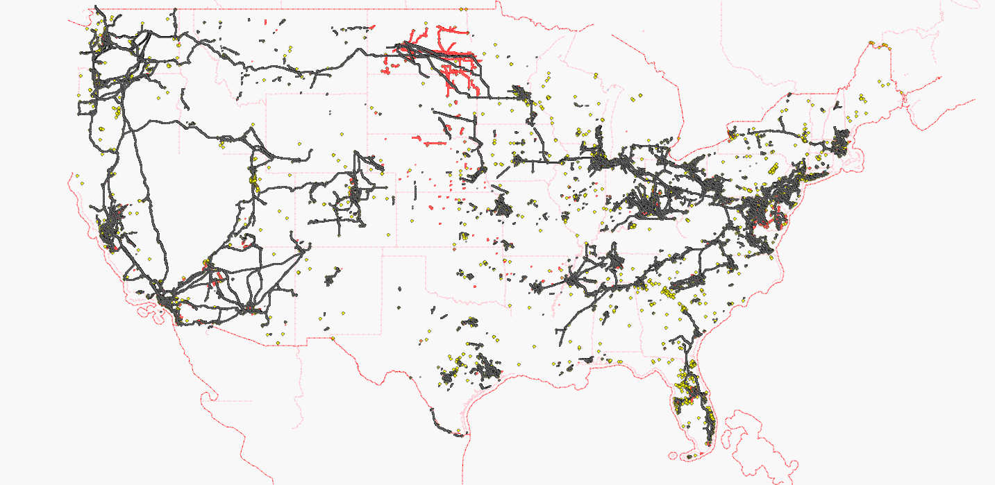
The coast-to-coast powerline across the United States is now complete. Thanks to the mappers who contributed their part of the transcontinental line (AndrewBuck, asciiphil, bruck4, choess, Chris Bell in California, Gone a.k.a. Nakor, iandees, lyx, mario824, Minh Nguyen, neuhausr, OSchlüter, stucki1, Tronikon, Vid the Kid, Your Village Maps, zephyr)!

Each black dot represents a pylon, each red dot represents a pole, each yellow dot represents a substation.
White areas are still looking for active mappers, of course. The Gulf Coast is the next destination that needs a coast-to-coast connection.
Maps have been updated on:
osm.wiki/WikiProject_Power_networks/United_States
ITO Map shows power lines with voltage tags:
http://www.itoworld.com/product/data/ito_map/main?view=4&lat=39.21897960807571&lon=-96.86002037316652&zoom=5
토론
2011년 11월 27일 12:52에 42429님의 의견
A map should be visible when the wiki works again!
2011년 11월 30일 15:27에 marscot님의 의견
great work