
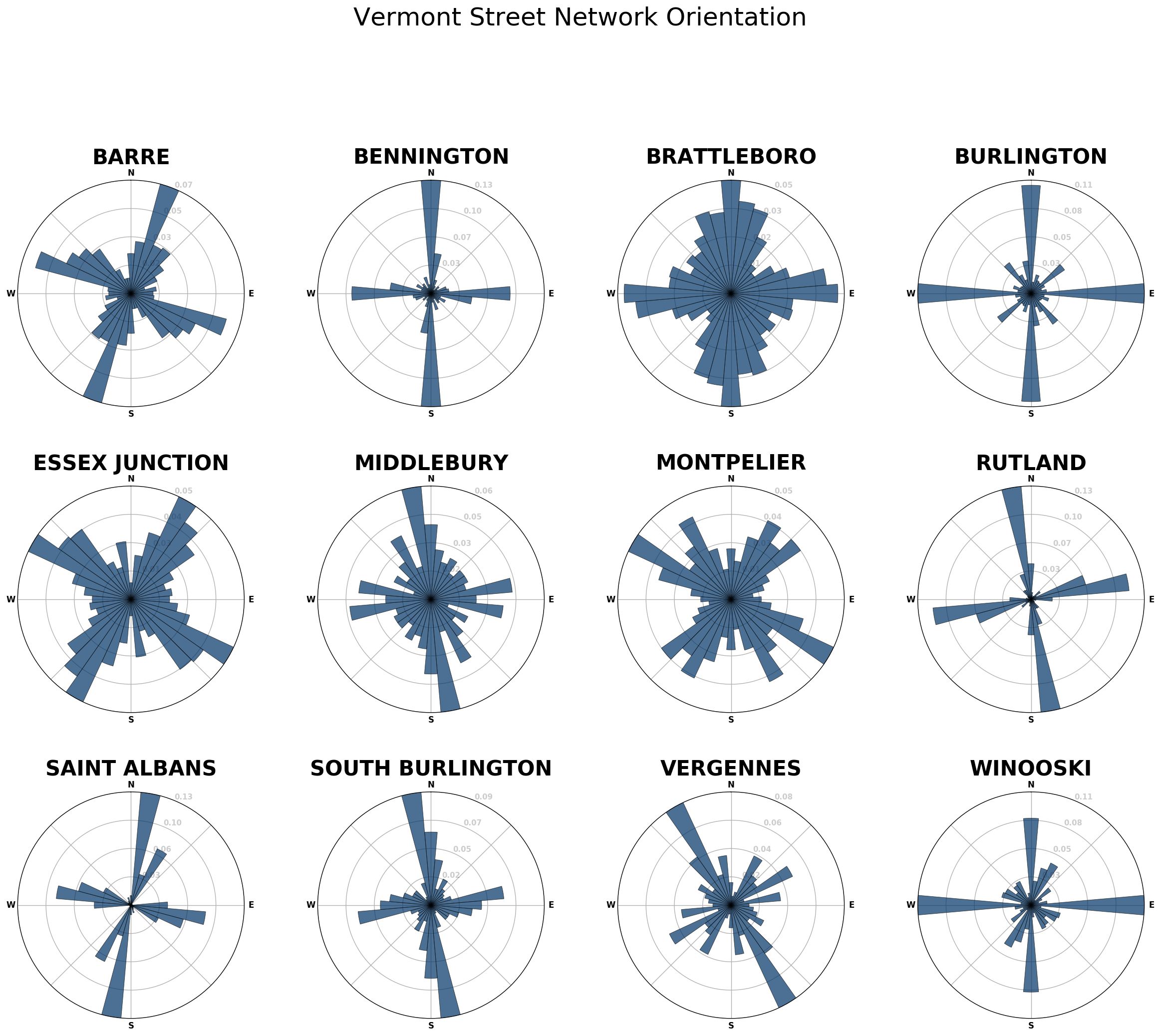
By now many folks have seen Geoff Boeing’s really neat charts of street orientation that highlight how “gridded” (or not) the layout of city streets are:
Since Geoff was kind enough to provide a full open-source tool-chain, I decided to tweak it to chart the orientations of the streets of some cities and villages in my home state of Vermont:
Unfortunately, until I get around to importing Vermont town boundaries, not all towns will be super easy to include in this analysis.
Thảo luận