
Adam Franco
- 가입일:
- 2008년 02월 18일
- 마지막 지도 편집:
- 2025년 09월 04일
Adam Franco is an active hobbyist mapper from Vermont, USA who enjoys mapping our highways and byways. Adam served on the board of the OSM-US foundation for two years in 2022-2023.
A software developer since 2002, Adam primarily focuses on web applications written in PHP, Javascript, and Python while also writing a smattering of software in other environments and languages. In the geography space, Adam is the author of the Curvature program, which analyzes the geometry of highways in the OpenStreetMap dataset to detect curves and ranks each segment based on how many curves there are.
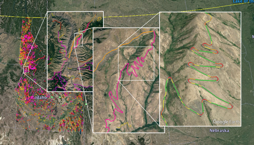 The highways are then filtered to include only the most twisty segments in the output. Additional filtering is done to exclude segments marked with surface tags that indicate that they are unpaved. The resulting highways are viewable in an in-browser map or color-coded KML/KMZ files that can be opened in GoogleEarth or other programs for viewing.
Initially getting into OpenStreetMap by adding road surface tags so that Curvature can better filter out dirt roads, Adam has gotten totally hooked and now finds himself improving the map in many ways, from adding trails and land-cover, tweaking road alignments, and more. :-)
When not creating virtual systems, Adam enjoys designing and creating things in the physical world — from wood furniture to photography. When his mind tires of the creative process, Adam focuses his energies on Aikido, dancing, cycling, motorcycling, skiing, and other out-of-door pursuits.
Related OSM Accounts
- My OSM Contributions: https://hdyc.neis-one.org/?Adam%20Franco
- OSM Wiki: osm.wiki/User:Adamfranco
- OSM Community: https://community.openstreetmap.org/u/adam_franco
- Github: https://github.com/adamfranco
- Adam Franco-import - my import account for the Vermont E911 address import and future import projects.
최근 일기
Announcing a new map for Curvature
I’m happy to announce the launch of a new in-browser Curvature map with worldwide coverage. Now you can browse the map without any need to download...
Video: Debugging multipolygons in JOSM
https://youtu.be/87nRQHuatOE A short tutorial of identifying and fixing errors in multipolygons when editing Open Street Map in the JOSM editor. ...
Video: Mapping OSM landcover multipolygons with JOSM
https://youtu.be/x7SPb0JtheA This is a brief overview of how I edit Open Street Map (OSM) to add adjoining land-cover areas as multipolygons with ...
Street orientations in Vermont
By now many folks have seen Geoff Boeing’s really neat charts of street orientation that highlight how “gridded” (or not) the layout of city street...