
Tracing guide for Aweil, South Sudan
AtomicBohm님이 English로 2016년 12월 13일에 게시함. 최근 2017년 2월 7일에 업데이트됨.This is a tracing guide for people mapping Aweil in South Sudan for MSF with Missing maps (see tasks here). Aweil is the capital city of the state of Northern Bahr el Ghazal. The city’s infrastructure is relatively developed. Aweil now has a functioning railway station, hotel, airport, soccer stadium, and public hospital. [1]
As we are mapping the suburbs of Aweil, you will see rather sparse settlement. Here are some photos of the structures that are visible on the satellite imagery. Very detailed information on what MSF is doing in this area, along with many useful photos (some published in this tracing guide) can be found here: One Day in Aweil: An MSF Team Portrait
Residential areas
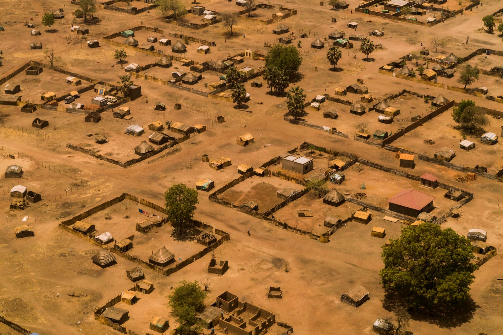
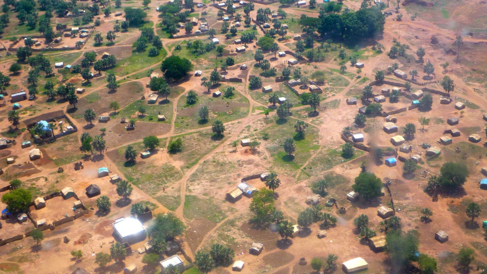
Residential area is an area with more than two buildings. Whenever you draw one or two buildings, do not draw residential area around it. Sometimes, it makes sense to draw one huge residential area instead plenty of small ones. Please, do zoom out and consider the right size of the residential area you are mapping. Here is an example of an area, where drawing one bigger residential area is a better decision. However, it is sometimes difficult to apply a global rule and you need to use your own judgement and expereince. If you are not sure, leave a comment with a link to your task in the comments and let me help you.
 (If you do not see the image, see it here)
Buildings
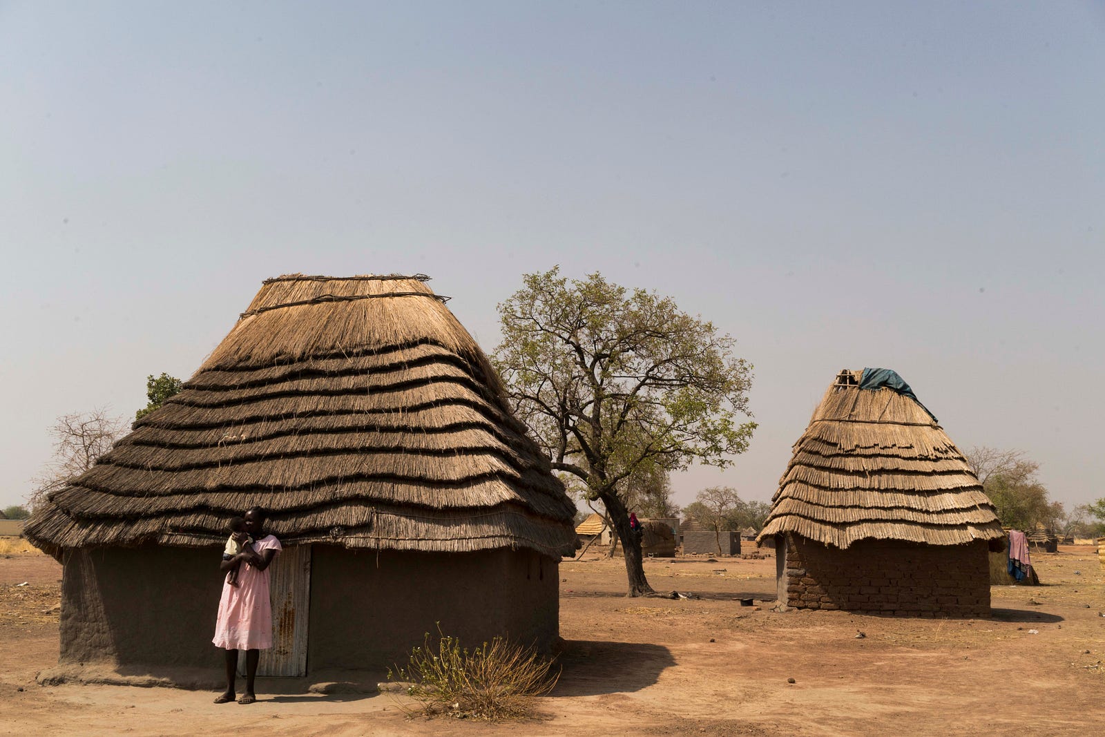
## The houses you are looking for look like this from the ground ![Aweil huts -areial image] (https://upload.wikimedia.org/wikipedia/commons/d/de/Sudan_Aweil_huts_2006.jpg) [2]
Another photo of Aweil from above
 [3]
[3]
And the last one
 [4]
[4]
Buldings
Houses in this area are usually either traditional African tukuls - round (or square) structures with thatch roof or more solid square buildings with roof from metal.
Tukuls
 [3]
[3]
Other buildings
 [3]
[3]
How does it look like in the aerial images?
See the huge square building on west of the residential area, and few tukuls (rounded or semi-rounded). South from a tukul in the north-east part of the area, there is a yard - you can see, that unlike buildings, the yard not drop a shadow. As the task is to map residential areas and buildings, there is no need to map the yard. ![Tukuls and other buildings] (https://cloud.msf.org/index.php/apps/files_sharing/ajax/publicpreview.php?x=1920&y=950&a=true&file=aweil_ideditor_tukul_squarebuilding2.png&t=ENTCN8KPn9shuu9&scalingup=0)
If you need any help, feel free to leave a comment here and post a screenshot of the area that you are mapping.
[1] https://en.wikipedia.org/wiki/Aweil,_South_Sudan
[2] https://upload.wikimedia.org/wikipedia/commons/d/de/Sudan_Aweil_huts_2006.jpg
[3] https://medium.com/msf-alert/one-day-in-aweil-an-msf-team-portrait-bb0fa1f95755#.q67969co7
[4] http://aweebitmore.blogspot.cz/2013/06/aweil-south-sudan.html
토론
2016년 12월 14일 12:44에 mustafakamil님의 의견
قطار اويل المسافة طويل
2016년 12월 14일 12:44에 mustafakamil님의 의견
old sudan
2016년 12월 18일 13:50에 Harry Wood Imports님의 의견
Those “Tukuls” are amazing. Wish my roof looked like that! …well it might look at bit out of place in London :-)
2017년 1월 15일 10:34에 Nielkrokodil님의 의견
Hi!
I’m not sure what to do with roads. Are they being mapped in part 3? I mapped some major roads (highway=unclassified), other mappers mapped some highway=track. As roads are not mentioned in the task I stopped mapping them to be faster with the buildings and residential areas.
ps: Congratulations to your tracing guide. It realy helped me a lot!
2017년 1월 15일 18:59에 AtomicBohm님의 의견
@Nielkrokodil Hi, the concept is same as in other Missing maps tasks: the most important is to map what the task is asking for (residential areas & building in this case), because that is what we need first of all. A wonderful thing about editing OSM is that the map can be used in many different ways by anyone, who needs it. So there can be someone, who would appreciate roads being mapped in the future. So technically, it is not wrong to map roads. But as we are under time pressure, please focus on buildings first, there are still a lot of unmapped squares in the priority area. Happy that the tracing guide helped. Jan
2017년 1월 17일 00:22에 ErickF님의 의견
Hi Jan,
The HOT Task Manager page (http://tasks.hotosm.org/project/2398) says to outline Residential Areas only where there are more than two buildings, but I see some parts of the completed map have Residential Areas outlined around 1 or 2 buildings. Can you maybe add a comment to this page clarifying that 1 or 2 buildings together should not have a Residential Area drawn around them? Just trying to be consistent with the Task page. Thank you!
Erick
2017년 1월 17일 14:29에 AtomicBohm님의 의견
@ErickF Hi Erick, thanks for the good point. I have updated the tracing guide by adding a paragraph about residential areas:
Residential area is an area with more than two buildings. Whenever you draw one or two buildings, do not draw residential area around it. Sometimes, it makes sense to draw one huge residential area instead plenty of small ones. Please, do zoom out and consider the right size of the residential area you are mapping. Here is an example of an area, where drawing one bigger residential area is a better decision.
2017년 1월 17일 22:12에 roosjes님의 의견
Hi Jan, thanks for clarifying that, but could you also maybe add a picture of how it could/ should be done? this combo still leaves some room for misunderstanding
and it will save people a lot of time ;)
2017년 1월 23일 04:15에 SamSunnyCT님의 의견
Like Erick I believe I need the same clarification. Are we meant to map the buildings within the residential areas that we are identifying, or only the residential areas (plus single buildings in groups of two or less)? Thank you.
2017년 1월 23일 11:07에 AtomicBohm님의 의견
@SamSunnyCT @roosjes: Send me the link to a task, where you are not sure.
And you are supposed to map buildings as well as residential areas, i. e. areas inside that are buildings.
2017년 1월 23일 11:21에 SamSunnyCT님의 의견
Thank you for the clarification @JanBohmMSF. In hindsight I’m not sure why that was unclear to me. It was my first OSM mapping session and I was figuring it out. I believe that I have corrected all my work and look forward to contributing more and hope to be doing it accurately. I hope that it is helpful.
2017년 1월 23일 11:31에 AtomicBohm님의 의견
@SamSunnyCT happy to help you. And thanks for your effort. Our teams in South Sudan are looking forward to work with the maps, so your help is really appreciated.
2017년 2월 7일 19:23에 AmitaJacob님의 의견
hi i have just started to map the tukuls do i need to map them as points or if i see two or more map them as smaller areas instead ?
2017년 2월 7일 20:15에 Thomas Starnes님의 의견
Automate residential area boundaries?
Would it not make sense to first digitise all of the buildings, and then apply a convex hull algorithm i.e. ‘join the dots with a 100 metre buffer’? This would reduce the work load and ensure a more consistent approach to mapping residential areas.
2017년 2월 8일 08:25에 AtomicBohm님의 의견
@AmitaJacob: Please, map the tukuls as areas, not points. Tukuls (as well as any other buildings) are supposed to be mapped as area and categorized as building.
2017년 2월 19일 00:31에 SoleneV님의 의견
Hi, there seems to be two contradictory instructions regarding mapping the residential areas: - on the instruction page we are asked to map the whole compound, paying attention to fences. (“Please outline residential areas (more than two buildings / structures) and tag as landuse=residential (in JOSM) or Landuse Features=Residential Areas (in iD). Try to trace around all of the compounds, not just the houses; the compounds often extend well past the inner circle of houses but are definitely part of the village. You should be able to see compounds as they usually have a fence around them.”) - in the posts above, drawings show residential areas outlines kept quite close to groups of buildings, not to the fence lines at all which, in rural areas, can be quite distant. Mappers have been using both methods… Could you clarify? Thank you.
2017년 2월 22일 19:04에 AwoowoArne님의 의견
Hello, I got the same question as SoleneV. When I started mapping some weeks ago I was very cautious and drew small residential areas. But watching the work of others I decided for myself to draw the compounds bigger and more following the fences and natural borders. For me that looks much closer to reality and till further notice I will trace ‘big’ compounds. Best Arne
2017년 2월 26일 15:34에 Gregor_D님의 의견
Hello, I was wondering if corrals are also to be mapped. Around some tukuls it looks like if there were corrals for cattle. Are they to be mapped as buildings or to be omited? Best
2017년 2월 27일 08:48에 AtomicBohm님의 의견
@Gregor_D Hi Gregor, there is no need to map corrals, so you can ignore them. Thanks for you effort!