
ALOS Global Digital Surface Model "ALOS World 3D - 30m" (AW3D30)
โพสต์โดย BushmanK เมื่อ 17 มิถุนายน 2016 ในภาษา EnglishSince I didn’t find any references to AW3D30 digital surface model in OSM Wiki, I decided to create a new page for it.
Briefly speaking, since JAXA license requires attribution for derivative products, it doesn’t seem like it’s possible to use these data to update OSM database, but it’s still possible to mix AW3D30 data with OSM data in third-party products.
Visual comparison between SRTM 1-arcsecond (source: NASA), upper half, and AW3D30 (source: JAXA), lower half:
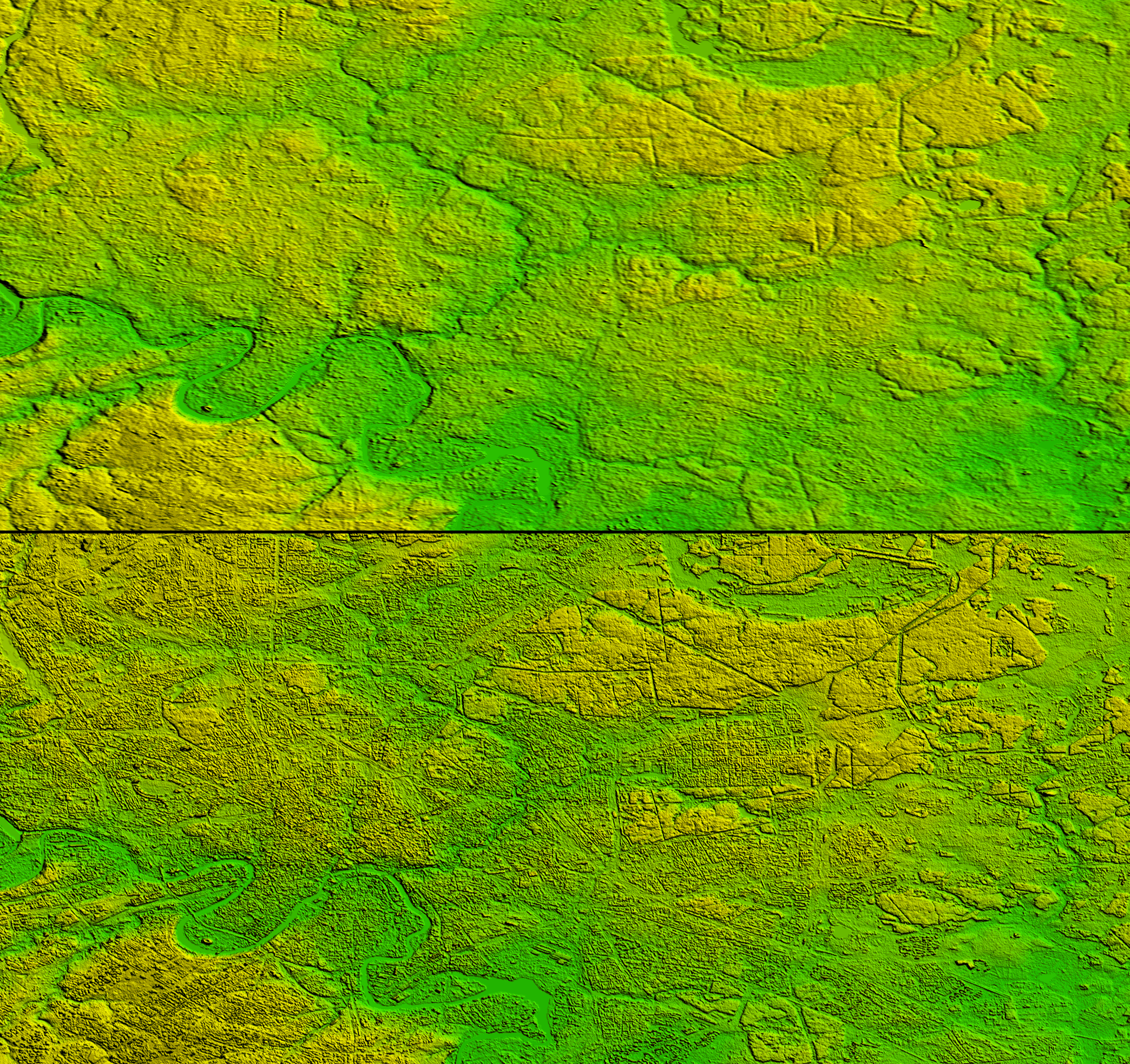 (Click on image for full resolution)
การอภิปราย
ความคิดเห็นจาก d1g เมื่อ 17 ธันวาคม 2016 เมื่อเวลา 22:20 น.
Christoph Hormann then published his review of AW3D30 in August:
http://www.imagico.de/map/reviews_en.php
ความคิดเห็นจาก BushmanK เมื่อ 17 ธันวาคม 2016 เมื่อเวลา 23:25 น.
@d1g, please, don’t be like @Zverik - I’ve added a link to this review to the Wiki page back in the end of September.
ความคิดเห็นจาก d1g เมื่อ 17 ธันวาคม 2016 เมื่อเวลา 23:42 น.
True, thanks for other references as well.