
A few years back, I successfully led a crowdfunding effort to raise £975 to purchase scans of the 1970s / 1980s 1:50k topographic map series of South West Africa / Namibia from a commercial map archive. It was a great success and I put them online: https://namibia-topo.openstreetmap.org.za/
Recently I have been speaking to the archive again about purchasing similar map series for other African countries. The map series vary per country from the 1960s to 1990s. Many were created with support from the United Kingdom’s former Directorate of Overseas Surveys (DOS).
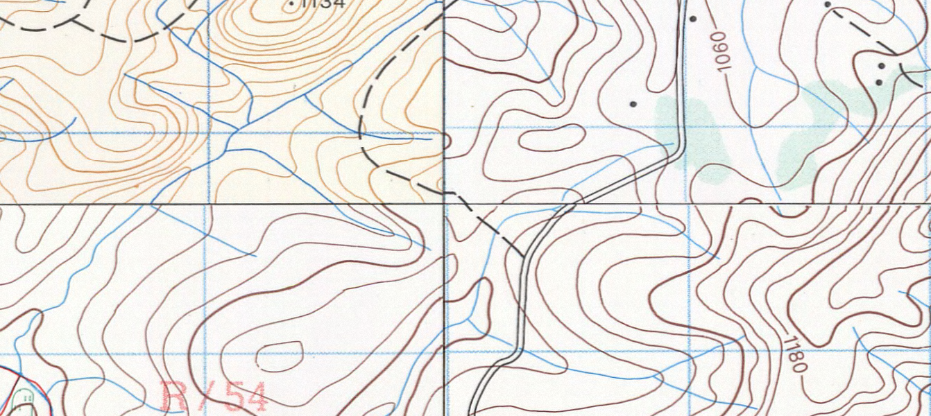
The 1991 1:50k Topographic series of Swaziland (now Eswatini) published by the Swaziland’s Surveyor General is available. It is made up of 31 sheets in total. The scans are supplied clipped and unclipped. Total price is US$ 400 for the scans.
It would be fantastic to get these maps online. Would you be willing to support this purchase?
Link: Worldcat reference for the 1991 Swaziland map series.
Example of the join between 4 cropped sheets:
Diskuse
Komentář od fititnt z 3. 12. 2023 v 04:26
Bump! (there’s no like here, so I will leave a comment)
Perhaps this type of map may be unusual among mappers more accustomed to aerial images, but they are useful!!
Here in Brazil I often use the “Cartas Topográficas do Excército Brasileiro”. Although it is outdated (some parts as old as 30 years, not as easy keep updated, because it requires field survey), there is a lot that does not usually change (although it still needs to be reconfirmed with more sources, such as aerial image). Also, sometimes aerial image is not as evident what a feature is, but with these kind of maps, helps a lot.
So, yes, this kind of map, is useful!
Komentář od CjMalone z 11. 12. 2023 v 17:10
I’ll help fund it.
Komentář od Firefishy z 17. 12. 2023 v 15:06
I am waiting for final confirmation from the private archive before I sent up a funding website.
Once the British Library is up and running again I will renew my pass and look at their archive of the Directorate of Overseas Surveys (DOS) map sheets of Africa.
Komentář od Firefishy z 7. 06. 2024 v 13:07
I’ve had no luck purchasing the sheets. After good communication with the archive they went silent and appear to be ghosting me. :-(
Komentář od Firefishy z 2. 10. 2024 v 09:17
@rafnow87 Wow! Thank you.