
I’d like to start giving thanks to everyone who participated in our Mapathons, specially Qeef for developing the DAMN project and Karl Prieb for being that incredible person that keeps mapeia.space working!
Since the beginning of the year I wanted to map entire cities, starting researching fields, adding unclassified highways of my city and rural buildings, and, of course, I had plans, as some may know, to take this to another level but it turned out that the COVID-19 came. So I started to focus more on what I could do remotely and inf 4 months through our DAMN instance we managed to improve the map considerably, I wouldn’t say that it can be used for projects that need precision, besides the lack of data, satellite images are not the best way to map.
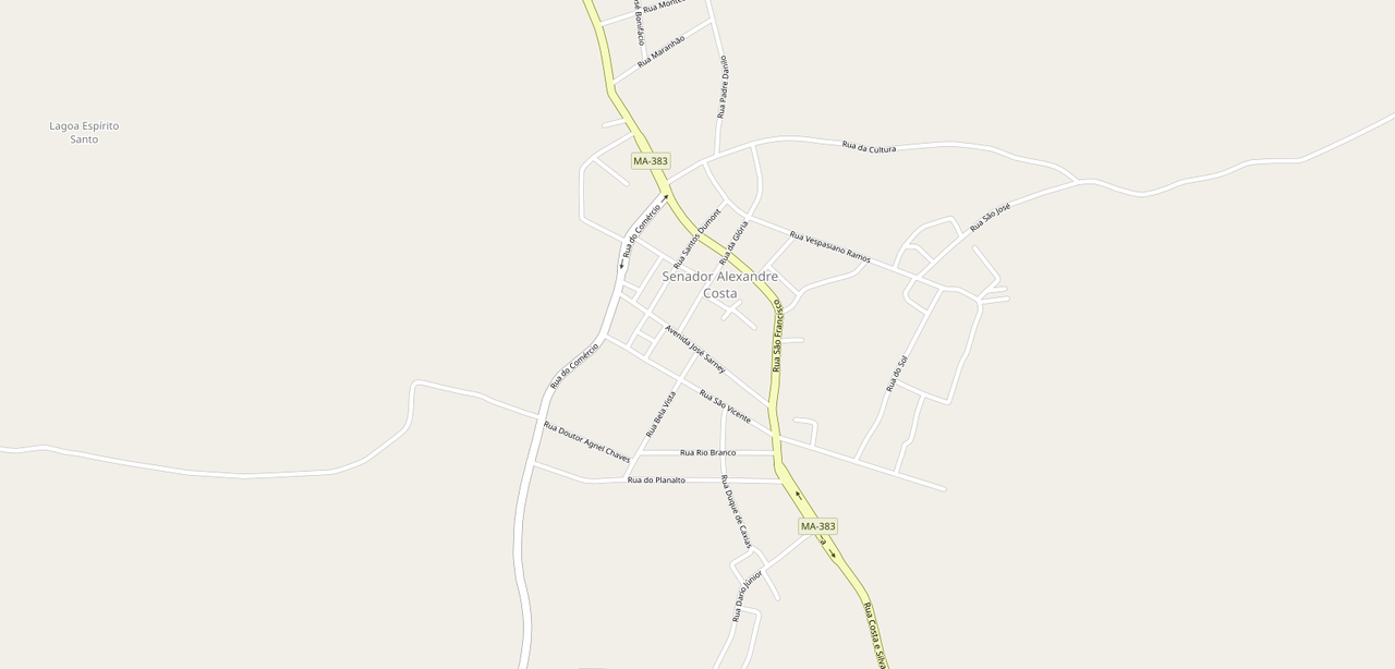
Before
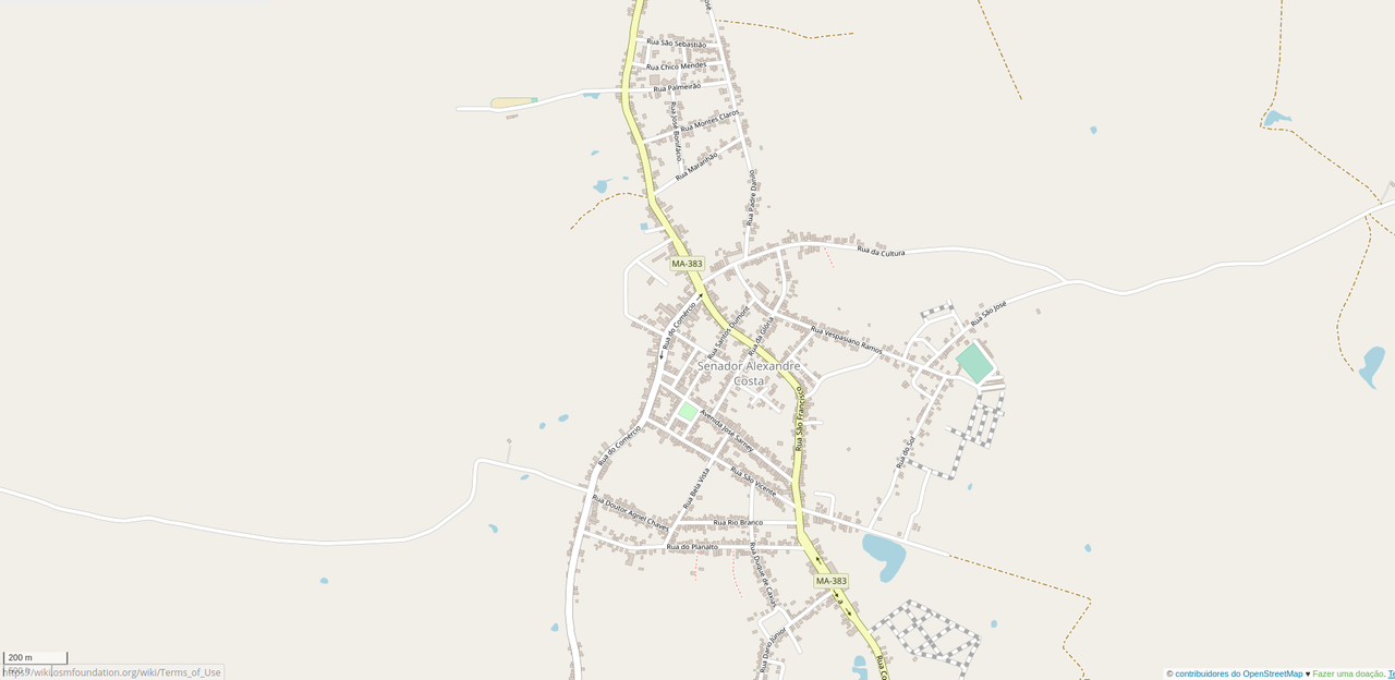
After
My goal in mapping these cities is to deliver a more humanitarian map of regions in my state that was forgotten or lacking data, mainly in rural areas, so with this data we can help generate vaccination campaigns, monitoring of families in need, rural settlements and much more…
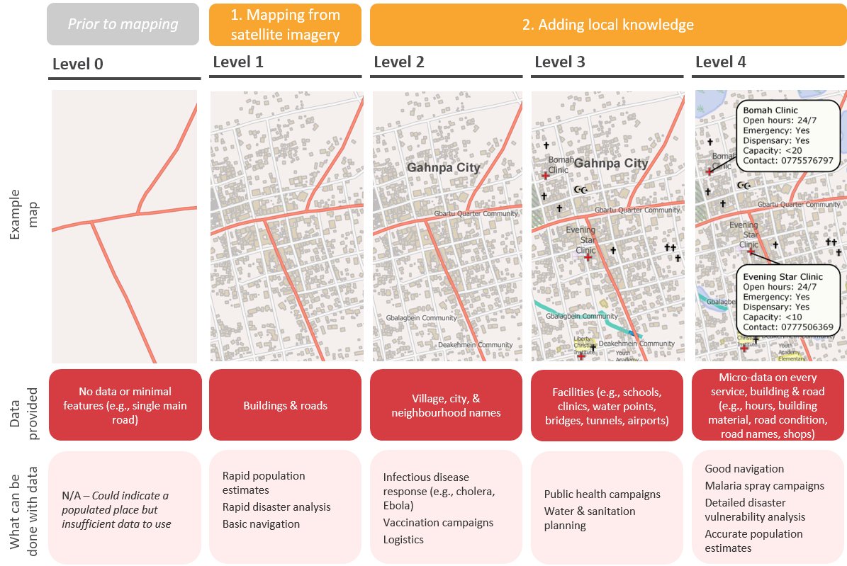 graphic source (https://twitter.com/rebeccafirthy/status/1202952838722342912?lang=en)
What to expect for 2021
In 2021 I intend to continue with my work through mapeia.space and expand my work by looking for the city halls and show OSM to them and maybe be able to do more field researches.
Working with City Halls
Many cities in Maranhão don’t have updated records or digital records about their city and OSM can be useful with that. In Brazil we already have several examples of cities that work with OSM, I intend to contact those already mapped cities and the ones that still need to be mapped and create a strong local community.
Mapathons
If you already follow me on Mastodon, you may have seen these mapathons invites that I did in the last months. In 2021 I intend to keep doing online mapathons, but as soon as possible I want to do a mapathon with the local community.
my Liberapay
讨论
SK53 于 2021年01月 3日 17:08 的评论
I really like the levels graphic: I’ve been toying with similar ideas for a range of different use-cases (logistics, hiking, solar power) & the graphic expresses this very powerfully.
Strubbl 于 2021年01月 3日 22:20 的评论
Wow, what a nice progress! Congratulations!
Gustavo22Soares 于 2021年01月 4日 20:59 的评论
@sk53 I ended up not putting the source of the graphic, I had saved but not the link together… sorry but I wanted to learn how to make these graphics to show some of my progress thanks for the comment
Gustavo22Soares 于 2021年01月 4日 21:00 的评论
@Strubbl thanks!!!
pedrito1414 于 2021年06月 8日 06:12 的评论
Hi, really nice post (I know I am late reading it!), thanks for sharing…
Be interested if you have links to examples of OSM use from any of the cities you mentioned…
By the way, I think the diagram came from Rebecca Firth originally… https://twitter.com/rebeccafirthy/status/1202952838722342912?lang=en
Gustavo22Soares 于 2021年06月 8日 22:13 的评论
@pedrito1414 Hi, I don’t think you are late, always good to be able to share knowledge…. Unfortunately I had difficulties in contacting the governments, as I am not able to go personally to each city and there are no organizations that use the OSM around here the data ends up staying in the OSM bubble. I am thinking about how I can break through this bubble and take OSM to more people in the mapped cities, if you have any suggestions I would be grateful!
Thanks, I didn’t know who had made the chart, it has helped me a lot and served as motivation sometimes.
Enora Lecuyer 于 2021年10月28日 20:56 的评论
Well done! That’s some amazing progress!