OpenStreetMap logo OpenStreetMap

Harry Wood's Diary

Recent diary entries

The first London winter pub meet-up is TONIGHT. We’ve rolled over into “winter pub meet-up” mode, since the clocks have changed and the evenings are properly dim and dismal now. So join us tonight for… no mapping just beers!

Three weeks ago we had a “Summer” mapping evening. I got off a crowded tube train at Old Street and found I’d lost my android phone. Either dropped or pick-pocketed. So as I went outside and tried to gather some map data in the gathering winter darkness and pouring rain, around the stark tower blocks streets of St Luke’s area, I gently sobbed to myself (*)

Imagine how my spirits were lifted as I arrived at the Wenlock Arms pub, to be greeted by a table full of OpenStreetMap friends, a wonderfully cosy atmosphere, a fine array of real ales, and a phone call to say “I’ve found your phone on the tube. D’you want to collect it tomorrow night?”

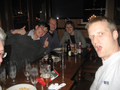
More OpenStreetMap friends arrived. We only had one little table but maybe 10-15 people! The Wenlock Arms is a small pub, but we were able to spread onto quite a few seats, plus a lot standing at bars etc, but still feeling like a nice cosy OpenStreetMap gathering. We also didn’t really fit into one photo. This was our best attempt:

See full entry

Location: De Beauvoir Town, Dalston, London Borough of Hackney, London, Greater London, England, N1 4DA, United Kingdom

The Monkey Puzzle pub switch2osm!

Posted by Harry Wood on 3 October 2012 in English. Last updated on 6 October 2021.

I was so hyper-enthused with a glowing sense of geotastic-all-conquering pride after last week’s London pub meet-up, that I went ahead and set up the next pub meet-up. Yes. We’ve had the details on the wiki page two weeks in advance. How very well organised! Do come along and join us on Thursday 11th in a pub over in Hoxton.

But what was I so pleased about at last week’s meet-up?

The Monkey Puzzle did a switch2osm! It was a sort of live-action-laptop-over-the-bar switch2osm.

I’ve chatted to the landlord, Gary, a few times before. He knows about those crazy guys who come to merrily drink with an “OpenStreetMap” sign on the table. And when I said they should switch from google maps to OpenStreetMap on the Monkey Puzzle website, he said “Errr. Yes… yes we should”, and after some confused behind-the-bar discussions about who knew how to update the website and what that would involve, he went and fetched his laptop.

This was highly amusing to me at the time, but then I had had several pints. Presented with a very slowly loading wordpress admin interface I didn’t try to do anything too fancy, but swapped out their google maps iframe and put in an OpenStreetMap one. Boom! switch2osm live and direct!

See full entry

Location: Paddington, London, Greater London, England, W2 6QS, United Kingdom

iOS, geomob and pub tonight

Posted by Harry Wood on 25 September 2012 in English. Last updated on 28 September 2012.

As I get psyched up ready for a London mapping session this evening (Listening to “Eye of the tiger”. That sort of thing) I realise it’s been an interesting few weeks…

Last week I went to Amsterdam and presented OpenStreetMap and H.O.T. at the PICNIC festival. Here’s a video of the session. There’s another interview video still to come I think. I’ll blog some photos and more details about that. UPDATE: blog now here

Last Thursday I had been sprinkling a few comments around the web, on press coverage of Apples debut of their iOS6 maps. iPhone users the world over, were loudly complaining about apple’s switch from google maps. This really shows how strong the big G’s dominance of web & mobile mapping is. Phone users and also tech-savvy app developers are insistant upon google maps. It’s hardwired deep into their psychology now, such that forcibly presenting a different map causes great upset. This is what OpenStreetMap is up against, but last week apple swung a battering ram at google’s mappy castle. They may be annoyed but users and developers being liberated. They’re experiencing a realisation that there is a choice of map providers. It’s only a short leap of logic from there to go seek the open alternative. That’s us! Over here!

So after spending the whole day pointing out what an evil grip google holds on people’s map preferences (slagging off google essentially) on various forums, I half expected to be refused entry the google campus building for Thursdays #geomob. Maybe I thwarted them by turning up late. I caught the end of Lawrence’s talk showing various old maps, and concepts for maps, particularly looking at “linear maps”. Anyone done any more OSM experiments on Linear Maps to list on this wiki page?

See full entry

License, Board, Soc and other events

Posted by Harry Wood on 14 September 2012 in English.

What’s been happening lately? Oh yeah…

We’ve finally changed the license! Hurray!

On the foundation blog I’ve been posting quite a lot about the license change process, as we in Communication Working Group have been working to ensure that this channel is a useful place to get “official” (carefully worded) updates on this sort of thing. Obviously in this capacity it’s important to be positive about it, but I’d just like to say from a personal perspective…

We’ve finally changed the license! Hurray!

The best thing about this is… we don’t ever have to talk abut the license change ever again! No doubt there’ll be lots of talk about the new license, but the fact is… it’s done. The license change sucked so much energy from the community and particularly from people who are core to making things happen in OpenStreetMap. So many ideas have been on hold while we battled with this thing. Thank goodness it’s over. I really need to go to the pub to celebrate (more on that later)

The Society of Cartographers conference also happened. This was maptastic, and quite OpenStreetMappy. In fact the very first talk was from David Earl (Freelance) - Project Drake: new maps for The University of Cambridge using OpenStreetMap. Steven Feldman talked about OSM and a bit about OSMGB. I blogged here about my little workshop on using OpenStreetMap data While I was doing that Andy Allan was doing a workshop on TileMill, which I wanted to go to. And on the third day as part of the ICA neocartography conference we had Richard Fairhurst presenting the Unstoppable Advance of OpenStreetMap including the awesome neo Steve Chilton slide:

See full entry

Thanks to those who came along and helped me celebrate my birthday with a big BBQ again. Thanks especially to Alex who crafted a custom rendered map birthday card for me:

OpenStreetMap themed birthday card (on flickr)

Spectacular!

That was a couple of weeks ago. Time flies, and I’ve been a bit slow to organise stuff, but THIS SATURDAY it’s already time to for a birthday celebration for OpenStreetMap!:

OpenStreetMap 8th Anniversary Birthday party

See full entry

A few weeks back (Thu July 19th) we had a little London Summer evening mapping session around Chancery Lane and a pub meet-up at the Penderel’s Oak. I probably should’ve written about some of the conversations closer to the time because the timing was interesting, but things have moved on. We were right in the middle of the redaction bot run at that point. Up until the the day before, I had been assuming that the redactions wouldn’t have reached London by this date. In my slice of the cake I had already deleted bad building outlines data and remapped them from bing, just in time, it turns out, to give the bot a little less redacting to do. By the time we were out mapping that evening, the bot had aleady delt with the whole of the UK, most of europe and the U.S. (it’s now complete of course)

This was the top topic of conversation in the pub. There was some relief and satifaction that things were going smoothly and the bot was running quite quickly. It had been widely predicted that speed was going to be more of an issue. We might have been watching my progress map for months and months, but by this evening it had become clear that the we’d be finished in a matter of days not months. It had also become clear that my progress map was going to be showing rather too many vector objects for most browsers to cope with. I had spotted this flaw from the beginning, but was expecting to have a week or so to figure out a solution!

See full entry

Location: St Clement Danes, Holborn, City of Westminster, Greater London, England, WC2B 4AQ, United Kingdom

OSMLondon Smithfields meet-up

Posted by Harry Wood on 9 July 2012 in English.

flickrf

Last week we had a London Summer OpenStreetMap event near smithfields. Although close to my office, it was a great urban explorational experience for me again. I was mapping St Bart’s Hospital (here), which I hadn’t particularly ever noticed before. A mix of old buildings around a nice square in the middle, a new bit with a sneakily hidden cafe, and lots of big new construction.

Actually I wasn’t mapping it, I was remapping it. It’s easy to forget that though, if you delete the red data in separate operation beforehand (which feels quite destructive), then later come back and imagine it was never there. You’re left with a nice new patch, and it feels like new mapping.

See full entry

Location: West Smithfield, City of London, Greater London, England, EC1A 9LQ, United Kingdom

London’s map is still looking like a bloodbath when you look at the OSM Inspector License Change View and there’s not much time left to sort this out before the redaction bots do their thing and sort it out in one big chop. However the bloodbath view is a little misleading. Zoom in and you see patches of building outlines are the main cause of red blotches in central London for example. Easy enough to sort those out. Building outlines would have been mostly put in purely via armchair mapping with bing imagery.

Speaking of which, a few weeks back bing removed their super-hi-res imagery over London, leaving us only with the kind-of-hi-res imagery which was newer but more shadowy, and generally much harder to pick out details in. I suspected this would be a temporary thing, and today I was pleased to discover that the super-hi-res is back, but newly updated. They’ve now eliminated the kind-of-hi-res imagery set, and made the lower zooms more consistent, with no jarring changes or offset problems while zooming. Here’s what Fenchurch Street station (here) looked like last week versus now.

See full entry

Bishopsgate mapping party

Posted by Harry Wood on 11 June 2012 in English.

On Thursday we had one of our regular London OpenStreetMap events. Standard stuff, but this one turned out a little different. We had quite a low turn out of people who normally regularly turn out, but then three new folks coming along, all of whom opted to join me for a data collection demonstration.

Happily it stopped raining and cleared up nicely in time for mapping. My cake slice slice number 6505 of cake number 116 involved some building mapping and remapping, for a bunch of big office buildings including the thing I always call “the Natwest tower”, more properly known as “Tower 42”. Tallest building in the city until the new Heron tower was built. When I say the city I mean “The City” financial area of London. Canary Wharf is taller, and is also in this city known as London, but not in “The City” if you know what I mean. Anyway I’d never looked around the base of this building. It’s quite interesting. Various complicated 3D arrangements of buildings which will be nightmare to input in all their detail. Also multi-level walkways, which I found quite interesting to explore. They are looking horribly run-down due to being made in concrete which looks messily stained thirty years on, and with drainage problems. There was also signs on the walkways saying “no public right or way” and “no through route”. I don’t know if they are looking so shabby because they are disused, or we’re disallowed from using them because they are shabby. Seems a shame. If only there were some wealthy financial institutions nearby who might spend a bit of money tidying it all up. Anyway, with signs dutifully ignored, we had fun exploring (me and the three people I was demonstrating to)

See full entry

Location: Leadenhall Market, City of London, Greater London, England, EC3V 1LR, United Kingdom

DC, geomob, and the Shoreditch Mapping party

Posted by Harry Wood on 30 May 2012 in English. Last updated on 1 June 2012.

We had a bit of a lull in the OSMLondon events while I was away. I was away in Brasil as previously described here and away in Washington on a HOT board strategy meeting as mentioned on the HOT blog and in my #geomob talk. As well as HOT strategising, we were presenting at geoDC, panelling at the Wilson Centre, workshopping at the world bank, and taking the Humanitarian OpenStreetMap Team to the highest levels of government:

flickrf

That was all a while ago now. #geomob was a geotastic follow up back here in London. Besides my HOT talk there were three other talks, this time not quite as OSMish, but still mucho mappy followed by pub. And then finally there was…

See full entry

Location: De Beauvoir Town, Dalston, London Borough of Hackney, London, Greater London, England, N1 4DA, United Kingdom

Mapping while on holiday in Brazil

Posted by Harry Wood on 30 April 2012 in English.

I’ve just arrived in Washinton D.C. now, but that’s another story. I’ve been away in Brazil having a nice holiday, but not really a holiday from OpenStreetMap. no no no. Lots of mapping. And even some OpenStreetMap meet-ups!

While packing in a bit of a hurry I managed to forget my GPS unit. My poor old NaviGPS has been languishing unused for so long, I’m not even sure where it is any more. But I did have my android phone for mapping, and I recently learned…

  • When the android GPS icon is flashing, it doesn’t have a location. It doesn’t flash each time it’s sampling or anything like that. When it’s flashing it has no GPS lock yet. My phone can take a good couple of minutes to get a GPS lock and stop flashing
  • When the GPS icon stops flashing and is on permanently, it works quite well, and stays on assuming (I guess) you’re running an app which asks for the location often</li>
  • The Power widget lets you toggle GPS to switch it on, but this more like ‘enabling’ it. It won’t even begin getting a lock until an app first asks for a location.
  • This means for example when I first select “My Location” in MapDroyd it has no hope of telling me my location!

In fact I’m sure those things should’ve been obvious, but I guess I just didn’t bother paying attention until recently. My phone (a cheap £100 Orange San Francisco AKA ZTE Blade) is a bit slow, which irritates me to the point of not bothering quite a lot of the time. Maybe this influenced my choice of tracking apps. oruxmaps has worked for me in the past (the recommendation here ), but I used OSMTracker throughout this holiday. Seems quite nice and simple. In fact the features could be stripped down further for my purposes. I just used it for recording a track, while doing photo mapping using my seperate camera.

See full entry

The next London pub meet-up will be this Thursday at Ye Olde Cheshire Cheese.

Last time we had a pub meet-up at the blue posts, where we got a table in the very quiet upstairs area. All the better for map chat.

See full entry

Location: East Marylebone, Fitzrovia, Camden Town, City of Westminster, Greater London, England, W1T 3PP, United Kingdom

geomob, geodrinks, MySociety, and pub tonight

Posted by Harry Wood on 29 February 2012 in English. Last updated on 20 September 2017.

The London OpenStreetMap pub meet-up is such a recent event it didn't happen yet! but it will happen TONIGHT. Now let's work backwards through some other London geo-goings-on in reverse chronological order:

Agi geodrinks were good. AGI events tend to be a great opportunity for mingling with geo industry folks, many of whome are interested in learning more about OpenStreetMap and perhaps even doing some geo-business. Andy Allan and I were there trying to do this, but mostly we accidentally ended up talking about OpenStreetMap between ourselves as usual. Good fun though. We did get chatting to someone who had a inflatable globe, and also with Nick Austin about a possible OSM event run by/for Swindon Council. More details on that soon hopefully.

See full entry

Holborn pub & Weybridge mapping + geomob tonight

Posted by Harry Wood on 16 February 2012 in English. Last updated on 17 February 2012.

Last week we had a pub meet-up in Holborn shortly followed by a real mapping party involving real mapping, over in Weybridge

In the pub we had another bumper turnout, including quite a few new faces, which is what we like to see. Maybe spacing out the events to every three weeks makes for a more popular gathering, or maybe 2012 is going to be a year for big London gatherings (let's hope so!) ...or maybe everyone secretly loves the cheapo prices of wetherspoons.

See full entry

Location: Weybridge, Elmbridge, Surrey, England, United Kingdom

London Lanyrd Londium and License change-over

Posted by Harry Wood on 7 February 2012 in English. Last updated on 13 February 2012.

I've been slow to get around to this, but the next London OpenStreetMap pub meet-up is all set up for this coming Thursday. You can sign-up using a twitter account on Lanyrd.

...and look! There's a little OpenStreetMap image showing where the event venue is. This came about as a rather awesomely speedily pro-active response by lanyrd to my cheeky tweet this week. It's not a big switch to OSM. In fact it's quite a minor switch, only showing OpenStreetMap in place of boring old google maps if the a topic of 'OpenStreetMap' is set on an event. But this is some kind of milestone. Of all the websites I've tried using to pimp OSM London events on over the years... we finally have one which doesn't show/link the wrong map alongside our event! (It's literally been annoying me for years)

So yes. We'll be at the Penderel's Oak on Thursday, and having said all that, the OpenStreetMap wiki page is still the best place for directions to find us at the pub, and read all about what the event is (it's not complicated) So link people to that if you know anyone who might like to come along on Thursday.

Last time we were at the Monkey Puzzle and had a couple of new faces, Andy and Tom, who sat next to Andy and Tom in the pub to create some kind of crazy alternating Andy Tom situation. One of them... either Andy or Tom I can't remember... was telling me about his site Londinium.com which is a London related website directory, and we chatted about how OpenStreetMap could be mixed in to this e.g. using our data on POIs with 'website' tags.

Great to have Paul The Archivist along too. I met him at WhereCampUK in Nottingham a while back.

See full entry

Location: Paddington, London, Greater London, England, W2 6QS, United Kingdom

Various London events

Posted by Harry Wood on 30 January 2012 in English.

I normally blog about the previous OpenStreetMap London pub meet-up, before announcing the next one here, but due to an intense time at work at the moment this process has gone right out the window. That's a bit of a shame because the previous meet-up was a corker... Apologies. I will get to it. But in the meantime, OSMLondoners, a couple of other events:

Tonight! Open Knowledge Foundation Event - It's a get together for all things Open Data. Given my OpenStreetMap and placr.co.uk open data campaigning connections, it seemed rude not to go along. In fact if anyone else would like to help me represent OpenStreetMap. Please come along!

This Wednesday! - Royal Hollow University Mapping Event. Dr. Patrick Weber is hoping to repeat some of the sucesses of previous mapping workshop events at UCL. They need volunteers! Anyone who knows how to do OpenStreetMap mapping can help, but he does need people during the working day, and the university campus is out near Egham. Interesting spot actually. Please reply to Patrick if you are available to help with this. I'm sure he'd most grateful.

That's it for the short term things. As I say, we need to get another OSM pub meet-up happening some time very soon too. Also on the not-too-distant horizon are these events:

dev8d workshop - Wed Feb 15th - dev8d is a three day conference for developers in the education. They'd like to run a workshop on OpenStreetMap use, possibly on the Wednesday. Details to be finalised

geomob - Thu Feb 16th - This one will surely feature some OpenStreetMap in the actual presentations, with Matt talking about MapQuest stuff, and Ed Freyfogle of nestoria. Looks like there's more than the usual number of London OSMers in attendance too.

AGI geodrinks - Feb 23rd - Geo industry folks (and some OpenStreetMap trouble-makers).

See full entry

My Mappy Christmas

Posted by Harry Wood on 5 January 2012 in English.

Phewee. I was expecting to have a long quiet somewhat boring christmas back home in Yorkshire, during which I would surely get time to do lots of OpenStreetMap things I've been putting off. It didn't really turn out that way. It was quite a busy house, with 11 people back home at one point. Siblings invited partners and other guests, and the crowdedness contributions following a long tail distribution with me comfortably in the high-to-middle-ground. :-)

Some things I did manage to do:


  • Talked to folks from the Japanese Ministry of Land, Infrastructure, Transport & Tourism. This was just before my holidays. They came to visit me in my office. Amusingly they were fresh off the train from visiting Ordnance Survey down in Southampton. Before they arrived I mashed together several of my slide decks to produce an updated general OpenStreetMap deck covering various angles. I ran through that with a translator, and they gave me japanese presents!

  • A bit of asking users to accept the ODbL. I fired off just a couple of emails to local contributors in West Yorkshire, customising the message to refer to their contributions.

  • Remote mapping of Nagpur, India (map). Added a few more missing roads from bing, but I kept getting distracted by rivers. Lots of beautiful big rivers to sketch in in India. My mum's off on a trip to Nagpur for two months, so I thought I'd try to improve the map there a bit. My plan was to load maps onto her new kindle, but didn't actually get as far as figuring out the best way to get them on there

  • I finished writing my chapter (about OpenStreetMap) for a book which I'll tell you more about some other time. I also roped the whole family into proof-reading. Still some illustration and formatting (and learning LaTeX) work to do on that

  • And of course blogging: fund-raiser target reached! Hurrah! It was my pleasure to do this on Christmas day.

So that was my Mappy Christmas, but wait... what about the OpenStreetMap Christmas Party?

See full entry

Location: Blackfriars, City of London, Greater London, England, EC4V 4EG, United Kingdom

A couple of weeks ago we had a small pub meet-up. It was sandwiched between various other events and at this time of year everyone seems to be ultra busy, hence the smallness.

OSM mulberry bush

But Gregory Marler was there! He was down from durhamsestershire and taking in the OSMLondon pub meet-up as well as the London Mapping Festival event the next day.

See full entry

Location: South Bank, Waterloo, London Borough of Lambeth, London, Greater London, England, SE1 9PX, United Kingdom

Fundraiser and Xmas party promotion

Posted by Harry Wood on 8 December 2011 in English.

Recently I've managed to catch two colds in row. How does that happen? Where's my immune system? At work I have one of those projects involving creating a whole new thing with a whole new technology to learn, which must be finished yesterday. Sometimes these things are fun, but I can't get it to work. Stress! Against this backdrop... there's quite a lot going on with OpenStreetMap, and there's a few things I could use some help on.

We kicked off the fund-raising drive. The idea originated from the Operations Working Group, and bounced around the Management Team and the board, but it seemed like it was down to the Communications Working Group to mould the idea into a co-ordinated announcement, description and kick-off date. I worked hard to try and do these things "in consultation" with everybody, which always makes things harder. The end of this somewhat painful process was a blog post. I'm pretty happy with that. Not sure how everyone else feels.

Pound Coins

See full entry