Many OSM validators will report an error if a waterway crosses a highway without some additional tags or structure at the intersection, such as a bridge, culvert, or ford. That makes a lot of sense if you’re working in an area where the roads and waterways are already well mapped and where the waterways are actually wet. Those assumptions might work well in Europe, for example. They don’t work well in the Southwest United States.
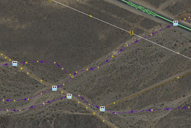
Of the possible resolutions, adding a node with ford=yes is the easiest, so many mappers will do this to satisfy the validator – sometimes without looking closely at the situation. Then you get results like this, where the ford=yes nodes are meaningless.
If you get a warning from a validator that a waterway and highway intersect and need additional tagging, there are some things to consider first:
1. Is this a usable highway? If the highway should be tagged with access=no or with a lifecycle tag like disused: or abandoned: there’s no need for additional infrastructure to cross a waterway.
2. Does this “waterway” have water in it? Look closely at the aerial imagery and consider the local environment. Maybe this feature would be better tagged as natural=gully or something similar.
3. Are the highway and waterway in the right place? In the Southwest US, there are a lot of highways that were imported from TIGER with alignment that ranges from imprecise to atrocious and that have never been updated. And there are a lot of waterways imported from NHD that are just as bad. If you take the time to correct the alignment of the highway and waterway, you may find that they intersect somewhere else or don’t intersect at all.
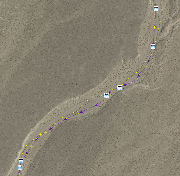
As a related question, is the course of the waterway distinct? Many waterways meander within well-defined banks, so the precise location of the waterway is difficult to determine and varies over time. Consider this before deciding where the waterway and highway intersect, if they intersect at all.
4. Is there existing infrastructure such as a culvert or bridge to allow the waterway to pass under the highway? Look closely at the aerial imagery and consider local road building standards.
5. Does this waterway only have water under conditions that could be described as a flash flood?

If so, it is not possible to ford this waterway. Locations like this should not be tagged with ford=yes.
6. Does the highway follow the course of the waterway? In arid environments, it is common for routes of travel to follow dry waterways. These highways are only usable when the waterway is not flooded. In this case, please do not add ford=yes to every node in the highway. That’s just nonsense.
Discussion