Kerploonk's Comments
| Changeset | When | Comment |
|---|---|---|
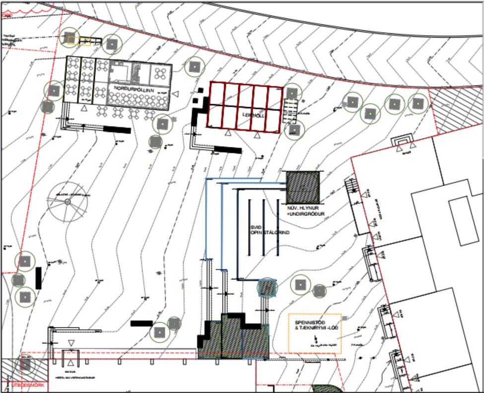
| 164001033 | 4 months ago | Hi. They will be moving an existing historical building, Norðurpóll, to Hlemmtorg as part of the 5th phase of construction. The other building, Laugavegur 111, will house a playground "Hlemmur Leikhöll". Unsure whether it's an actual building, but it has an address. A part of Hlemmtorg after construction of the 5th phase can be seen here:
|
| 163173565 | 4 months ago | Hi MissMarcoPolo, The updated ref tagging is based on Vegaskrá 2024, a public document in Icelandic published by the Icelandic Highway Administration (Vegagerðin), available for download from https://www.vegagerdin.is/samgongukerfid/vegakerfid/vegir .
The document is quite heavy and local knowledge is often needed to decipher the alignment of the roads. The data from Vegaskrá is also published as a GIS feature by LMÍ (National Land Survey of Iceland) under the IS 50 V set of GeoPackages for features in Iceland ( https://gatt.natt.is/geonetwork/srv/eng/catalog.search#/metadata/41D3314D-55AF-4FE3-9A9F-B9CB18AC5CAA ).
Cheers. |