
Mapping on OpenStreetMap allows many things, like 3D mapping.
Having played Cities: Skylines, I was always intrigued by this game, and the idea emerged: “It would be nice if for Pyongyang I could come up with something nice like Cities: Skylines”.
Well, the reality is that it’s a lot of work (and yes, as always!) and OSM wasn’t designed for 3D… but there are ways of getting close and having a lot of fun! So I explored this topic on the city that interests me, and you guessed it: it’s Pyongyang, see it on DemoF4map !
Today, I estimate that there’s a third of the city “in 3D”, as well as a good proportion of the monuments.
For me, most of the time, 3D on OSM covers different objects: simple buildings, and monuments.
- 3D informations of simple buildings gives a faithful image of a city’s skyline, and a better representation of space.
- 3D informations of monuments is primarily intended to look pretty, but can also be used as a landmark in a 3D environment.
The Simple 3D Buildings wiki page is one of the most useful resources on the subject, in my opinion.
North Korea
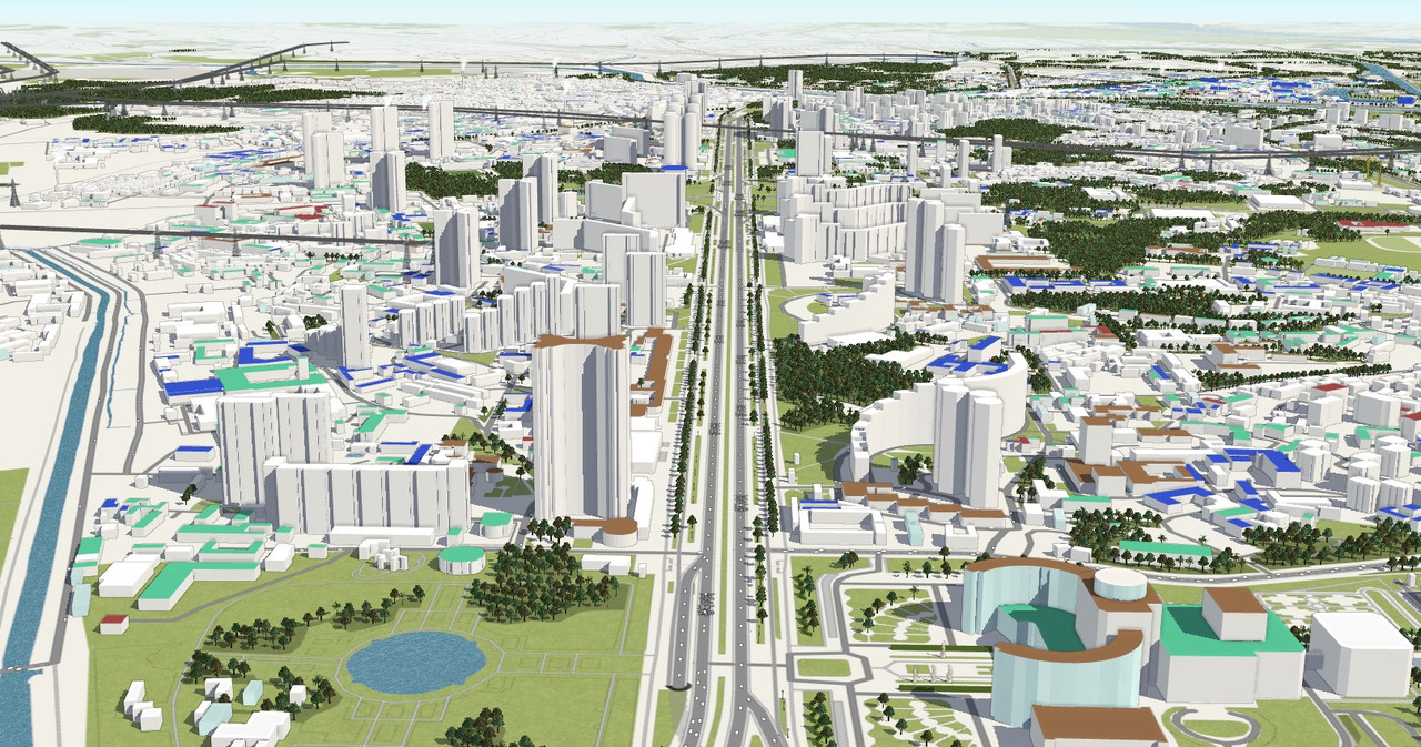
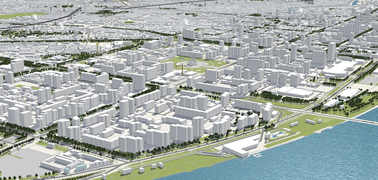
Having mapped the entire capital – see my diary on the subject – I started wanting some nice 3D renderings.
Simple buildings
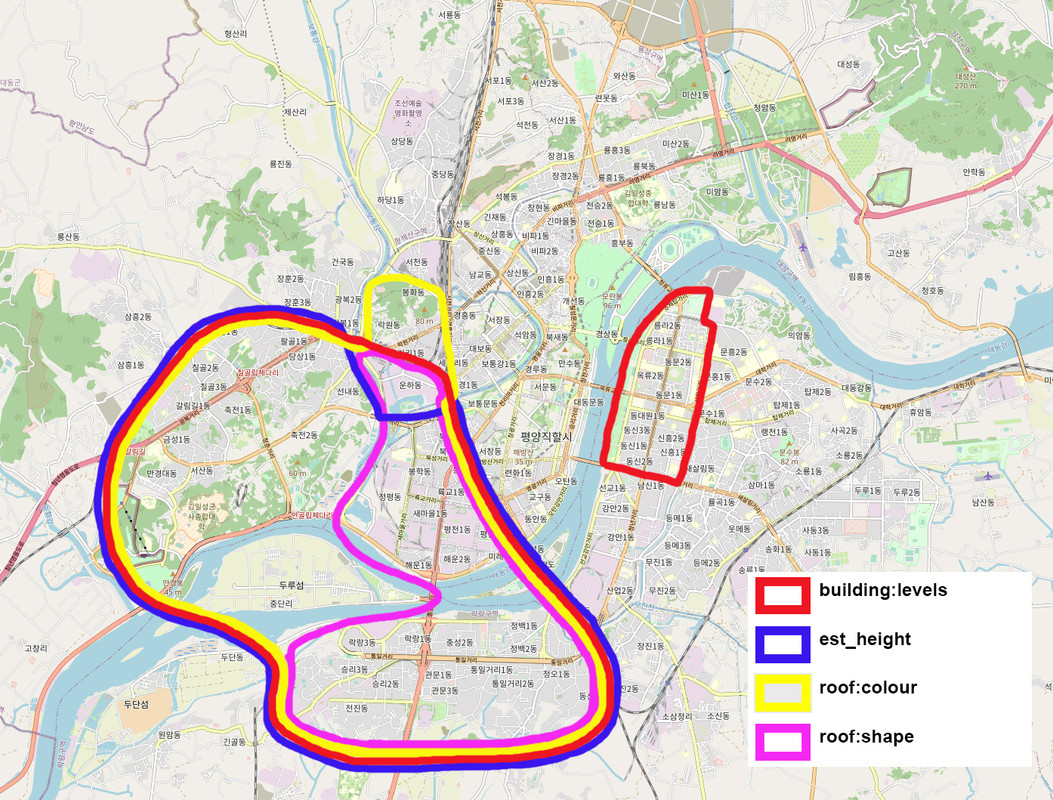
I tried to complete the information in building:levels=*, roof:shape=* and roof:colour=*. Sometimes I do them at the same time, sometimes only the building:levels=*.
I started by doing the Kwangbok district, then I continued work on Tongil Avenue, and lately I’ve started to do the east bank of the Taedong river, although I haven’t finished yet.
Initially, I was adding the height=* tag, but I finally replaced this value with est_height=* (cf. the method here), and now I think it’s the building:levels=* value that’s best (because it’s more objective and better verifiable!).
Monuments
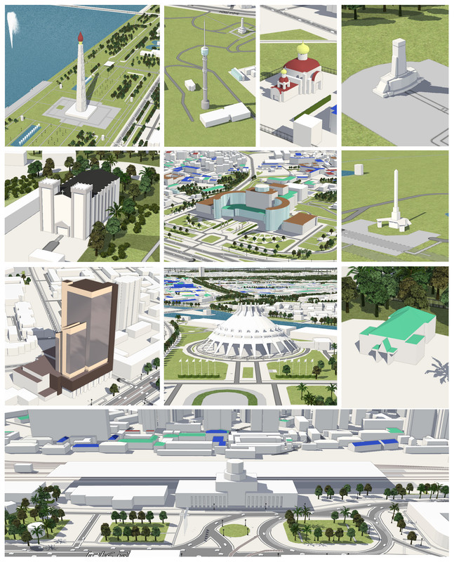
I tried to make 3D renderings in OSM for the monuments in Pyongyang.
For the more complex ones, it took me half a day or even a day!
For example, the Party Founding Monument, which on JOSM is quite difficult to understand, but renders very well!

I’ve made a compilation of the monuments (or complex buildings) I’ve made in Pyongyang using F4map rendering.
Sometimes it’s really a matter of tinkering to get renderers to interpret data in just one way, and in this trial and error the roof:shape=skillion tag is often the key!
Tags
I would distinguish between ordinary tags for simple buildings and tags for monuments. Sometimes ordinary tags are used for monuments.
Simple buildings
Monuments
+ all simple building tags.
These are non-exhaustive lists, but they reflect the tags I use most!
Tools
When working on monuments (complex structures), I use JOSM with OSM2World. OSM2World is rustic software, but it allows you to visualize renderings before sending them to OSM. Without it, it would be very time-consuming and impractical to quickly see what your JOSM rendering looks like.
For exemple, see the Pyongyang Ice Rink where the building:part=roof is not rendered but which, overall, reproduces the shapes well.
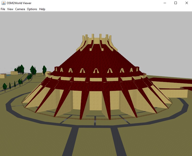
To use OSM2World, simply save the JOSM data layer in an .osm file (“File” → “Save as” → File type: “.osm”) and open this file in OSM2World.
Rendering site
OSM data is interpreted in different ways depending on the rendering service used.
I know of several sites for viewing OpenStreetMap 3D renderings:
- Demo4Map (https://demo.f4map.com)
- Streets GL (https://streets.gl)
- Mapbox Standard Demo (https://labs.mapbox.com/labs-standard)
- OSM Buildings (https://osmbuildings.org)
Some of these sites have datas that don’t come from OSM. Compare the modeling of the Eiffel Tower in Paris between Streets GL and the other rendering services and you’ll see if it’s based exclusively on OSM data or not!
The sites I use the most are Demo4Map and Streets GL.
Demo4Map is a non-free site, but the data refresh is very good, and the rendering is very efficient and aesthetically pleasing.
The other interesting site is Streets GL, which is free and open (see the GitHub page), despite the fact that the data refresh takes a long time (several weeks). The advantage is that they regularly add tag renderings that are not rendered on any of the other websites.
Bonus
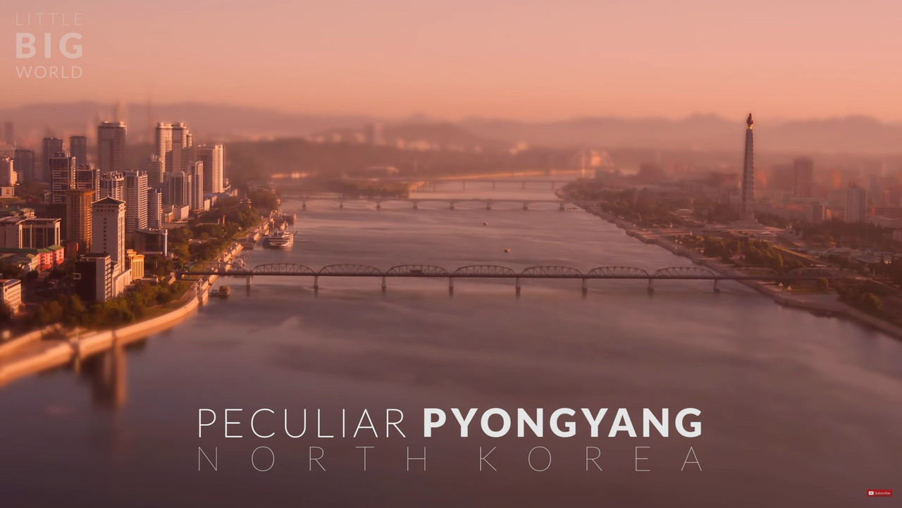
See this wonderful YouTube video “Peculiar Pyongyang - North Korea (DPRK) 4k -Time lapse -Tilt- shift” from “Little Big World” channel, where the spirit of a small world like Cities: Skylines is very well captured.
Обговорення
Коментар від 快乐的老鼠宝宝, 1 Березня 2024 в 20:36
To draw the various architectural features of a city so carefully requires both a lot of field investigation (but since this is NK, so it should be based on photos?) and enough tenacity. (To use OSM’s model to depict such three-dimensional details may require a certain amount of artistic accomplishment)
It’s unbelievable!
Joke: General Kim must have been delighted to see his city drawn so realisticallyКоментар від kwiatek_123, 2 Березня 2024 в 12:27
Good job!
Коментар від matheusgomesms, 6 Березня 2024 в 20:03
Wonderful job, congrats! It seems Best Korea is also the best Korea on OSM! :P
Коментар від mglsj, 10 Березня 2024 в 13:16
🗿
Коментар від warkaree, 11 Березня 2024 в 11:23
interesting and great job. i hope i am able to do something like this in my city one day.
Коментар від jfd553, 14 Березня 2024 в 19:47
Just impressive! Keep doing such great job :-)
Коментар від spughetti, 19 Березня 2024 в 13:49
Very impressive!
Коментар від Convectional, 20 Червня 2025 в 09:56
🙌😭🙌😭🙌