Alugu n OpenStreetMap OpenStreetMap

Aɣmis n Maanya

Inekcamen ineggura n uɣmis

Weekly Roundup of Edits

Yuzen-it-id Maanya af 26 August 2016 s English

Following were some of our observations on the edits made on OSM for this week. The associated changesets have also been mentioned for your kind reference.

  • Camp sites that were’int present was being added in this changeset as opposed to what was seen on the satellite imagery. Also, this changeset neither had a comment nor the source of information.

  • Coastline of an island was deleted; Changeset link

  • ATMs, artwork and campsites were being added all over the map; Changeset link 1,2,3.

  • Amenities such as town halls, supermarkets and unclassified, secondary roads were being deleted ; Changeset link 1,2,3

  • In yet another case, the user was found adding tourist spots with improper and arbitrary names; Changeset link

  • Here, the user was found deleting a lot of trunk, primary, secondary, tertiary roads and amenities. In some of his other changesets he was found tampering with the disputed border between India and China; Changeset link.This user was subsequently blocked by the DWG and all the changesets were reverted.

An attempt to address these issues have been made both, by the community and us by leavings comments in the respective changesets.

The previous week’s review can be found HERE

Happy mapping. Let’s all make OSM the best map ever.

Thank you all so much!

Field mapping is so much fun!

Yuzen-it-id Maanya af 14 July 2016 s English

Although mapping technologies have revolutionized the way we create spatial data, field mapping still lies at the heart of every geography fanatic. Not only is field mapping a great way to verify what we see from space, it also helps in capturing details unique to a locality and is so much fun!

A few weeks ago, some of us at Mapbox went out for a field mapping quest to map POIs, trees, house numbers and levels for the buildings around our neighborhood (Indiranagar, Bangalore). Manohar, Ajith and I teamed up with Nikhil, Abhishek and Jothi respectively, to add as much data as possible.

ezgif com-gif-maker

There’s always something to map for everyone!

Along with the fieldpapers, we also used Maps.me and Mapillary to supplement the paper based approach. Ajith added POIs, while me and Manohar added house numbers, building levels and trees.

Following are some take aways on using Maps.me:

See full entry

Weekly roundup - Suspicious mapping

Yuzen-it-id Maanya af 30 June 2016 s English

Here is a roundup of some suspicious changes to OpenStreetMap from this week (27 to 30 June): ​

  • This changeset an experienced editor changed the value of a major highway in Nepal from highway=trunk to highway=yes making the highway disappear from the map for 15 days. ​
  • This user traced multiple buildings but forgot to tag it as a building. Changeset
  • In this case the user was found adding an amenity on the road. Changeset
  • We also came across an edit where the user was found deleting the tag addr:housenumber from the buildings. Changeset

​ These were some of the inconsistent edits for this week. Do keep an eye and please comment on such changeset, this will help in maintaining the data on OSM accurate and coherent.

Mapping My Hometown

Yuzen-it-id Maanya af 27 May 2016 s English Last updated on 30 May 2016.

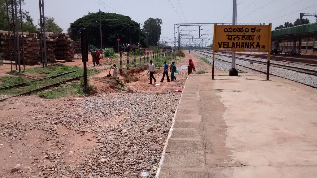
Welcome to Yelahanka

### 13.1N , 77.5E (degrees) I reside in a place called Judicial Layout near Yelahanka, which is ~21 km north to the Bangalore city. It is skirted by two beautiful campuses namely, the University of Agricultural Science and the Central Institute of Medicinal and Aromatic Plants, making it a perfect escape from the otherwise concrete jungle. Yelahanka Railway Station Source: Skyscrapercity

Status prior to my mapping task:

See full entry