I recently moved to Singasandra and realised that being a new colony, this area was very badly mapped. The creation of AECS(Aeronautical Engineers Cooperative society) Layout involved the area being carved out of Chikka Begur village, Singasandra. Not the problem is that the area is not not mapped correctly on any official or non-official platform. Let me Illustrate
The highlighted area is designated as AECS B Block(Verified on location)
Given that its a new area, there are very few location markers placed by authorities- precisely 3 in the area(highlighted below)
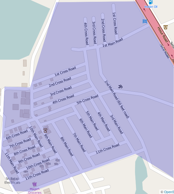
(1) Marked as 2nd Main Road (2) Marked as 3rd Cross Road (3) Marked as 2nd Cross Road
These are the only 3 physical markers in the area and the rest of the area just has to guess its own address. All the roads have been marked out on the basis of these 3 reference points. But there are some major issues here.