Is it bad form to write 2 diary entries in one day? Possibly. But the network drives in the office have conked out, and it’s Friday afternoon, and I have this all ready to go, so what the hell.
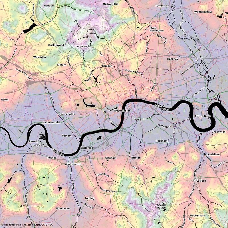
London’s lost rivers have fascinated me ever since I first read about them, and since I started cycling in London the contours have fascinated me too. Finding a way to visualise these things was what first got me into OSM (via Maperitive), but I never found the time to finish the job to a reasonable standard. So here’s a first attempt, see what you think:
토론
2013년 5월 17일 23:36에 cartinus님의 의견
Interesting picture.
As usual when a map is rendered with a different emphasis, something strange get noticed. Why are both forks of the lost river north of Camden named “Fleet”?
2013년 5월 18일 12:39에 Pgd81님의 의견
Thanks! RE Fleet: as far as I have been able to discern, the two upper branches don’t have separate names.