OpenStreetMap logo OpenStreetMap

PlaneMad's Diary

Recent diary entries

How to find the changeset details of any OSM map feature

Posted by PlaneMad on 8 August 2018 in English. Last updated on 9 August 2018.

Wrote this quick guide after realizing its not so easy to find how to do this.

Visible features

The easiest way to find more details about any feature that is visible on the map is to use the Query features tool. Use to to query the map features at any point to find the object you are looking for.

Alternatively, you can also use the search box and directly search by the name of the feature for matching results worldwide.

Deleted features

Deleted features that you know were visible in the past is slightly more tricky. You can use this Overpass Turbo Attic query to query all features in the map view at any given historic date to find the object you are looking for.

Tip:

See full entry

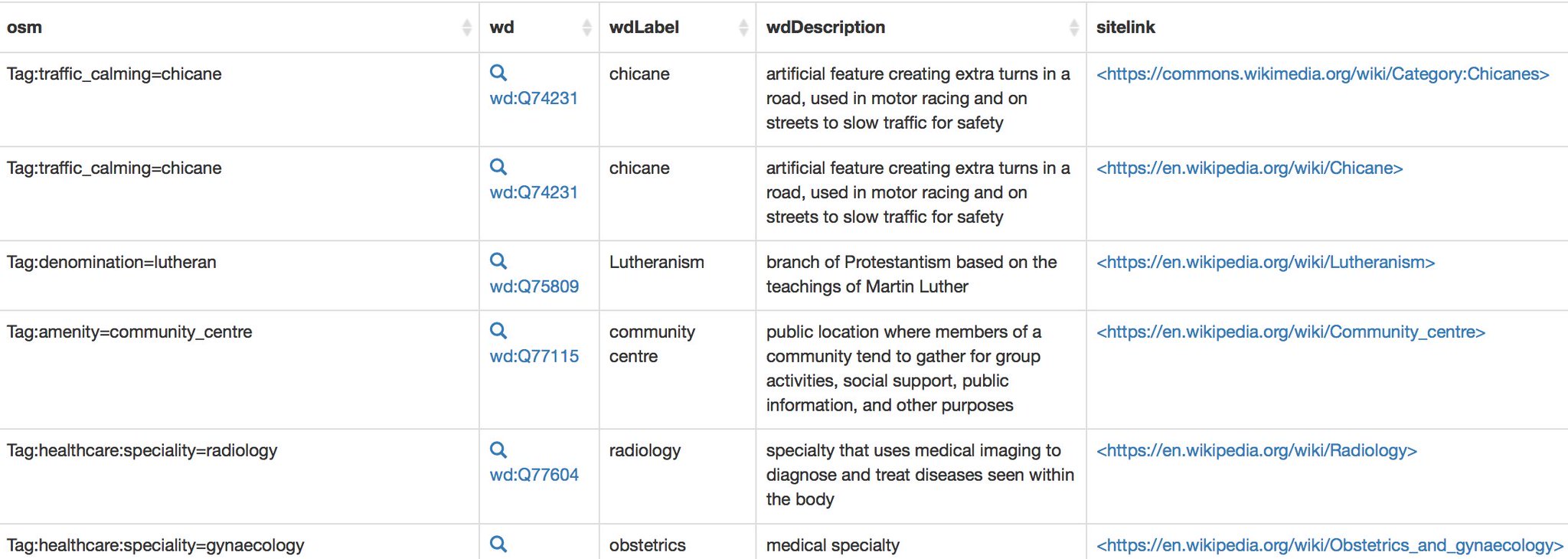
Descriptions of OSM tags in any language using Wikidata

Posted by PlaneMad on 10 January 2018 in English. Last updated on 12 January 2018.

Ever wanted documentation of OSM tags in your own language?

Thanks to Wikidata, this might be quite simple: OSM tags in Japanese | German | English
(Hit edit query to change to your language)

If you find a missing tag or translation, you can add it by editing the relevant Wikidata item and adding a new translation or a new OSM tag property.

The post was inspired by a recent discussion on OSM wiki questioning the value of Wikidata links on the wiki pages. Atleast in my part of the world, this is going to be quite useful since the Wiki pages have not been translated into my language.

Note It is known that OSM tags don’t always map 1:1 exactly with existing Wikidata concepts and such derived definitions need further review to make sure it is consistent with the OSM Wiki. In such cases a new concept can be created in Wikidata if it does not overlap with any existing definition.

Viewing OpenStreetMap tiles in GL

Posted by PlaneMad on 22 December 2017 in English.

Was fiddling through the Mapbox GL JS API today, and thought i’d see if I can get the default OSM raster tiles to render on GL. Turned out to be surprisingly easy using this example.

Result:

Demo+code: http://bl.ocks.org/planemad/5670e14b67e3eb82b707ba46c9d3010f

Notes:

  • The OSM tiles are raster which are rendered at discrete zoom levels, but the GL interface allows for smooth scrolling. The result might be slightly blurry tiles and may not be as crisp as viewing them in Leaflet.
  • The original example was for adding a WMS layer. So any external TMS/WMS layer should work by swapping the tile url in the code. See osm.wiki/Tile_servers for options.
  • The color transition of the tiles from b&w was achieved using the raster-saturation property and zoom functions. Not sure if this is practically useful, but definitely avoids needing to render separate b&w tiles.
  • An alternative to using Mapbox GL JS for viewing the OSM tiles in GL is to use OpenLayers

This Friday, I will be at SOTM in Aizuwakamatsu, Fukushima this weekend talking about the state of validation on OpenStreetMap! I will talk about the need for making a validated error free map with OSM data, the recent efforts of the Mapbox Data team to review OSM changes and what the future of data validation might look like. If you are interested to attend the talk, grab a seat in the main hall at 4:10pm on Friday at the Aizuwakamatsu City Culture Center.

If you are interested in a deep-dive into validating edits in your area on OpenStreetMap, attend Validating the Map workshop conducted by manoharuss on Sunday at 1:30pm in Room-1.

image

_Distribution of reviewed and validated changesets using OSMCha in 2017 View Interactive Map_