People sometimes ask me: why add all these route relations to Openstreetmap, when De Lijn already has them as shape files?
For one thing, De Lijn cannot share them with us. A good example is the following:
Line sketch on Overpass for De Lijn 91
If you click through to one of the other lines, change the url so it has &style=wuppertal once again at the end. Also keep in mind not each and every line is already mapped, although we’re doing quite well in Oost-Vlaanderen.
Another example is a map I rendered where I’m combining the PT network (pink on the background), the walking nodes network (orange) and the route I wanted to talk about:
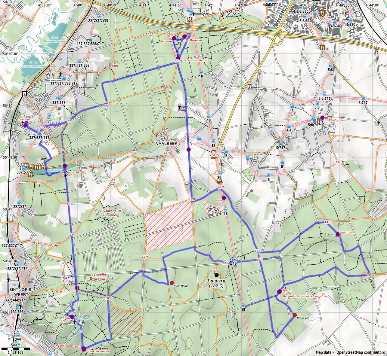
Only, say 10 years ago, creating such a map would have been an impossible endeavour. It’s important for the explanation on this site:
To be able to show where the bus stops are and the walking node numbers are used in the directions, but not exactly used the way they were meant to be used… only to help point people in the right direction, instead of following them from node to node.
Incidentally you’ll have to have a look at the Dutch version of the article to see the map used. The English version uses Openstreetmap too, but in a more dynamic way.
Jo
토론