
So I figured I’d add it to cycle.travel’s elevation graphs. It was already in the turn-by-turn instructions, but this is still more fun.
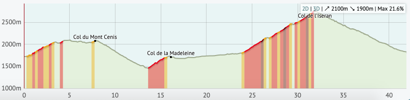
mountain_pass=yes or natural=saddle as a node on the highway, with a name= tag too (obviously).
So I figured I’d add it to cycle.travel’s elevation graphs. It was already in the turn-by-turn instructions, but this is still more fun.
mountain_pass=yes or natural=saddle as a node on the highway, with a name= tag too (obviously).
Diskussioun