OpenStreetMap logo OpenStreetMap

Romeo Ronald'ரின் நாட்குறிப்பேடு

சமீப டைரி உள்ளீடுகள்

In a world where technology is at our fingertips, it is easy to forget that not every corner of the globe has been extensively mapped or can enjoy the benefits of modern cartography. This is especially true in regions torn by conflict, where infrastructure and basic services have been devastated. South Sudan, a nation born out of conflict, is one such place where mapping takes on a unique and critical role.

South Sudan, the world’s youngest country, has been grappling with conflict since its inception in 2011. The violence has often been drawn along tribal lines, making reconciliation and rebuilding particularly challenging. In such a fragile post-conflict environment, the work of organizations like OSM South Sudan takes on profound importance.

The OSM South Sudan Initiative

OSM South Sudan, an open mapping community, has taken up the mantle of mapping the nation’s remote and conflict-affected areas. Mapping in such an environment is not just about geographical data; it is a tool for social healing, reconciliation, and empowerment. The volunteers involved in OSM South Sudan are driven by the belief that the act of mapping can foster peace and unity in a divided land.

Concept Mapping as a Starting Point

To initiate this endeavor, OSM South Sudan starts with a fundamental step – concept mapping. The first phase of their approach is all about introducing the local communities to the concept of mapping in a way that resonates with their everyday lives. By asking simple questions like, “What would you do before you build a house?” the volunteers create a bridge between mapping and the participants’ own experiences.

See full entry

இடம்: Hai Buluk, Juba City, Juba, Central Equatoria, South Sudan

Unlocking South Sudan’s Digital Potential: The Impact of IGF on Open Knowledge Access and Open Source Tools

Group Photo During the recently concluded IGF 2023 
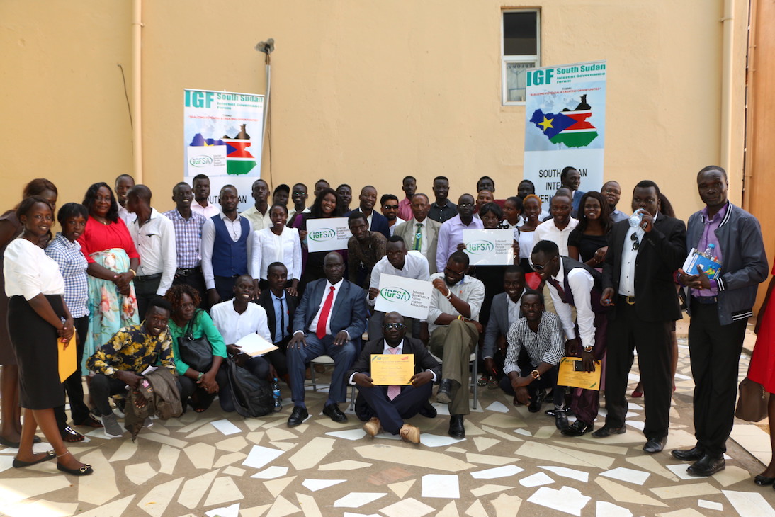
On 10.October. 2023, South Sudan took a significant step towards realizing the dream of an inclusive digital future by hosting the Internet Governance Forum (IGF) under the theme “The Internet We Want: Empowering All South Sudanese People.” This momentous event held at the Hotel provided a platform for stakeholders from various sectors to come together and address the critical issue of digital access in a country where connectivity costs are among the highest in East Africa.

The IGF in South Sudan served as a rallying point to discuss, deliberate, and take action on the challenges of the digital age, with a particular focus on open knowledge access and open-source tools. Here’s what this event means for South Sudan and its journey toward digital inclusivity.

Digital Divide in South Sudan: A Stark Reality

See full entry

இடம்: Hai Nyakuron West, Nyokuron West, Munuki, Juba, Central Equatoria, South Sudan

As a proud resident of Juba, the capital city of South Sudan, and a team leader of the OSM South Sudan, I’ve witnessed the winds of change sweeping through our beloved city. It’s a transformation that holds the promise of reshaping our lives, empowering our community, and charting a new course for Juba’s future. At the heart of this metamorphosis is Juba’s journey towards becoming an open-source city, a path significantly influenced by projects like #ASKNet Access to skills and Knowledge, Wikimedia Community User Group South Sudan and open mapping—a benchmark of this revolution.

Embracing Open Source: What Does it Mean?

Before delving into the profound influence of open mapping, let’s grasp what it means for Juba to be an open-source city. Essentially, it signifies a commitment to transparency, accountability, and active citizen participation. It’s a city where information flows freely, governance is collaborative, and innovation flourishes.

The Role of Open Mapping: Charting New Possibilities

Open mapping stands as a pivotal benchmark of Juba’s open-source revolution. It’s a movement that has profoundly impacted our city, unlocking new possibilities and transforming the way we interact with our urban environment.

1. Navigating the City with Precision: Juba’s dynamic growth posed a challenge for residents in terms of navigation. Thanks to open mapping initiatives, we now have access to detailed, up-to-date maps of our city. Whether it’s finding the quickest route to work or discovering a hidden gem in our community, open mapping has made life easier and more convenient.

2. Empowering Disaster Preparedness: The significance of open mapping came into sharp focus during times of crisis. It’s remarkable how open mapping has contributed to enhanced disaster preparedness. In times of natural disasters, such as floods, the ability to access real-time information about affected areas and potential evacuation routes is a lifeline for our community.

See full entry

இடம்: Hai Jebel, Nyokuron West, Munuki, Juba, Central Equatoria, South Sudan

OSM as a peace building Tool

Posted by Romeo Ronald on 1 பிப்ரவரி 2022 in English.

Mapping in a conflict Zone

In a war-torn and post conflict environment like South Sudan, the approach for mapping can be way different, basing on the fact that South Sudan’s war was based on a tribal line, it is again more difficult to perform a more inclusive program like mapping, but as for us at OSM South Sudan looked at this as an opportunity more than a challenge, so we began more basic training with basic tools like the ID editor and concept mapping.

See full entry

இடம்: Hai Soura, Juba City, Juba, Central Equatoria, South Sudan

OSM South Sudan is Launched in Juba

Posted by Romeo Ronald on 29 நவம்பர் 2021 in English.

The OpenStreetMap Community of South Sudan, was launched on 26th.Nov.2021, in an event that brought together Government agencies like the National communication Authority, Companies like East Africa GoGreen, Academia like The University of Juba and among other individuals, this launch event was the commence point of the upcoming programs of OSM South Sudan and it strives to achieve its goal of facilitating the creation, and use on OpenStreetMap data, this shall be made possible by the couple of partnerships OSM South Sudan is looking with the Government and other entities who shall either be data users or contributors, though the collaboration with other HOT and the Open Mapping hub, East and Southern Africa has come handy in building and pushing for success of the community. OSM South Sudan is now in the process of collaborating with the NCA to map and solve address issues in Juba.