
I’m on the move at the moment, currently in Spain visiting Menorca and Mallorca, and have been using OsmAnd on my phone a lot. It’s a great program! Especially the bus stops and routes. I just want to say thank you to everyone who’s mapped these things; it really is worth it! And using OSM data in this way has given me more enthusiasm for contributing more transport data in my home town.
The only drama I’ve had with OsmAnd is the GPX-recording, and really that was my fault. For some reason I thought I’d hit ‘stop recording’ before ‘save’… and lost my whole day’s travels. Still, at the least the photos I was taking were safely geocoded (and now on Flickr). From now on I’m going to stick to my trusty old Garmin Vista HCx and proper camera.
I’ve made some small edits to the map, and will try to do more. There’s one bit that I’m not sure about, that I shall leave to mappers more au fait with the area than me; I’ve left a note for that.
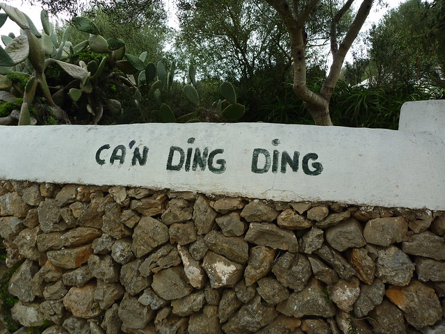
I did add my grandparent’s old house, Ca’n Ding Ding (nice name eh?)—
Diskusija
Naudotojo Omnific komentaras, parašytas 2016 m. balandžio 25 d., 21:38
That’s odd, you should be able to hit stop and then save just fine. Strange that it failed for you.
Naudotojo Sam Wilson komentaras, parašytas 2016 m. balandžio 26 d., 15:01
@Omnific: yeah, I thought so, but somehow I managed to not save anything :-( Now I’m being more careful, and pressing save at various points throughout the walk.