SebastianHelm's Comments
| Post | When | Comment |
|---|---|---|
| First week | Thanks for the research. It looks like, when they named the street, they intentionally picked a word with richer connotations than those of alternatives such as « bavardage ». Similarly, according to your second source, they named a path for cyclists and roller skaters « chemin des pensées ». 🙂 Speaking of terminology, your first source uses the German word „blockhaus“ in a sense I hadn’t known yet. So I now learned that there is not only this civil sense, but also Blockhaus (Militär). |
|
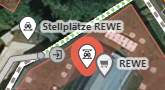
| First week | Thank you, your second last paragraph addresses exactly what I need. BTW, funny name on your example map: « Alllée des Chuchotements ». Do you know the history of that name, by any chance? Kind regards, Sebastian |
|
| First week | Thanks to both of you who replied in the last few days. (I thanked Richard privately). Tony: I currently am not very active here, but I will install JOSM when I do more. The other editors listed on the wiki page are interesting, too; I might install one of them on my cell phone. Florent: From the history page you describe, I see no way to get the history of a specific feature. E.g. from the screen shot in my OP, I get just another map view, which doesn’t even display my selection anymore. The only potentially interesting thing related to history is one orange line crossing it; presumably part of the border of some bigger changeset affecting some features in the displayed area. The sidebar shows entries such as the following:
Not very informative – in general, the whole sidebar shows no information in any way related to the feature of interest. Even when I go further, checking individual sidebar entries, I see nothing that points to the selected feature. Or am I missing anything? |
|
| First week | Thank you, Jerry.
Kind regards, Sebastian |
|
| First day | Thank you for your informative reply. I now understand how this came about, and I commend you for writing this in the QA page. Duplicating this information in the Good practice page, IMHO, doesn’t promise to be particularly helpful, though. Instead, it may be more helpful to merge these pages… Wait a minute – I just noticed that there’s a third such page: Editing Standards and Conventions. 😲 So we have three different articles for topics which appear pretty much the same to a beginner! A three-way merge may be a lot of work, and may result in a page that would be too long. If those three topics are different enough to an advanced mapper to deserve individual articles, then it may be best to optimize one for beginners and point to the others from there, with some short text that helps the beginner select the next topic to read up to before they can map with confidence. |
|
| First day | Thank you for your explanation and the link. The change you link to, as well as the duplication you discuss, was not brought about by an “editor warning”, but by a wish of a fellow mapper, expressed in a note. Rest assured that I didn’t act in any way that could justly be termed “blindly”: Not only did I see the duplication, I pinpointed it both in the edit summary as well as here, so as to make it visible to good mappers like yourself. In addition, I studied the wiki and specifically asked about this duplication on the appropriate talk page. You write “These […] should not be accepted if you don’t know what the change means”. Is that an official rule on OSM? I don’t see that in the good practice recommendations. Would you have a link to that rule? Re: “editors are not always using the newest tag”: That sounds like a problem of the editors. Instead of trying to change all fellow mappers’ reasonable behavior for all their work with tags, wouldn’t it be much more productive to submit specific feedback to the appropriate editor’s github to get those issues fixed? |
|
| First day | Thank you for reading my diary entry and for your advice. I’ve become a bit rusty on github, but it’s a good suggestion to provide my feedback there. I will probably do so next week. Yes, I wasn’t aware of the undo button – that’s a big help! My suggestion would be to
But yeah, you’re right, this comment isn’t the best place for that, I’ll probably have to provide that on github, too. Yes, I did respond to – or more exactly: resolved – some notes. But I don’t understand what you mean by “blindly accept”. That isn’t how I operate. Can you please be more specific? Would it help if I gave you a list of the notes I resolved? Kind regards |