Лого на OpenStreetMap OpenStreetMap

Дневник на Severak

Последни публикации в дневника

Metropolis style

Написано от Severak на 21 септември 2016 на English.

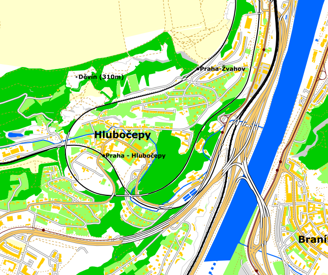
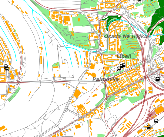
I am glad to introduce you Metropolis style. It was developed for Matička Metropolis, a travel agency based in Prague. It aims to be general purpose city plan.

As of today, it’s available at Czech portal Openstretmap.cz for general use.

If you are interested in that style feel free to contact me.

Now some pics

Prague city center

See full entry

Lunarender roadmap

Написано от Severak на 11 юли 2016 на English. Last updated on 23 септември 2016.

Once upon a time I introduced lunarender map renderer here.

A month ago somebody asked on github if project is still alive. I told him project was suspended.

But this was impulse for later development.

I began to investigating how to solve major problems with my renderer.

GeoJson as rescue

I decided to switch to GeoJson as native input format. It will solve major problems with my renderer.

Firstly, there is nice nodejs app osmtogeojson. I will use it for assembling multipolygons.

Secondly, there are geojson-encoded vector tiles from Mapzen. I will use them to render large areas of maps in “tile by tile” fashion.

Planned features for v2

  • cross-platform installation (aka no win binaries in linux zip)
  • better command line parameters (inspired by Pandoc)
  • better user manual (inspired by Pandoc again)
  • multiple input formats (OSM XML, GeoJson, Mapzen tiles)
  • multiple output formats (SVG, PNG, PDF, GeoJson)
  • more map projections (probably via proj4)
  • ability to render large area from vector tiles
  • some improvements in rules syntax

Icon editor

I am also thinking about creating svg icon/texture editor. I used Piskelapp for my pixel-art-style icons, but it has no support for saving in SVG.

Feedback welcome

Feel free to ask some questions or suggest some ideas.

Soviet style

Написано от Severak на 1 януари 2016 на English.

For next style of my renderer I took a lofty goal - Soviet military topography maps.

I think OpenStreetMap definitely deserves an Soviet-military-like layer, because it’s more than just a map - there are tons of data hidden in database which are not shown on standard layers.

So I made one for my renderer. It can be used with command like this:

lunarender map.osm rules/soviet.lua

Enough talking, show us teh maps….

Maps

viaducts in Hlubočepy and Barrandov bridge on right side:

Hlubočepy

(not bad for week old renderer software, isn’t it?)

panel housing estate Lužiny:

See full entry

LunaRender

Написано от Severak на 31 декември 2015 на English.

I am glad to introduce you a new renderer written by me.

Despite its name it is used for rendering of earth surface mostly.

Useful for ad-hoc rendering, not intended as batch tileset renderer alternative.

For more info and download visit severak/lunarender at Github.

Features

  • input format: OSM XML, Overpass API JSON output
  • output format: SVG
  • rendering rules scriptable with lua

Demos

(following demo pictures are centered on Palmovka)

default stylesheet:

default style

(note missing river - LunaRender cannot render multipolygons for now)

grey style with trams drawn in color:

See full entry